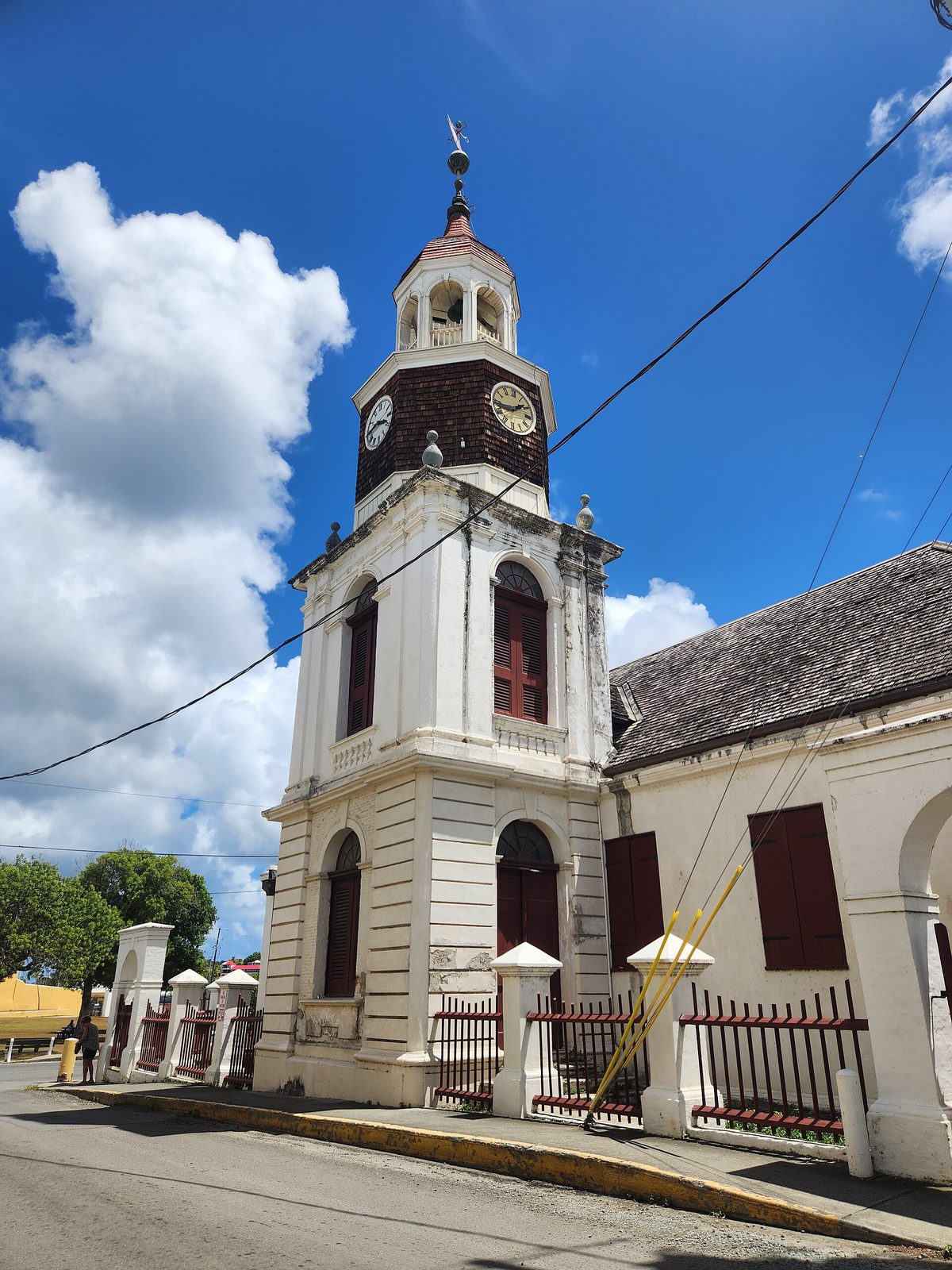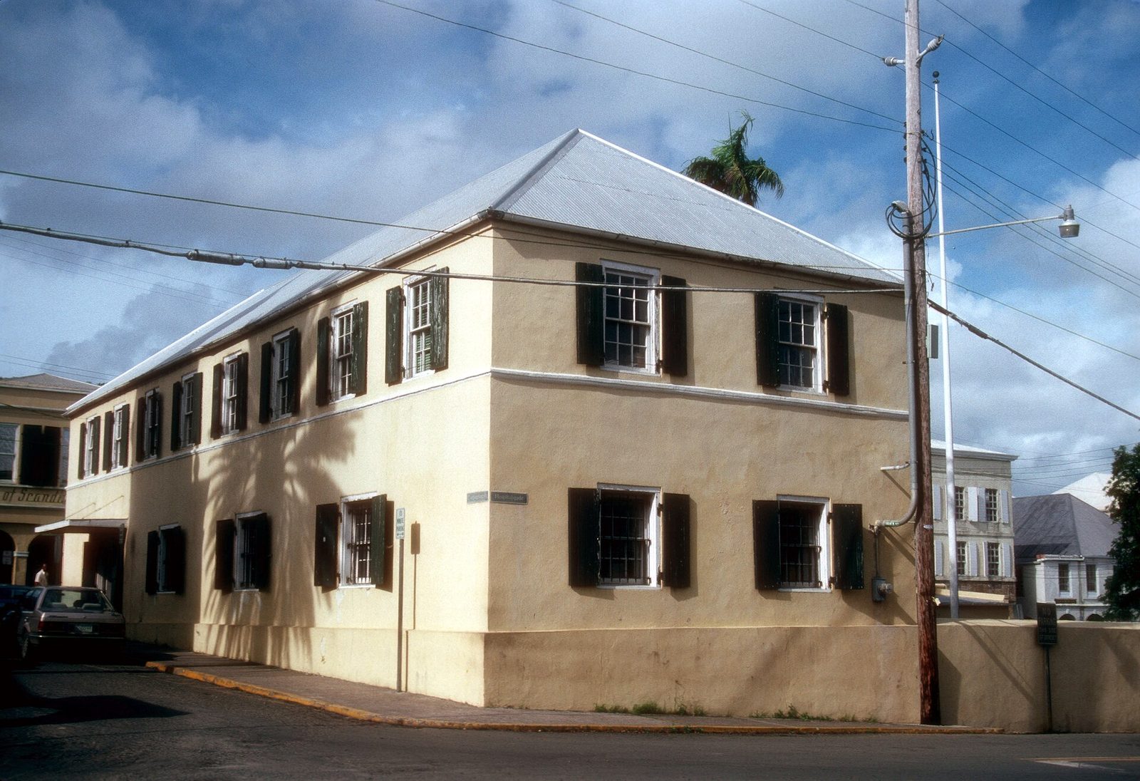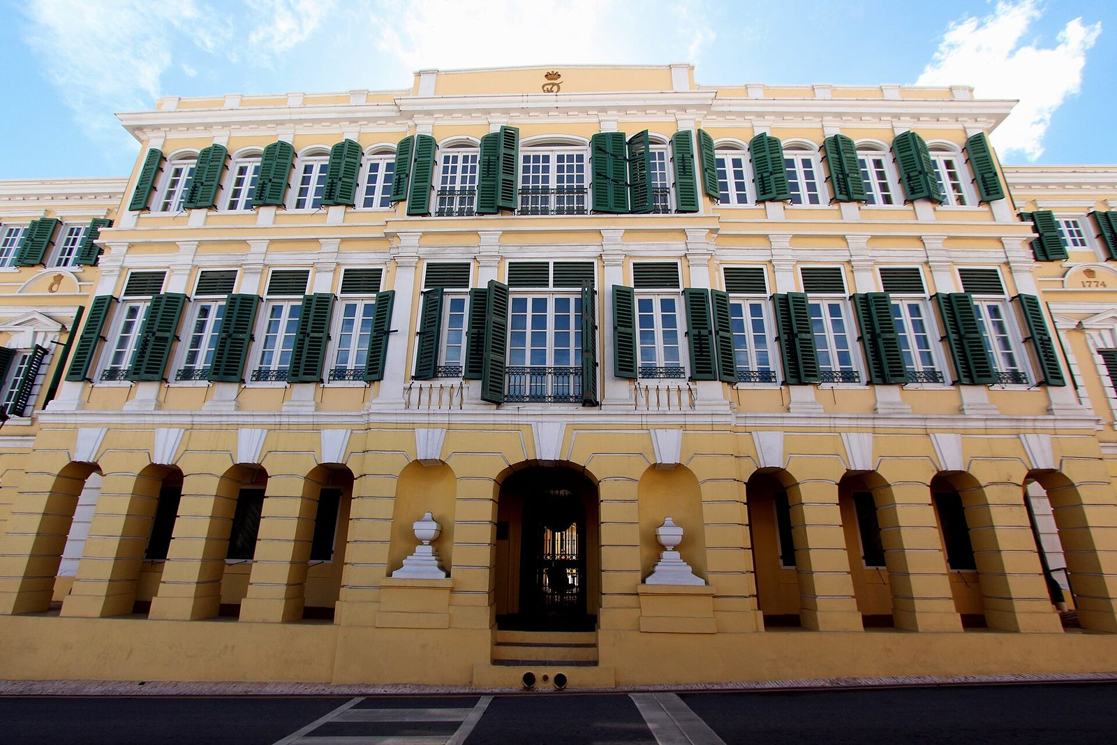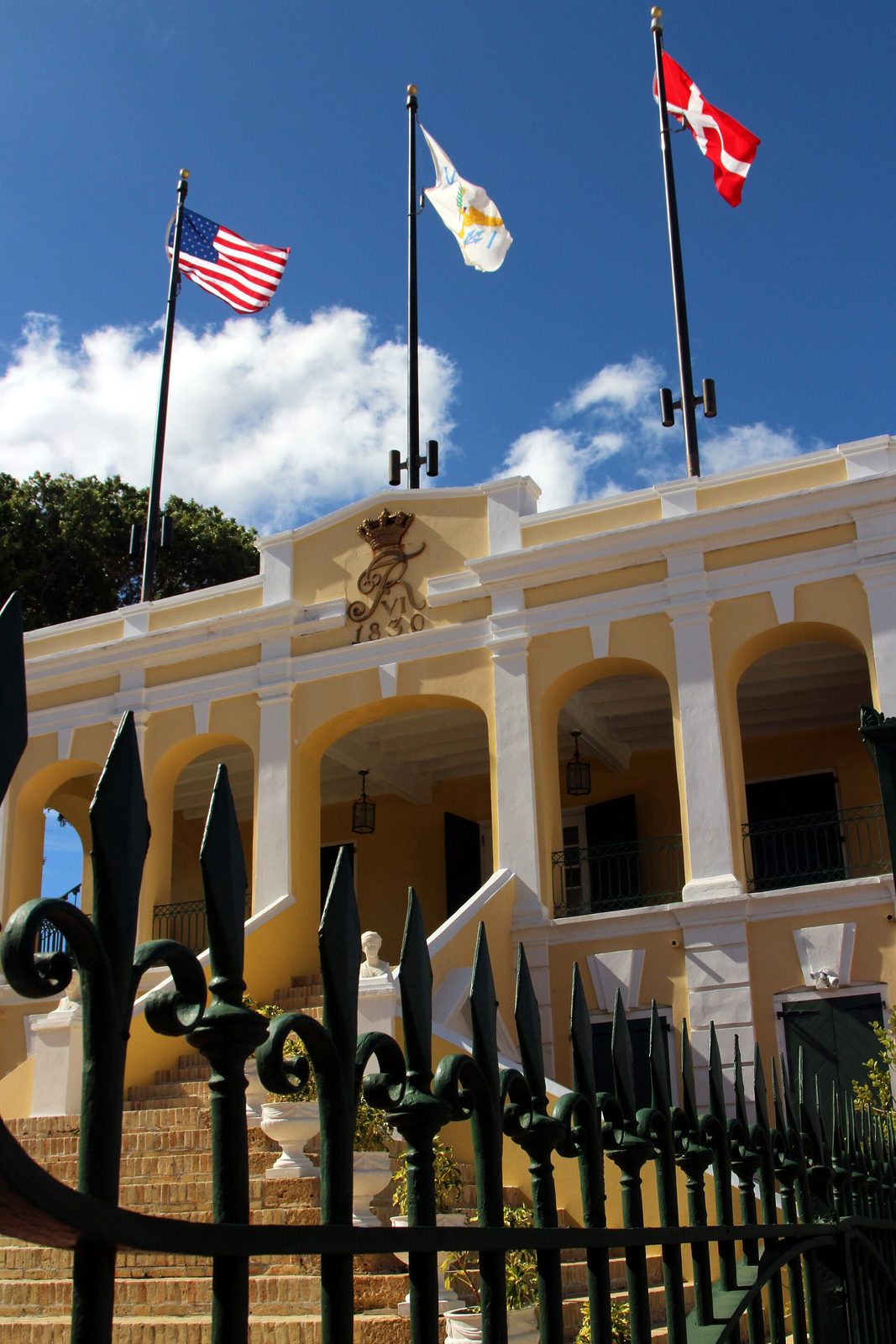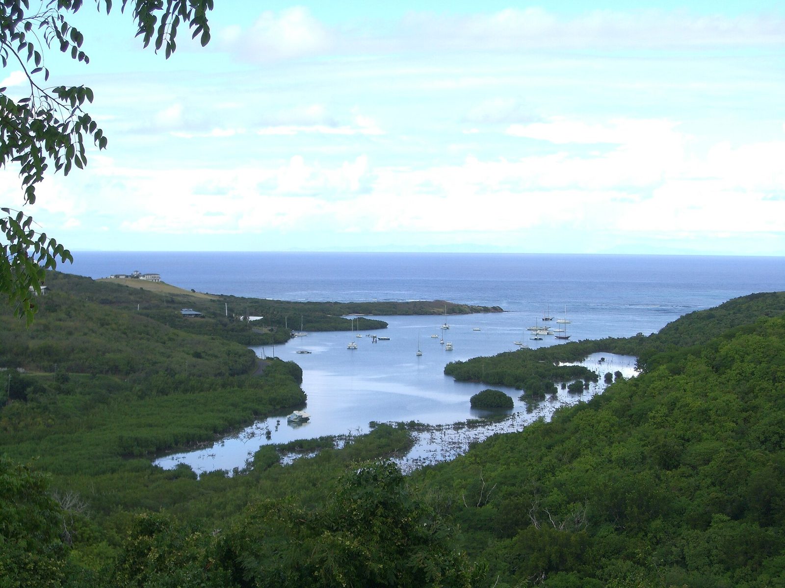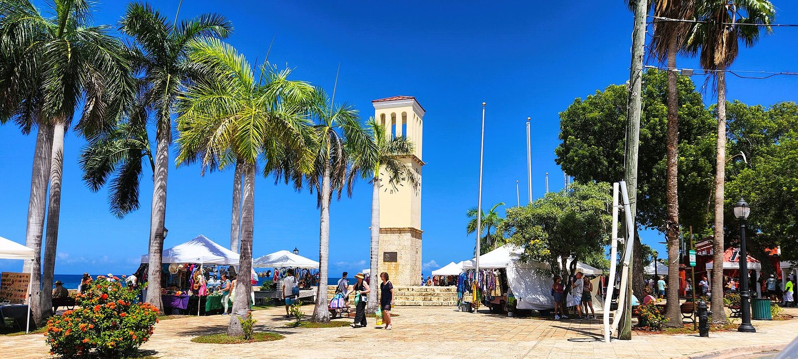


The CeruleanSt. Croix · U.S. Virgin Islands
CHRISTIANSTED NATIONAL HISTORIC SITE

The History of St. Croix: From the First People to Today

A thousand years of Native life, seven flags, a self-freeing in 1848, a fire-lit revolt in 1878, and a sale to America in 1917 — the whole island story, told straight.

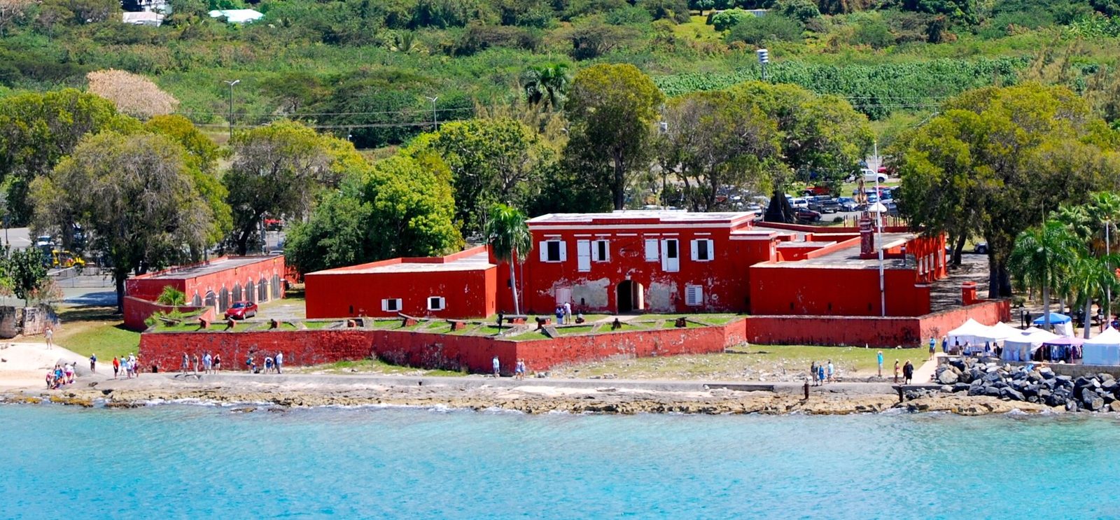
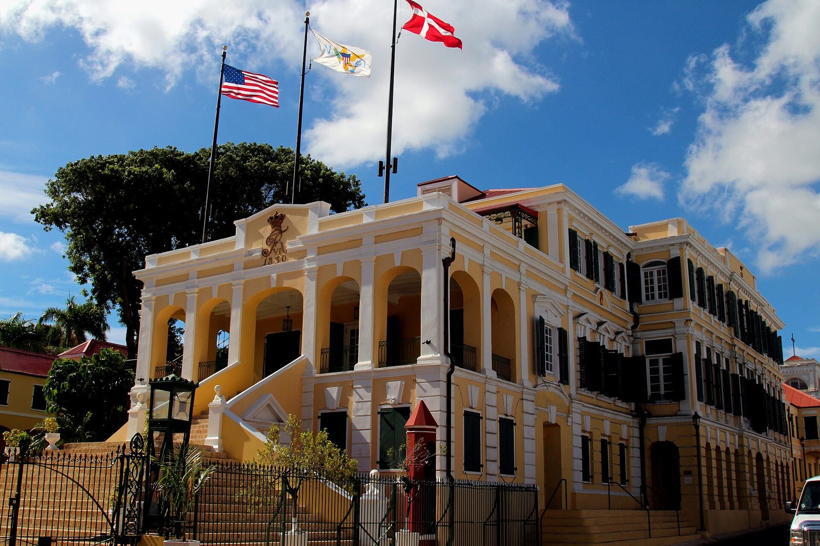
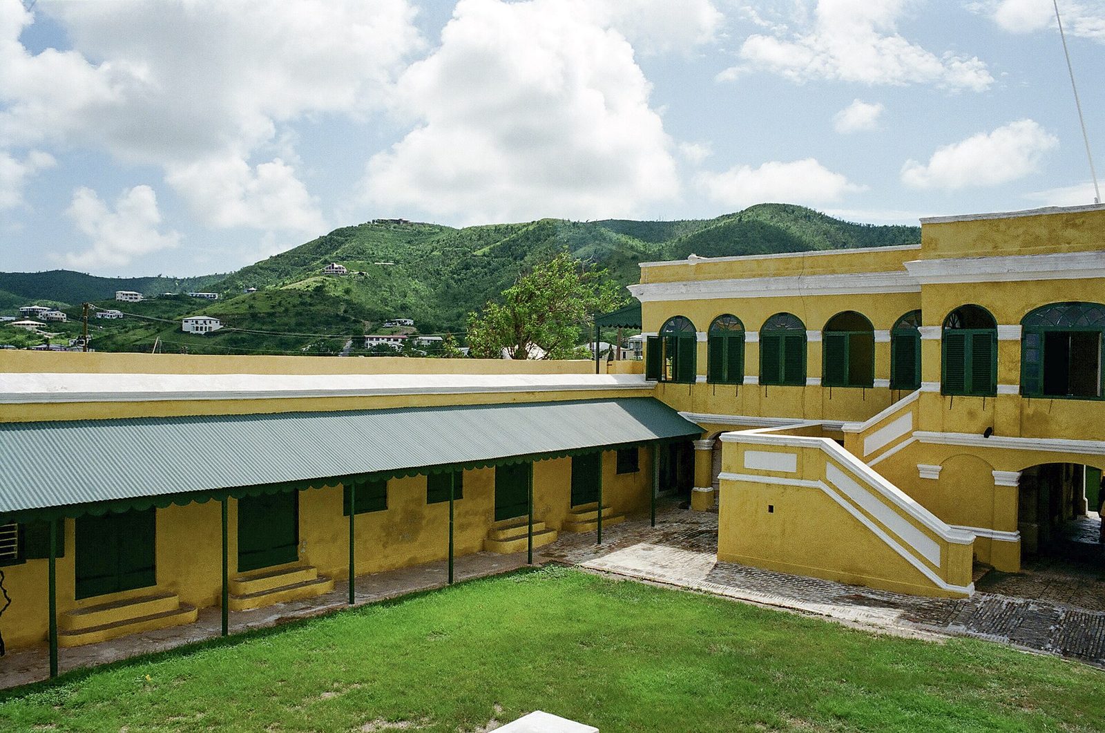
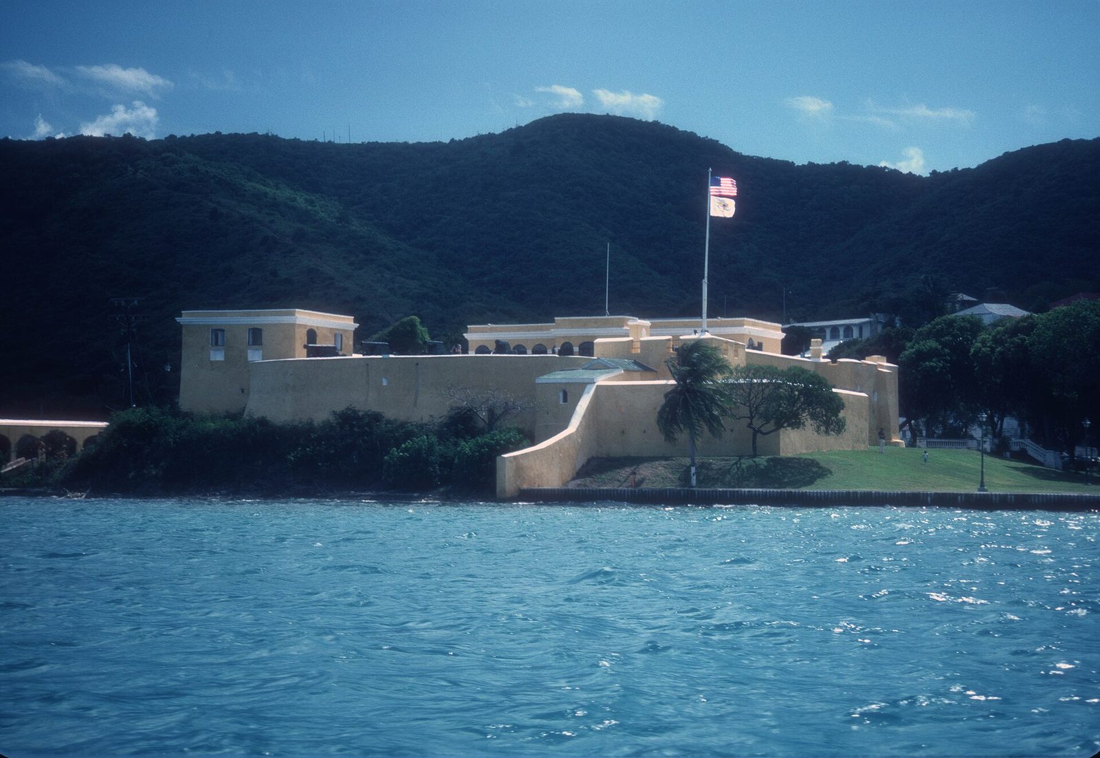
Photo: JERRYE & ROY KLOTZ MD (CC BY-SA 3.0)

St. Croix is a small island with a very long story: a thousand years of Native life, then seven flags in four centuries, a hundred and eighty-four years of Danish rule built on the labor of enslaved Africans, a self-freeing in 1848, a fire-lit revolt in 1878, and a sale to the United States in 1917 for twenty-five million dollars in gold. This is that story in full — dated, sourced, and told without softening the parts that hurt.

How to read the history of St. Croix

Start with the name, because the name is the history in miniature. Columbus called the island Santa Cruz, Holy Cross, on a single day in 1493. The French, who took it in 1650, made it Sainte-Croix. The Danes, who bought it in 1733, wrote it Sankt Croix. The Americans, who bought it in 1917, settled on Saint Croix. The people are Crucians, from the Spanish form, and they say it KROO-shun. Five spellings, four languages, one island — and every one of them the residue of somebody arriving with a flag.

The flags are the usual way to tell it: Spain, the Netherlands, England, France, the Knights of Malta, Denmark and the United States, the famous "seven flags," plus two British occupations the count leaves out. That is a real and useful frame, and this guide follows it. But the flags hide as much as they show. Behind almost every one is the same three-word engine — sugar, war and debt. Spain claimed the island and never farmed it. The Dutch, English and French came for tobacco and killed one another over it. Denmark came for sugar, built two towns and two forts on the profits of enslaved labor, and sold when the sugar and the money were gone. The United States bought it for a war it had not yet entered. Read the flags that way and the island's map — Danish forts, a French name, English estate names, American citizenship — turns into an explanation.

The flags hide something larger, too: the people who were here before the first of them, and the people who built the island under all of them. St. Croix was farmed, fished and defended for well over a thousand years before Columbus anchored off Salt River. For most of the Danish centuries the great majority of the island's people were enslaved Africans and their descendants, who cut the cane, boiled the sugar, built the towns you will photograph — and then freed themselves, twice over, in 1848 and again in the streets of Frederiksted in 1878. No flag stands for them. This guide keeps them at the center, where they belong, because a visitor who takes the architecture without the history is missing what the architecture was for.

A word on how this was built. The dates and numbers here are drawn from the National Park Service, the Library of Congress, the Danish National Archives, the St. Croix Landmarks Society, contemporary newspapers and the standard reference histories; where good sources disagree, the text says so rather than picking the tidy version. Hours, prices and ferry times change — treat those as "as of 2026" and confirm before you go. What follows runs in order, from the making of the island to the island today, and it is long on purpose. If you only have a minute, the shorter seven-flags guide is the express version. This is the whole thing.

  1. c. 1–700 CEIgneri (Saladoid) people are living on the island
  2. c. 700–1400Taíno settlement
  3. c. 1425Kalinago take the north-shore village
  4. Nov 14, 1493Columbus anchors off Salt River
  5. c. 1590After a century of Spanish raids the island is said to be uninhabited
  6. 1650France takes the whole island
  7. 1733Denmark buys St. Croix from France for 750,000 livres
  8. 1734Christiansted is founded
  9. July 3, 1848Some 8,000 enslaved people force emancipation at Fort Frederik
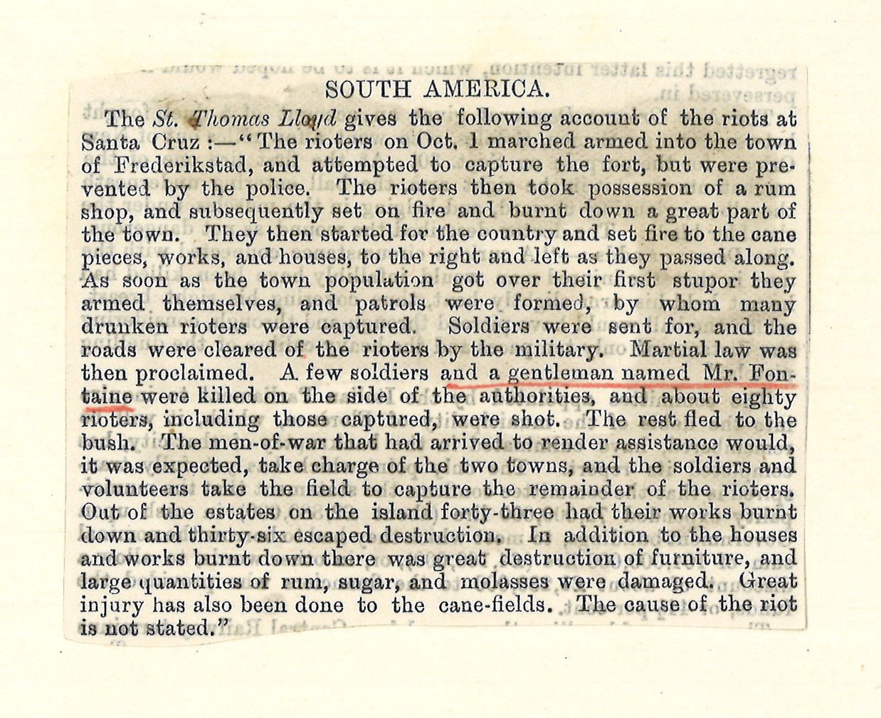
  10. Oct 1, 1878The Fireburn: laborers led by four women burn most of Frederiksted
  11. March 31, 1917Denmark transfers the islands to the United States for $25 million
  12. Feb 25, 1927Virgin Islanders are granted U.S. citizenship
  13. 1966The last commercial sugar-cane crop is cut at Bethlehem
  14. 1989 & 2017Hurricanes Hugo and Maria strike the island

An island built apart

St. Croix is the largest of the U.S. Virgin Islands, about 84 square miles of it, and it is also the odd one out. St. Thomas and St. John lie close together to the north, within sight of each other, sharing one shallow underwater bank. St. Croix sits well south of them, alone, on a platform of its own. Between the two lies deep water — the Virgin Islands Trough, a trench that runs somewhere between sixteen and nineteen thousand feet down. You cannot see across it from the other islands. St. Croix was set apart before there were people to notice, and much of what follows in this history follows from that one fact.

The trough is no ordinary stretch of sea. Just north of St. Croix the sea floor drops away and keeps dropping until it joins the Puerto Rico Trench, the deepest part of the whole Atlantic Ocean. The trench's lowest point, the Milwaukee Deep, reaches about 27,500 feet — nowhere in the Atlantic is deeper — and the trench itself runs for some 800 miles along the northern edge of the Caribbean. St. Croix perches on the southern rim of that system, while the other Virgin Islands sit on the far side, up on the shallow bank. Deep water has divided them for a very long time.

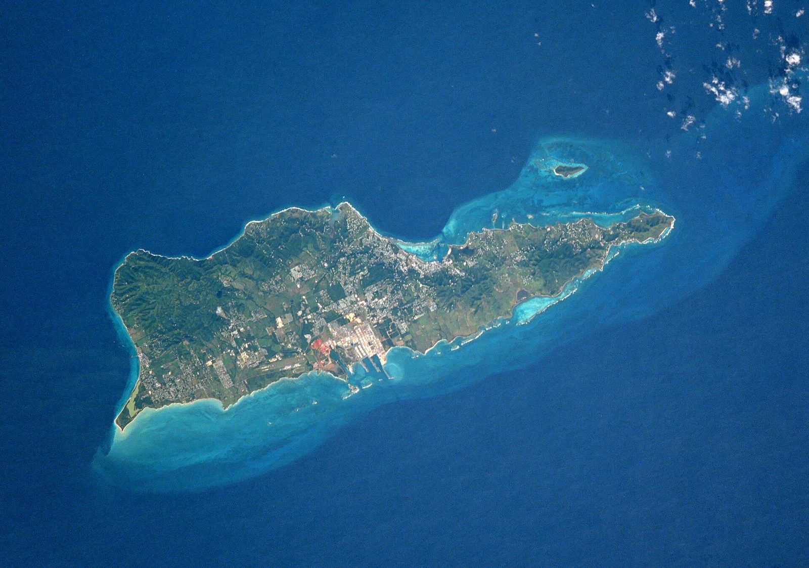
St Croix NASA
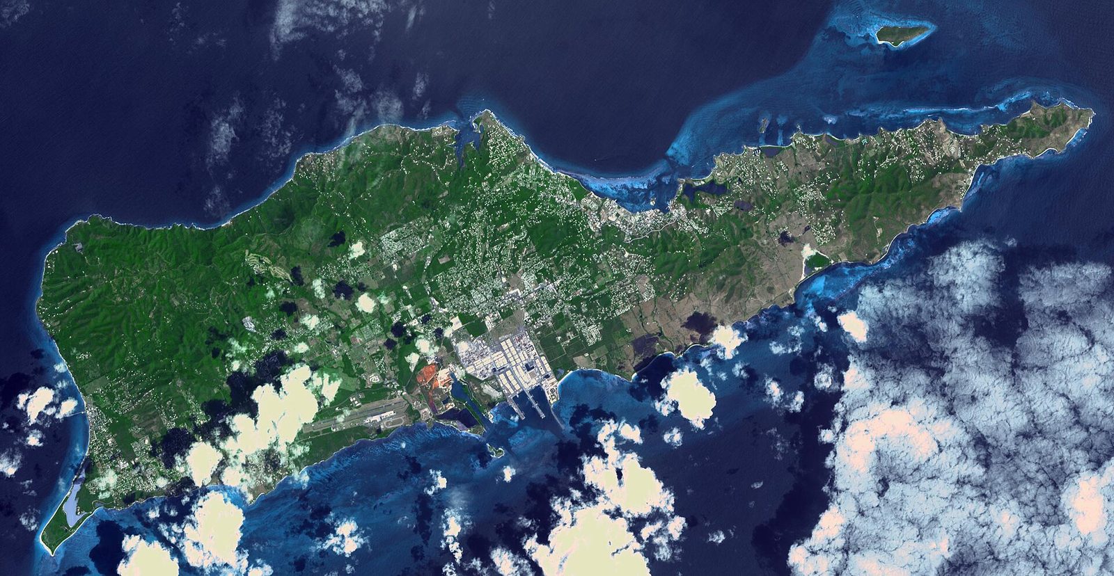
St. Croix from above — about 22 miles of limestone and clay, with wet forest in the northwest hills and dry scrub at the eastern end. Photo: NASA (Public domain)

The separation shows in the rock. The northern Virgin Islands are the tops of drowned volcanic mountains: steep, green and hard to farm. St. Croix is mostly low and flat, a broad central plain of pale limestone and clay with hills at either end. Its rocks are Late Cretaceous — laid down when dinosaurs still walked the earth — and the main formation geologists map across the island is called the Kingshill Limestone. The mechanics can be argued, and are; the outcome is not in doubt. St. Croix is geologically distinct from the mountainous northern islands, and it always has been.

Exactly how it came to sit apart is still worked over by geologists. St. Croix shares an ancestry with Puerto Rico and the northern Virgin Islands — all of them tied to the old volcanic island arc that built this corner of the Caribbean — but its rocks were laid down on the sea floor, and the accounts differ on what happened next. One holds that they formed south of the arc; another that the island began as part of the same platform as the others and was later split off along faults. The primary work is technical and, in places, unsettled, so this guide will not claim more certainty than the science has.

84 sq miLand area
About 22 milesLength
Mount Eagle, ~1,165 ftHighest point
Over 3,200 ftCane Bay Wall drops to

What the geology handed St. Croix, in the end, was flat ground and workable soil — and that shaped its entire human story. St. Thomas and St. John are too steep for much beyond kitchen gardens, and their fortunes were made in shipping and trade rather than in fields. St. Croix could be plowed. Its central plain could be laid out in long rectangular fields, and the limestone-and-clay ground held water well enough to grow one crop above all others: sugar cane. When the Danes went looking, in the 1700s, for an island to plant in sugar, the flatness that had set St. Croix apart was exactly what made it worth buying.

You can still read the difference from the air. Coming in over the north shore, the land climbs into forested hills, then opens into the wide, dry middle where the old estate fields and stone mill towers stand, then lifts again toward the drier east. It is a farmer's island in a chain of sailors' islands. The sugar economy the rest of this history describes — the estates, the enslaved labor, the towns and forts raised on the profits — grew out of that geological accident: a flat limestone plain, cut off in deep water, lying south of everything else. Our guide to the sugar plantations and Estate Whim picks up what happened on that ground.

The deep water left its mark just offshore, too, along the north coast. Because St. Croix falls away so steeply into the trough, its northern reefs do not run out gently into shallows the way reefs do on many islands. They end at a wall. From the beach at Cane Bay you can swim a few minutes out and look down over a reef edge that drops beneath you into open blue. Divers call it the Cane Bay Wall, and the dive guides put the drop just offshore at something over 3,200 feet — you are swimming above a canyon as deep as many mountains are tall.

Because that deep, open water sits so close to shore, the drop-off is rich in coral, tropical fish and the migrating sea turtles that pass along the coast, which is why the north shore is one of the best-known dive coasts in the Caribbean. That isolation shaped the land life too: an island cut off in deep water gets its plants and animals the hard way, carried on wind, wings and currents, so what grows here is a Caribbean sampling rather than anything found only on this spot. The reefs, though, are the island's real wealth of living things, and they ring it almost entirely, from the ridgelines down to the water's edge.

It is worth holding the whole picture in mind before the people arrive, because the land sets the terms for everything they did. A flat, farmable island, alone in deep water, with a fertile middle and a deep-water coast — that is the stage. Every flag, every crop and every person who came here, by force or by choice, arrived on ground the sea had already shaped and set apart. The story of the people begins with the shape of the island, so it is worth knowing the island first.

Twenty-two miles of contrasts

For an island you can drive end to end in under an hour, St. Croix holds a startling range of country. It runs about 22 miles from east to west and about 7 miles north to south at its widest — a small footprint to contain a rainforest, a desert, a farming plain and a coral coast all at once. The contrasts are real, and they sit close together. You can start a morning under dripping trees in the northwest and finish it among cactus and dry scrub on the East End, with maybe forty minutes of driving in between.

The high ground is in the northwest. Mount Eagle, the island's highest point at about 1,165 feet, rises behind the north-shore forest; Blue Mountain, the second-highest at about 1,070 feet, stands a little to the west. These are not big mountains — nothing on St. Croix is — but they are high enough to catch the trade-wind clouds and wring the rain out of them. The result is the wettest corner of the island, a genuine tropical moist forest, shaded and dense, that Crucians simply call the Rainforest even though it is not, strictly, a rainforest.

The rainfall map tilts hard from there. The northwest hills take something like 50 inches of rain a year; the East End gets roughly 25 to 38, and it looks the part. Drive east past Christiansted and the trees shrink, the green pales toward gray-green, and the roadsides fill with cactus and thorn scrub. This is the dry end of the island, swept by steady wind and open sun, and it runs out to Point Udall. Because St. Croix reaches so far east, Point Udall is the easternmost point of the United States, and it is often called the first place in the nation to meet the morning sun. Our Point Udall guide has the walk out to it.

Northwest, St Croix 00840, USVI - panoramio (20)
St. Croix's north shore. Along this coast the sea floor falls away fast — within about a mile the reef gives out to deep, open water. Photo: Андрей Бобровский (CC BY 3.0)

That a single island holds both a rainforest and a cactus scrub is the first thing many visitors find hard to credit, and it comes straight out of the land. Wind and rain arrive from the east; by the time the air has crossed the island and lifted over the northwest hills, it has dropped most of its water. So the east bakes and the west drips, and the middle — the old sugar plain — sits in between, dry enough to work and wet enough to grow. The estates were laid out to take advantage of exactly that gradient.

The coast changes as sharply as the land. The north shore, backed by hills, drops fast into deep water — this is the Cane Bay Wall side, where the reef ends at an underwater cliff. The south and west coasts are gentler, with shallow flats and the island's biggest beaches. Cutting into the north shore is Salt River Bay, a broad estuary where a river meets the sea: the largest mangrove system left on St. Croix, a nursery of red-mangrove roots, coral reef and a rare bioluminescent lagoon that lights up at night. It is also the single most important place in the island's early history, for reasons the next sections take up.

Off the northeast corner sits Buck Island, small and uninhabited, ringed by one of the finest reefs in the Caribbean. The whole of it — 176 acres of dry land plus the reef around it, 19,015 acres in all — is protected as Buck Island Reef National Monument. Its elkhorn-coral barrier reef shelters a marked underwater snorkeling trail, one of only a few in the country, and more than 250 species of fish. The reef was first given federal protection in 1948; President Kennedy made it a national monument in 1961, and President Clinton enlarged it in 2001. Our Buck Island guide covers the trip out.

The reefs are not a backdrop; they are part of what makes the island what it is. St. Croix is close to entirely rimmed by coral, and a barrier reef along the south shore ranks among the largest in the Caribbean. Reef, sea-grass and mangrove work as one system — the mangroves raise the young fish, the reef shelters them, the turtles graze the shallows between — and it is why the water around the island carries as much life as it does. That living rim, as much as the sugar plain, is the island's real inheritance from its geology.

All of this belongs to about 41,000 people. The 2020 census counted 41,004 residents on St. Croix, most of them along the north-central belt between the two towns: Christiansted, the old Danish capital on the north shore, and Frederiksted at the west end. When the Danes surveyed the island they cut it into nine "quarters," and the far eastern one became East End, Quarter B — dry, windward and never the richest cane ground, which is part of why it stayed open and thinly settled. It is the island's quiet quarter still, a scatter of small bays and long views back over the water toward the hills.

Northwest, St Croix 00840, USVI - panoramio (24)
Photo: Андрей Бобровский (CC BY 3.0)
Northwest, St Croix 00840, USVI - panoramio (25)
Photo: Андрей Бобровский (CC BY 3.0)
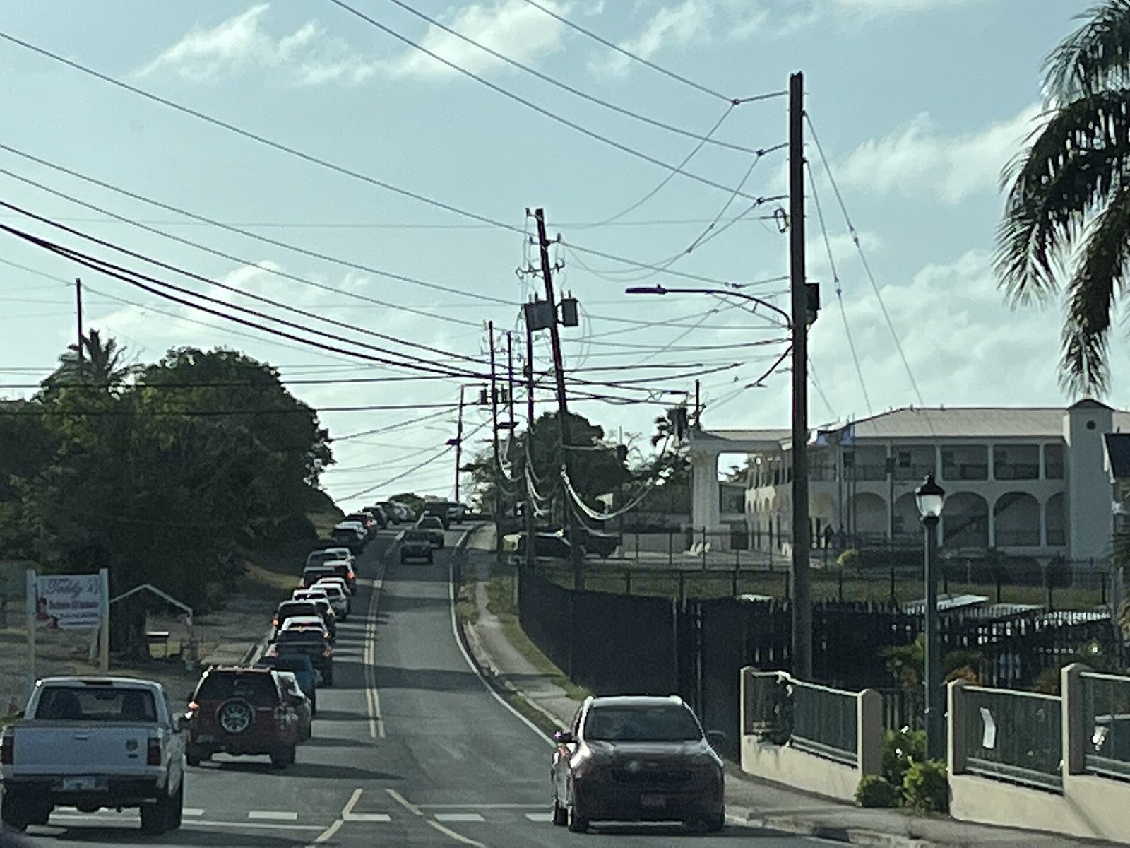
North side road in St Croix, USVI
Photo: CrucianCarolinian (CC0)

Put together, this is a great deal of island in a small space, and the variety is the point. Few places its size offer a forest hike, a desert headland, a barrier reef and a bioluminescent bay within the same short drive. That range is not a slogan; it is geography — the direct product of a flat limestone island lying broadside to the trade winds in deep tropical water. Knowing how the land is arranged makes the human history easier to follow, because people settled, farmed and fought over these different grounds for very different reasons, from the first canoes onward.

The first Crucians

People lived on St. Croix for well over a thousand years before any European saw it, and they are the island's true first chapter — not a warm-up for Columbus, but a long civilization in their own right. The evidence is in the ground: pottery, shell tools, house posts, burials and the stone-lined ball court at Salt River, dug up and studied since the late 1800s. What it shows is not one people but a succession of them, each arriving by canoe from the south, each leaving a distinct style of pottery, across a span of roughly fifteen centuries.

The earliest potters archaeologists can date are called the Igneri, part of the wider Saladoid culture that spread up the island chain from South America. Their pottery on St. Croix dates from around the first century of the Common Era to about 700 — which means people were living settled village lives here around the time of the Roman Empire, fishing, gardening and making fine painted ceramics. They had come island by island, in large dugout canoes, carrying crops and pottery styles that can be traced the length of the Lesser Antilles behind them.

Around 700 the pottery changes, and archaeologists mark the arrival — or the rise — of the Taíno, part of the Ostionoid tradition. The Taíno were the people spread across the Greater Antilles, with Puerto Rico and Hispaniola at the center of their world, and St. Croix sat on its eastern edge. They were the dominant people on the island for roughly seven centuries, to about 1425. It was the Taíno who built the ceremonial ball court at Salt River, and Taíno society — its villages, its chiefs, its religion — is the one the next section looks at closely.

The Taíno called the island Ay Ay, a name usually glossed as "the river," almost certainly for the estuary at Salt River — the one real river mouth on the island and the site of its oldest known village. It is a fitting name. Fresh water is scarce on a limestone island, and a place where a river runs down to the sea, ringed by mangroves and backed by good ground, is exactly where people would settle first and stay longest. Ay Ay is the oldest name the island carries, older than Santa Cruz by centuries.

  1. c. 1–700 CEIgneri (Saladoid) people settle the island
  2. c. 700Taíno arrive and build at Salt River
  3. c. 1425Kalinago take the north-shore village
  4. 1493Columbus anchors off Salt River
  5. c. 1590The island is reported uninhabited

The last of the pre-European arrivals were the Kalinago — the people early Europeans called the Island Caribs, and the ones whose name the Caribbean carries. By one widely cited account they took the Salt River village from the Taíno around 1425, only a couple of generations before Columbus. The Kalinago had their own name for the island: Cibuqueira, glossed as "the stony land." So on the eve of European contact the island answered to two Native names at once — the Taíno "the river" and the Carib "the stony land" — depending on who was speaking, a small sign of how recently and how partially the newcomers had taken hold.

How far the Kalinago had really displaced the Taíno by 1493, and how far they had simply settled in alongside them, is not fully resolved — the ceramics blur together and the written record begins only with the Europeans, who grasped little of what they found. What is clear is that the island was inhabited, named and defended when Columbus arrived, and that the people who met his ships were most likely Kalinago. The clash that came at Salt River in 1493 was not Europeans stumbling on an empty coast. It was Europeans meeting people on ground those people held.
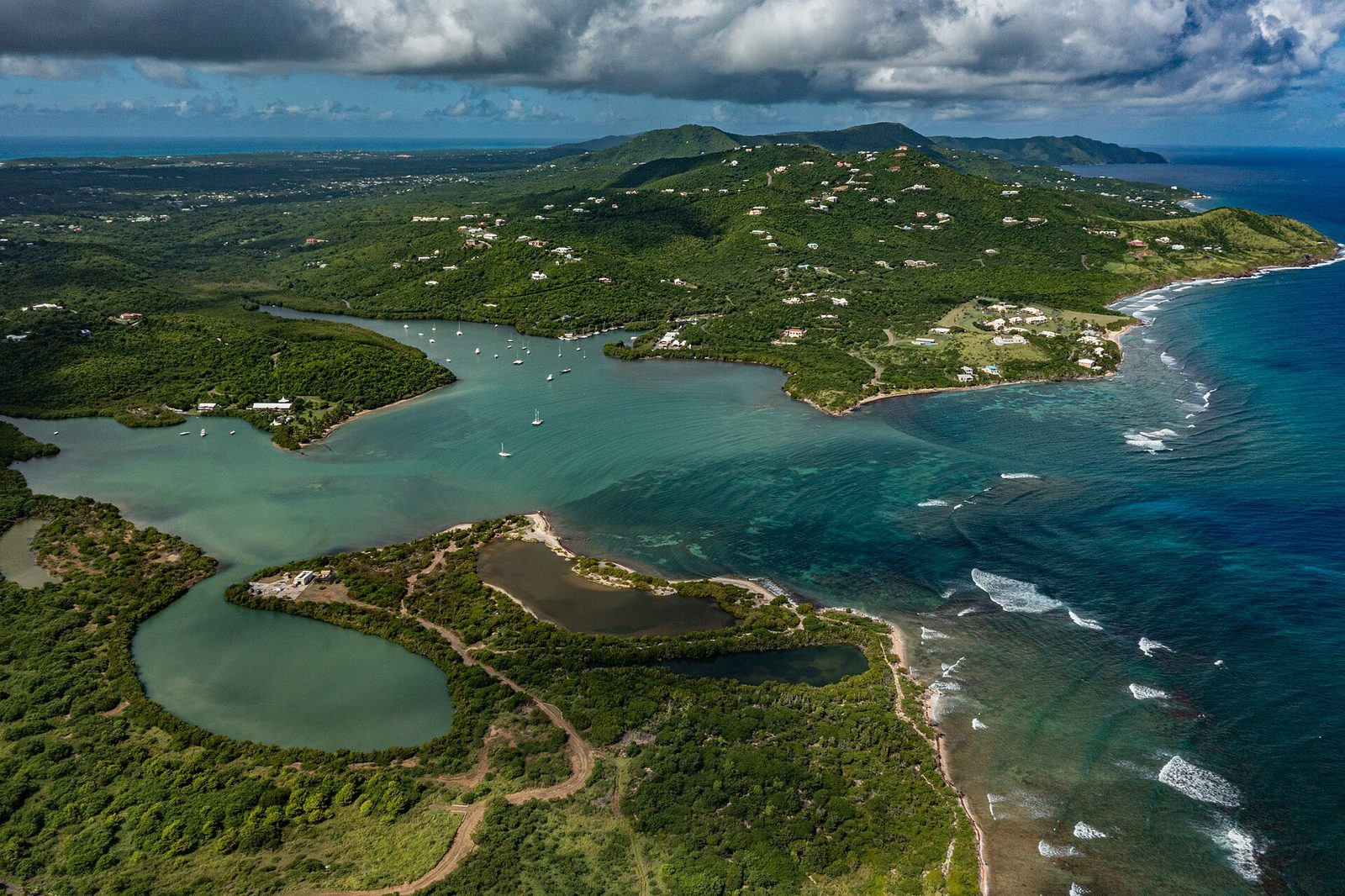
09.07.2024 - NPS Kayak DRONE 05
Salt River Bay, on the north shore — the estuary the Taíno named Ay Ay, and the site of the island's oldest known village. Photo: Alchematics (CC BY-SA 4.0)

The way these people lived can be reconstructed from the middens — the layered heaps of shell, bone and broken pottery they left behind. They fished the reefs and the bay with nets, hooks and traps and ate a great deal of shellfish, reef fish, turtle and crab. Their staple was cassava, also called manioc, a root they grated, pressed and baked into a flat bread that keeps for weeks — the mainstay across the Taíno world — grown alongside the other roots and garden crops of the Caribbean farming tradition. They wove cotton, carved wood and shell, and moved between the islands by canoe as readily as later people moved by road.

This was not a thin or a passing occupation. It was fifteen centuries of continuous village life — people born, buried and remembered on the same bay, generation after generation, for longer than there has been an England or a Denmark to send a flag. By the time Europeans arrived, St. Croix had been farmed and fished for something like sixty generations. Holding that in mind changes how the rest of the story reads, because nearly everything written about the island after 1493 was set down by the people who ended that world, not the people who had made it.

The names carry the confusion of first contact. "Taíno" and "Carib" are broad labels that Europeans applied and later scholars refined; the people themselves would have used narrower names, for their own villages and lineages, most of them now lost. "Kalinago" is the name the Island Caribs used for themselves, and it is increasingly preferred over "Carib," a word tangled early on with European propaganda about cannibalism. Where this history uses the older terms, it is because the sources do, not because the labels are exact.

The people of Ay Ay left no writing, so their voice reaches us only through what they made and what outlasted them: the pottery in the museum cases, the shell tools, the carved stones at Salt River, and a handful of words — Ay Ay, Cibuqueira — caught in the record by the men who displaced them. It is not much to hold fifteen centuries. But it is enough to say plainly that St. Croix was a Native island first, and had been one for a very long time, and that the ground at Salt River is where most of that story still lies.

The ball court at Salt River

Of all the Native sites on St. Croix, one stands above the rest: the ceremonial ball court at Salt River, the only one ever found in the U.S. Virgin Islands and, by the account of the National Museum of Denmark, the only one known in the whole eastern Caribbean. A ball court — batey in the Taíno language — was the center of a Taíno town, part playing field and part sacred plaza, where a rubber-ball game freighted with religious meaning was played between teams and the community gathered for ceremony. That St. Croix has one marks Salt River as a place of real weight in the Taíno world, not a backwater on its edge.

The court came to light through the work of a Danish archaeologist named Gudmund Hatt, who surveyed the Virgin Islands for the Danish National Museum in 1922 and 1923, just after the islands passed from Denmark to the United States. Hatt excavated fourteen sites on St. Croix alone and worked several blocks of ground at Salt River Point. His dig established the first prehistoric chronology for the island and the Virgin Islands — the basic sequence of Igneri, Taíno and Kalinago that the previous section rests on. Almost everything scholars first knew about the deep human past of St. Croix traces back to those two seasons of digging.

What Hatt found at Salt River was a row of nine large stone slabs, set on edge, marking one side of the court — the first ball court ever identified in the Virgin Islands. The slabs are substantial: about 26 feet as a row and a foot and a half high. Four of them are carved. The carvings that survive show a "wrapped ancestor" figure, a "Frog Woman" that scholars identify with the Taíno goddess Attabeira, and human faces looking out of the stone. These were not ornament. They were the presence of gods and ancestors, set deliberately around a sacred ground.
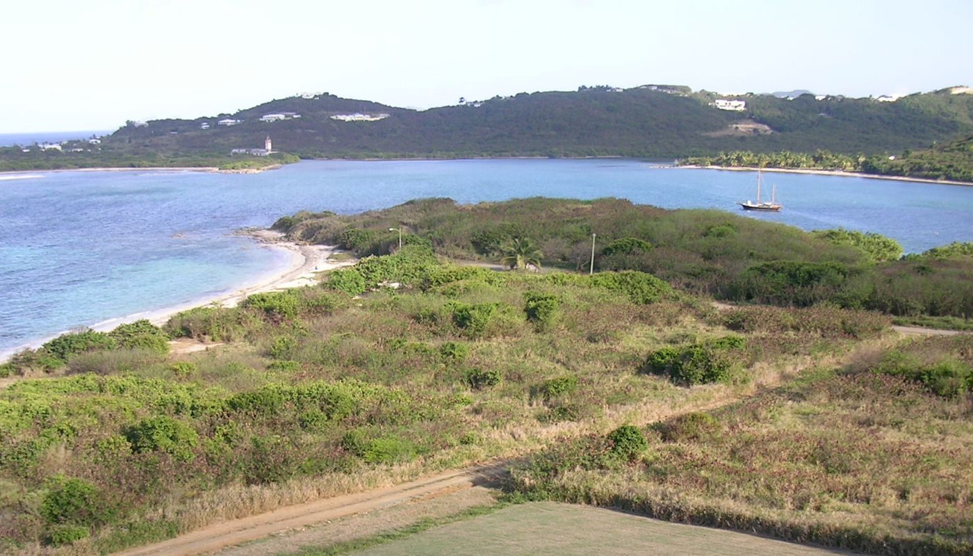
Salt-River-Bay-1
The same bay a century of archaeology made famous: Salt River, where the only Native ball court in the U.S. Virgin Islands was unearthed in the 1920s. Photo: self (Public domain)

Attabeira, the figure in the stone, was among the most important deities in the Taíno world — a mother goddess tied to fresh water, fertility and childbirth. To find her carved at the edge of the ball court, at the mouth of the island's one river, on the bay the Taíno had named "the river," is the kind of detail that makes a distant people suddenly legible. The carving ties the place, the name and the religion into a single knot. Salt River was not merely where people lived. It was where they addressed their gods, on a court laid out for the purpose.

There is a hard fact attached to all of this, and it belongs out in the open. Everything Hatt dug up at Salt River — the carved ball-court stones, along with petroglyphs, three-pointed carved zemis, stone belts and collars, and human burials — was shipped to Denmark, and it is held today by the National Museum of Denmark in Copenhagen. The island's single most important Native monument does not sit on the island. It sits in a European museum, thousands of miles from the bay where it was made, carried off in the same decade the Virgin Islands became American. Visitors to Salt River can stand where the court was. They cannot see the stones.

The carvings deserve a closer look, because they are easy to file under archaeology when they are really something more. A "wrapped ancestor" is a depiction of the honored dead, bound in the posture the Taíno used for important burials; the Frog Woman is a goddess of birth and water; the human faces are the watching presence of the spirits the Taíno called cemís, or zemis, believed to inhabit carved things. To ring a ball court with these figures was to set the game inside a circle of ancestors and gods. The court was a sacred instrument, and the stones were how the Taíno kept the gods in the room.

The site itself is protected now. In 1992 Congress created Salt River Bay National Historical Park and Ecological Preserve around the estuary, a joint effort of the National Park Service and the Virgin Islands government that guards the archaeology together with the mangroves, reef and bioluminescent lagoon around it. The visitor center on the hill above the bay has been closed since Hurricane Maria in 2017, but the land is open in daylight and free to walk. Our guide to Salt River Bay and its bio bay covers the park, the night kayak trips and the drive out.

It is worth being straight about what there is to see. Salt River is not a ruin you walk through like a fort. The ball court was excavated and its stones removed a century ago; what remains is the setting — the bay, the point, the mangroves, the water — and the knowledge of what happened here. For some visitors that is plenty; for others, expecting a monument, it can come as a surprise. The reward at Salt River is understanding rather than spectacle. It is the oldest continuously important place on the island, and it reads that way only if you bring the story with you.

There is a second layer of history stacked on the same ground, which is part of why the place matters so much. The bay that held the Taíno town is also where a boat from Columbus's fleet came ashore in 1493 — the one documented spot where any of Columbus's men set foot on what is now United States soil. So Salt River holds both the height of the Native island and the moment of first European contact, on the same shore, a few hundred yards apart. The ball court and the landing site are the before and the after of the island's turning point, and the turn came fast.

How the island was emptied

The end came fast, set against fifteen centuries. Within about a hundred years of Columbus's arrival, the Native people of St. Croix were gone — killed, carried off, or driven out — and an island that had been lived on continuously since the Roman era was reported empty. This is the hinge of the whole history, and it is the part most often skipped. Before St. Croix could become a Spanish claim, a Dutch outpost, an English and French battleground and a Danish sugar colony, it first had to be emptied of the people already here. It was.

The emptying began the moment the ships appeared. When Columbus's fleet anchored off Salt River on the north shore on November 14, 1493, and sent a boat ashore for water, the men ran into a Kalinago canoe, and the two sides fought — the first recorded armed clash between Europeans and Native people anywhere in what is now the United States. It was a short, sharp fight, with dead on both sides, and Columbus named the point where it happened Cabo de la Flecha, the Cape of the Arrow. But the skirmish was a preview, not the main event. The real destruction came slowly, and from three directions at once.

The first was raiding. Spain never settled St. Croix — it planted no town, built no fort, cleared no field — but it did not leave the island in peace. From its base on Puerto Rico, the large Spanish island to the west, Spain treated the Native people of the smaller islands as a resource to be seized, and mounted slave raids to carry them off to labor on Puerto Rican farms and in its mines. Raiding parties came and went for decades. Every raid took people the island could not replace, and taught the survivors that their own coast was no longer safe.

The second was disease. Europeans carried illnesses — smallpox above all, along with the other Old World diseases the Caribbean had never met — and the people here had no resistance to them. Sickness moved faster than any army, often running ahead of the Europeans themselves, and it killed on a scale that is hard to take in: across the Caribbean and the Americas, Native populations fell by the great majority within a few generations of contact. A community already thinned by raiding had no defense against a season of smallpox. Disease did the quiet, enormous part of the work.

The third was flight. Faced with raids from the sea and sickness in the villages, those who could leave did. Kalinago and Taíno alike took to their canoes and withdrew to islands that were harder for the Spanish to reach, down the chain to the south, where Kalinago communities held on for another two centuries and more. St. Croix, close to Puerto Rico and open to the sea, was among the first islands abandoned. The emptying was not one event but a steady draining — some killed, some seized, some dead of disease, some simply gone.
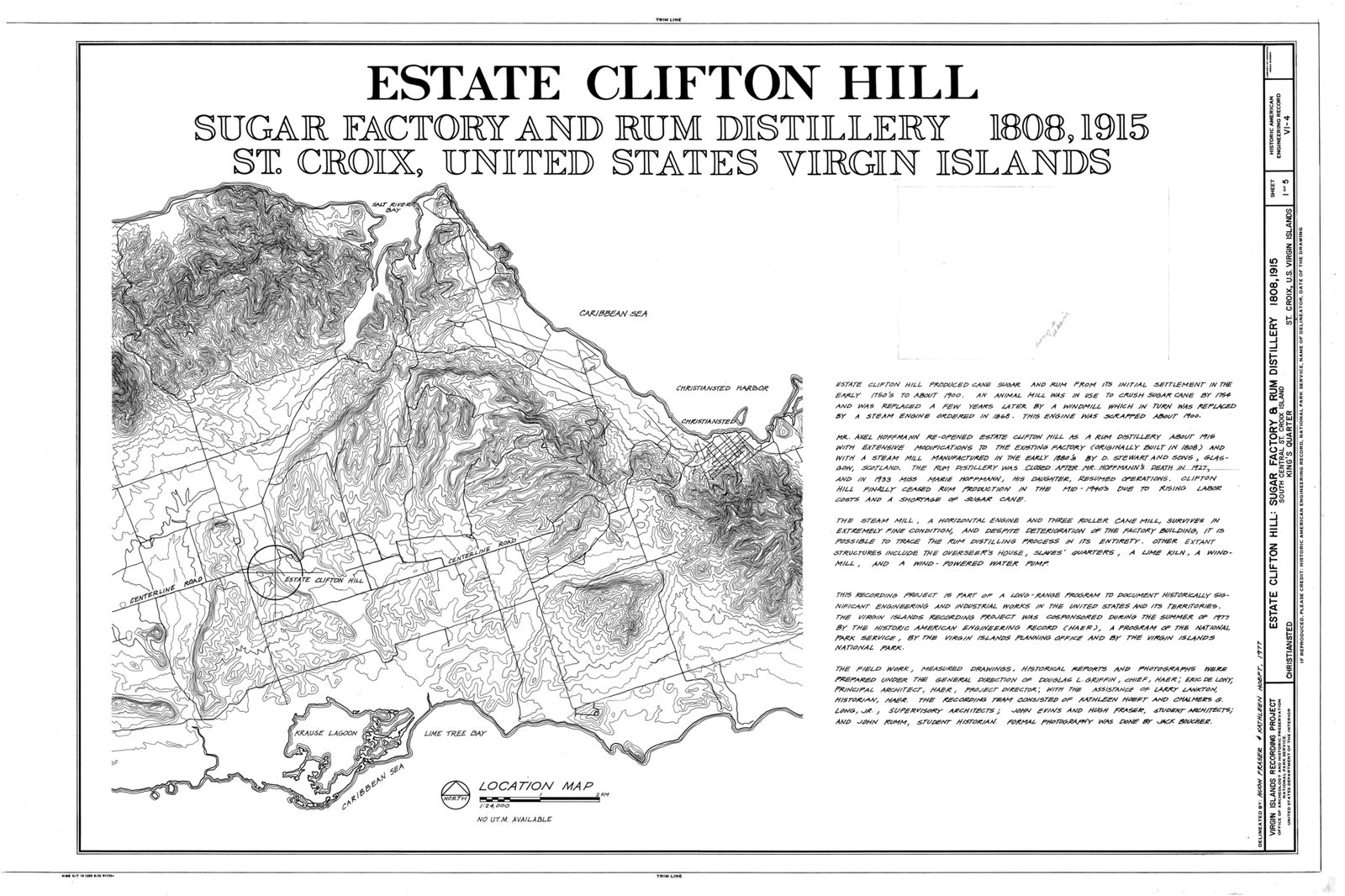
Estate Clifton Hill, Sugar Factory and Rum Distillery, Title Sheet - Estate Clifton Hill, Sugar Factory and Rum Distillery, South Central Street, Christiansted, St. HAER VI,1-KING,2-A- (sheet 1 of 5)
An early European chart of St. Croix. By the time mapmakers were drawing the island in detail, the people who had named it were long gone. Photo: Fraser, Hugh (Public domain)

By about 1590 — the date the sources give for when St. Croix was reported uninhabited — the work was done. The ball court at Salt River stood abandoned. The gardens had gone back to bush. The names, Ay Ay and Cibuqueira, survived only in the odd European document, attached to an island with no one left on it to speak them. A civilization that had lasted longer than the whole stretch of time from ancient Rome to its own undoing had been broken inside a single century, most of it without a battle. The island was, for the first time in fifteen hundred years, empty of people.

This is the fact to carry into everything that follows, because it is the one the old histories quietly drop. When the Dutch built a post at Salt River in the 1600s, when the English and French fought over the west end, when the Danes bought the island in 1733 and laid it out in cane, they all described themselves as settling an empty island. They were not. They were moving onto land that had been farmed, fished, named and worshipped on for something like sixty generations — land that was empty only because an earlier wave of Europeans had emptied it. The "unsettled" island was a made thing, and the making of it was the first act of the island's colonial history.

It is a pattern that repeats across the Caribbean, but St. Croix shows it unusually starkly, because here the island really was cleared and then really was left alone for long stretches — decades at a time with no settled population at all. The seven flags the island is known for all flew over ground that had been emptied of its first people before the first of those flags arrived; this history means to begin underneath them.

It matters, too, for who the Crucians are today. Because the Native population was destroyed so early and so completely, the people who now call themselves Crucian descend overwhelmingly not from the island's first inhabitants but from the Africans brought here in chains to grow sugar, and from the Europeans who ran the colony. The thread back to Ay Ay was cut in the 1500s. What survives of the first people is in the ground, in a museum in Copenhagen, and in the island's oldest names — not, for the most part, in its living population.

None of which the early European sources dwell on, so it falls to a history like this one to say it plainly. The St. Croix the rest of this story describes — the Spanish name, the seven flags, the sugar and the slavery, the towns and the forts — begins on ground where one people had already been replaced by another through force. The next chapter goes back to the start of that colonial century, to the November morning in 1493 when a boat from Columbus's fleet pulled for the shore at Salt River. Our guide to Columbus at Salt River tells that day in full.

Where it is on St. CroixChristianstedFrederikstedPoint UdallThe CeruleanSalt River
Where it is. Island outline © OpenStreetMap contributors (ODbL).

Columbus at Salt River, November 1493

When the last chapter closed, St. Croix was empty — reported uninhabited by about 1590, its Native people raided, sickened and driven off. But an island does not empty itself. People had lived, farmed and fished here for well over a thousand years, and the emptying was the work of other people, done on purpose, over a violent century. That century opened on a single morning: November 14, 1493, when a fleet of seventeen ships stood off the north shore and put a boat in the water. The European history of St. Croix begins there, and it begins not with a discovery but with a fight.

This was Columbus's second voyage, and it was nothing like the first. Three small ships had felt their way across the Atlantic in 1492; now seventeen sailed from Cádiz, on September 25, 1493, loaded to plant a Spanish colony on Hispaniola. The fleet raised Dominica on November 3, worked north through the Lesser Antilles, and on November 14 stood off a large, green island Columbus named Santa Cruz — Holy Cross. The Taíno who had lived on it called it Ay Ay. He did not know the name and did not need to; naming was a European ritual of possession, and he performed it.
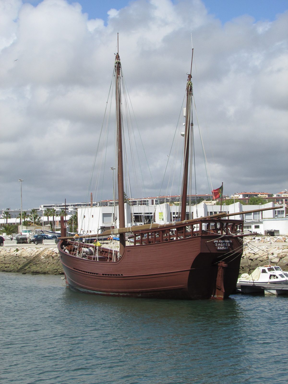
Diego Álvarez Chanca, the fleet's physician, wrote that the island looked populous and extensively cultivated as the ships came along it — his own phrase, and a useful one, because it tells you the shoreline the Spanish were looking at was farmed land, not wilderness. This was no empty coast in 1493. It was worked country, with villages, gardens and a people who had held the island for centuries. The fleet's need that day was an ordinary one for a big convoy far from home: fresh water, and somebody who could point the way west toward the Taíno world Columbus already knew.

Columbus did not go ashore. He sent in a boat — the accounts put it at about twenty-five men — to the bay we now call Salt River, to fill water casks and, if they could, to seize a few people who might serve as guides. The men found a village near the shore, its people already gone; they had watched seventeen ships climb over the horizon and left. The crew took what captives they could find in the emptied houses, several women and boys by the accounts, some of them Taíno held by the Kalinago who then controlled the bay, and started back for the ships with them.
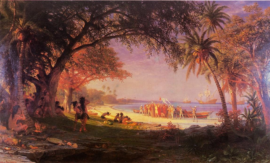
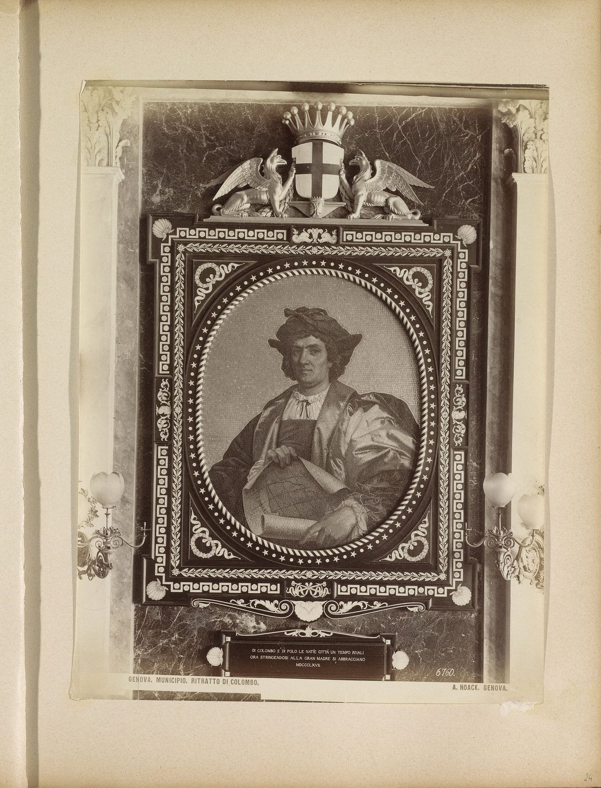
The story of Columbus (1892) (14596194799)
A 19th-century illustration of Columbus's second voyage, from an 1892 book. Photo: Internet Archive Book Images (No restrictions)

As the boat pulled for the fleet, a canoe came around the point — a few Kalinago men, two women, and two Taíno captives. Cornered on open water, the people in it did not surrender. They took up their bows, and the women drew and shot alongside the men. Two Spaniards were hit and one of them died within days; at least one person in the canoe was killed, and the rest were seized. It was a small, sharp fight in a bay, over inside an hour, and it is the first recorded armed clash between Europeans and the native people of the Americas anywhere in what is now United States territory.

“they most courageously took to their bows, both women and men”

Dr. Diego Álvarez Chanca, the fleet physician, describing the canoe fight at Salt River, in his letter of 1494

Columbus marked the day the way conquerors mark things, with a name. He called the point Cabo de la Flecha, the Cape of the Arrow, for the wounded man who died, and the promontory still carries the sense of it on the east side of the bay's mouth. Then the fleet sailed on; it was off the coast of Puerto Rico three days later. The whole Spanish landing on St. Croix was that — one afternoon, one skirmish, and two names left on the map, the cape and the island itself. Nobody stayed. Nobody came back for more than a century.

Two men on the fleet wrote the day down, which is the only reason we have it. Chanca sent a long letter home to Seville describing the crossing, the islands and their peoples; Michele de Cuneo, a friend of Columbus's, wrote a shorter and blunter one. Neither the Kalinago nor the Taíno left any account of their own, and none could have been kept in a form Europe would later read. What survives is the Spanish version of a fight the Spanish started, written by the men who sent the boat, and it should be read as one side of it and not as the record.

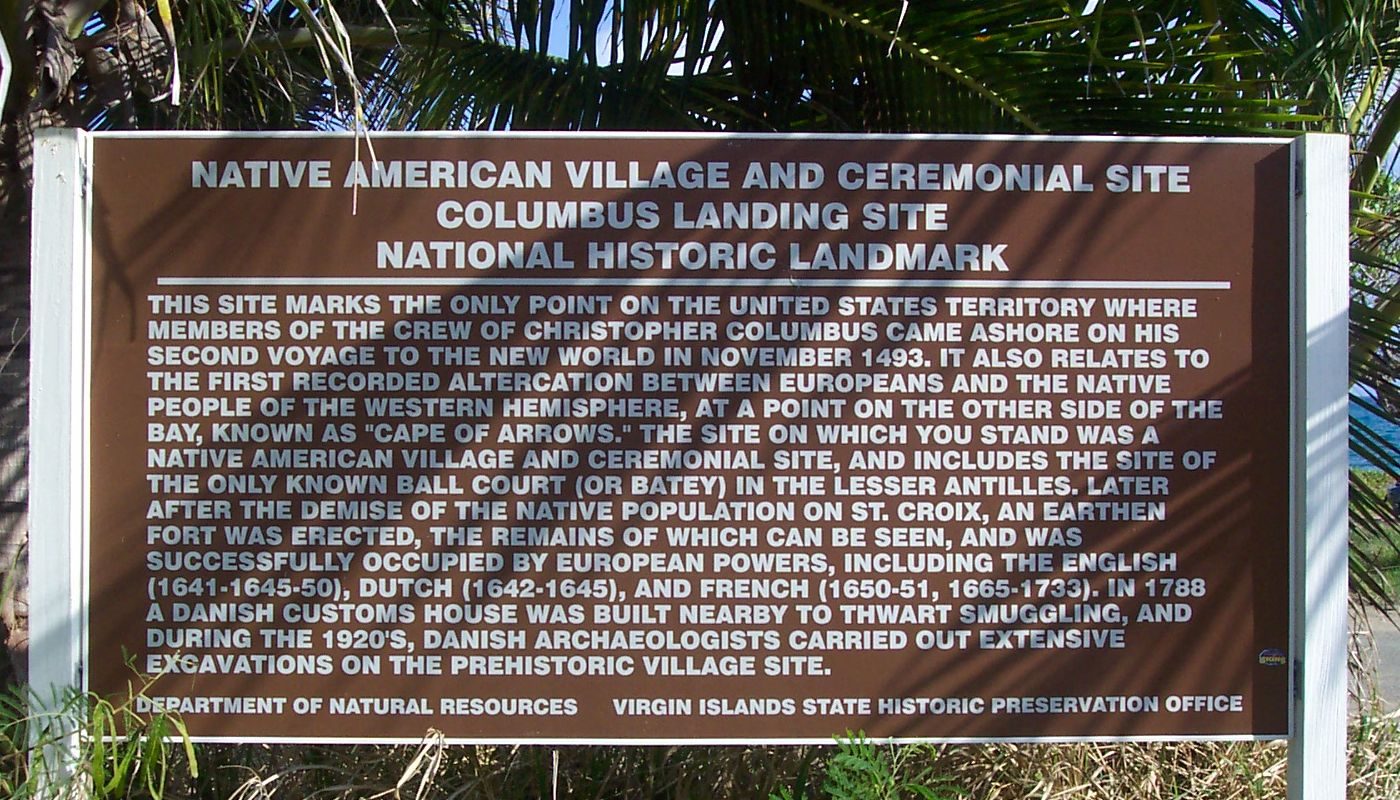
Salt River is the only documented place under what is now the American flag where members of a Columbus expedition came ashore. That is a real distinction, and it is worth stating precisely: not that Columbus discovered St. Croix, and not even that Columbus himself set foot on it, but that his men landed here once and fought the people who already lived here. The island had been settled for fifty generations. It was claimed in an afternoon and left the same day, and that claim — the right, as Europe reckoned such things, to call the island Spanish by discovery — is all Spain ever carried away.

Nothing Spanish was built at Salt River, then or later. Spain took a claim and no more, and it would hold that claim for a century and a half without once settling the land or raising a wall on it. The full day at Salt River — the archaeology in the ground, the ball-court finds now in Copenhagen, and what there is to see today — is in our 1493 landing guide. Here the thread to follow is the claim itself: what an empire does with an island it owns on paper and never means to live on.
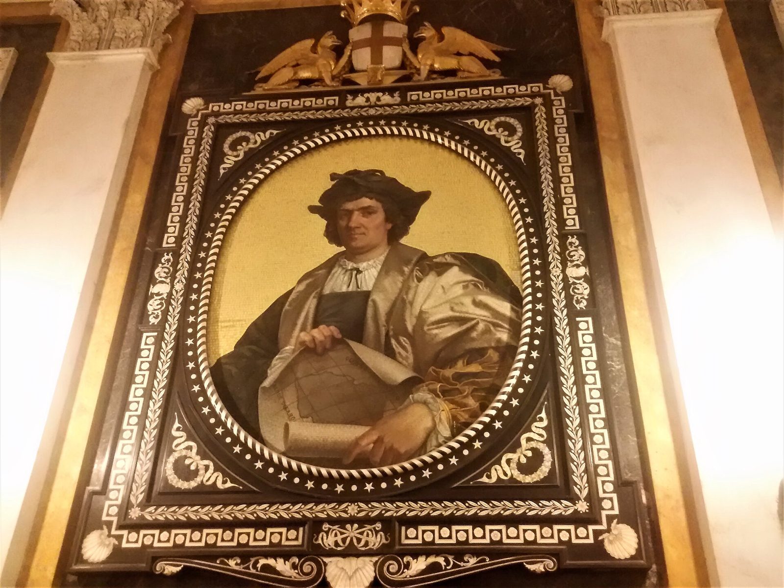
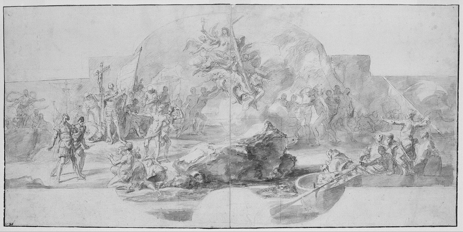
  1. 1493Columbus anchors off Salt River and his men fight a Kalinago canoe
  2. 1638Dutch settlers dig in at Salt River and the site of Christiansted
  3. 1645English planters kill the Dutch and French leaders and take the island
  4. 1650France takes the whole island without a fight
  5. 1651The Knights of Malta buy the island and rule it to 1665
  6. 1695France evacuates its colonists and the island lies empty for 38 years

Spain's empty claim

Spain's flag over St. Croix was a claim and almost nothing else. By the reckoning of the age, Columbus's afternoon at Salt River had made the island Spanish property, and Spain treated it as exactly that — property it did not need to occupy. For most of the sixteenth and seventeenth centuries the Spanish flag here meant no governor, no garrison and no town, only the standing promise that a warship would come if anyone else tried to put down roots. It is a strange way to own an island, holding it by denial rather than by settlement, and Spain kept it up for a hundred and fifty years.

The reason lay to the west. Spain's Caribbean was built around the Greater Antilles, and Puerto Rico — San Juan, its harbor and its soldiers — was the piece that mattered in these waters. St. Croix, low and green on the southern horizon, was a flank to be guarded rather than a prize to be worked. Empty, it was harmless. Settled and fortified by the Dutch, the English or the French, it would have become an enemy strongpoint within easy reach of the Puerto Rico shipping lanes. So Spain made a policy out of emptiness, and enforced the policy with the one tool it cared to spend here, which was the raid.

The historian Aimery Caron, reading the surviving seventeenth-century records, dates a whole run of those raids, and the pattern never changes: someone lands and plants tobacco, and a Spanish force sails over from Puerto Rico to burn the settlement out. English planters from Barbados dug in around 1631 and were attacked within a few months. French and Dutch settlers arrived in 1634 and were, in the phrase Caron quotes, promptly dislodged by a Spanish force of forty men aboard a frigate. The island was not so much unsettled as repeatedly un-settled, cleared again each time somebody tried to hold it.

It kept happening for a generation. English settlers from Tortuga established themselves from 1635 and were driven off over two hard years, with forty killed and twenty-three taken by 1637. A Spanish force of about 150 men swept the island in April 1647, and a final expedition came in July 1650. Read Caron's list end to end and it is a century of the same event on a loop — settle, burn, repeat — and it is the machinery behind the flat word the older records use for St. Croix. The island did not fall empty on its own. It was emptied, on purpose and at gunpoint, and then kept that way.

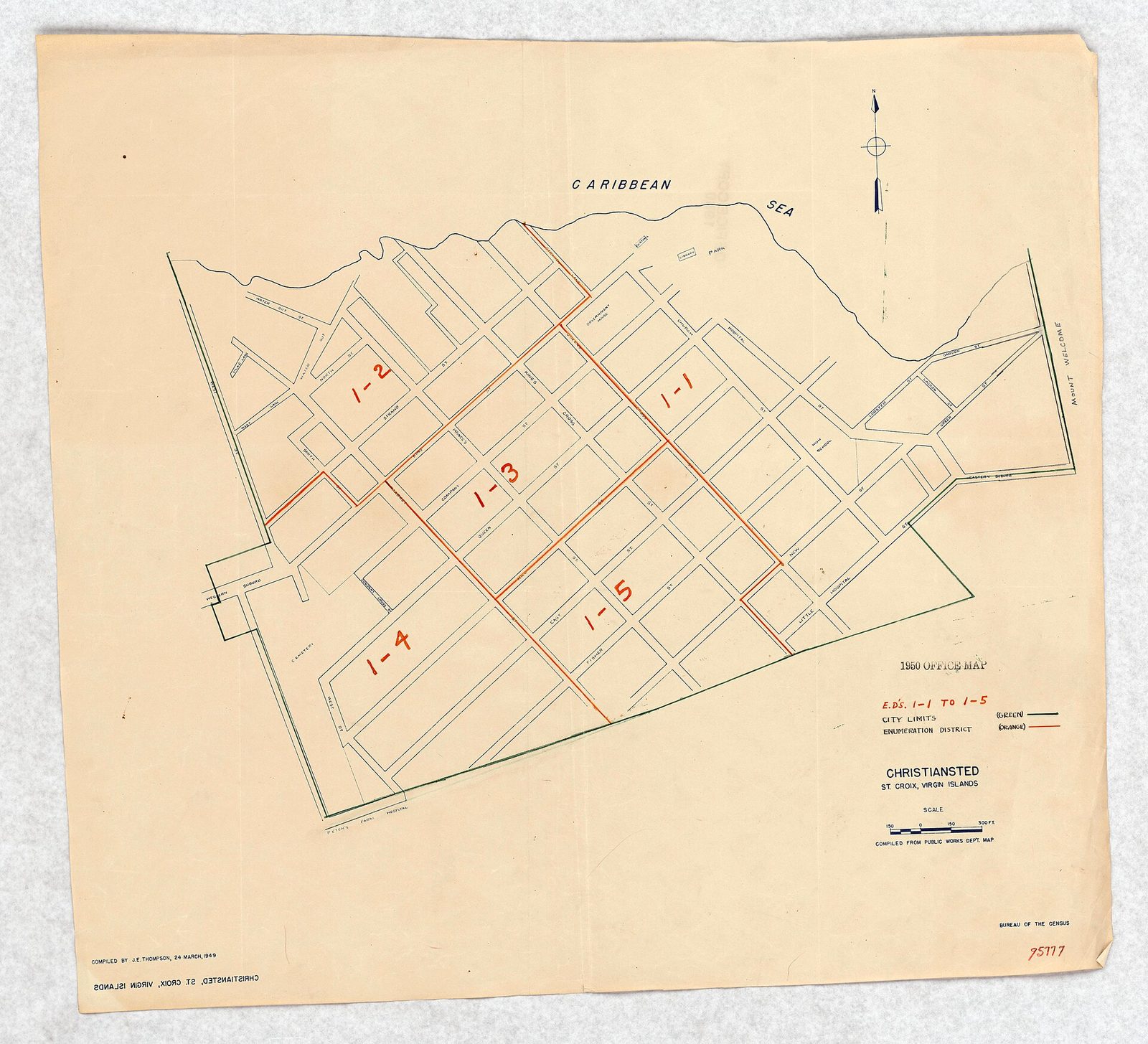
1950 Census Enumeration District Maps - Virgin Islands -Christiansted - ED 1-1-5 - NARA - 75639635
St. Croix as European mapmakers drew it in the 1700s, under the French and then the Danish flag. Photo: Unknown author Unknown author or not provided (Public domain)

The raids fell on the Europeans, but the same Spanish pressure had already broken the people who were here first. Through the sixteenth century the Kalinago and the last Taíno of St. Croix faced the ships that would later burn the tobacco camps, and by about 1590 they were gone — dead, taken, or fled to other islands. The two emptyings run together: Spain cleared the Native people off across the 1500s, then spent the 1600s keeping every European rival off the same ground. By the time Caron's raids were flying, there was no one left on St. Croix to conquer — only the land, and the fight over who could hold it.

What Spain never did was build. There is no Spanish fort on St. Croix, no Spanish town, no Spanish church or estate — nothing standing or buried that a Spanish mason laid. In a century and a half of ownership, Spain's entire physical mark on the island is the absence of anyone else's, which is a curious kind of monument. The raids that kept the ground clear also kept it blank, and when Spain at last let go, in 1650, it gave up an island it had never once plowed. The single thing it left behind was not a thing at all.

What it left was the name. Columbus's Santa Cruz — Holy Cross — outlived the Spanish claim and every flag that came after it. The French, taking the island in 1650, turned it into Sainte-Croix; the Danes, buying it in 1733, wrote it Sankt Croix; the Americans, buying it in 1917, settled on the English Saint Croix. Four spellings, one meaning, and the cross held through all of them. The people carry the Spanish form too — a Crucian, pronounced KROO-shun, from Santa Cruz by way of the Latin for cross, not from the French or Danish spelling that governed the island far longer than Spain ever did.

It is a small, stubborn survival, and a pointed one: the single European power that never built anything here is the one that named the island and its people, and the names outlasted the claim, the raids and the empire that made them. A claim kept by raid could hold an island empty, but it could not hold it forever. Spain's warships could burn a tobacco camp, but they could not be everywhere at once, and the same flat ground that made St. Croix worth denying to rivals kept drawing them back to try again. In 1638, one attempt, for the first time, did not wash away with the next raiding season.

Tobacco and blood

The settlement that finally held began in 1638, and it was Dutch. A party under a deputy governor named Louis Capoen established itself at Salt River — the same sheltered bay where Columbus's boat had fought the canoe — and at the site where the Danish town of Christiansted would later stand. Caron names the core of the group: fifty Zeelanders, sent out by the Dutch West India Company, planting tobacco on ground Spain still called its own. This time, when the raids came, the settlers bent but did not break, and for the first time since 1493 St. Croix held a European community that lasted more than a single season.

They did not stay alone for long. French deserters from the hungry, overcrowded colony on St. Kitts crossed over and joined the Dutch in 1639, and by the early 1640s St. Croix held a mixed Franco-Dutch settlement of perhaps a hundred people. Then the English arrived. In 1641 a party at the west end under Colonel William Caverly and a man the records call Mr. Brainsby — about fifty strong — set up far from the Dutch. One small island now carried three European nations that were rivals everywhere else on earth, and all had come for the same crop and the same flat fields to grow it in.

The crop was tobacco, and tobacco is the whole reason any of them were there. Before sugar remade the Caribbean, tobacco was the poor settler's cash crop — quick to plant, light to ship, and sold into a European market that could not get enough of it — and every small island in the chain was being clawed over to grow it. St. Croix's ground grew it well. The Dutch, the French and the English on the island were not pioneers spreading out into open country; they were competitors crowded onto the same good land, watching one another's fields, and the crowding did not stay peaceful for long.

In 1645 it turned to killing. The trigger, by the records, was a quarrel over the quality of the tobacco — whose leaf was sound, whose was cut with bad, and who would eat the loss. English planters were seized and jailed; their countrymen broke them out by force; the Franco-Dutch side struck back; and in the fighting both Louis Capoen, the Dutch deputy governor, and Brainsby, the English leader, were killed. A dispute over a crop had become a war among neighbors, and the neighbors, having buried their leaders, sent home across the water for soldiers to finish it.

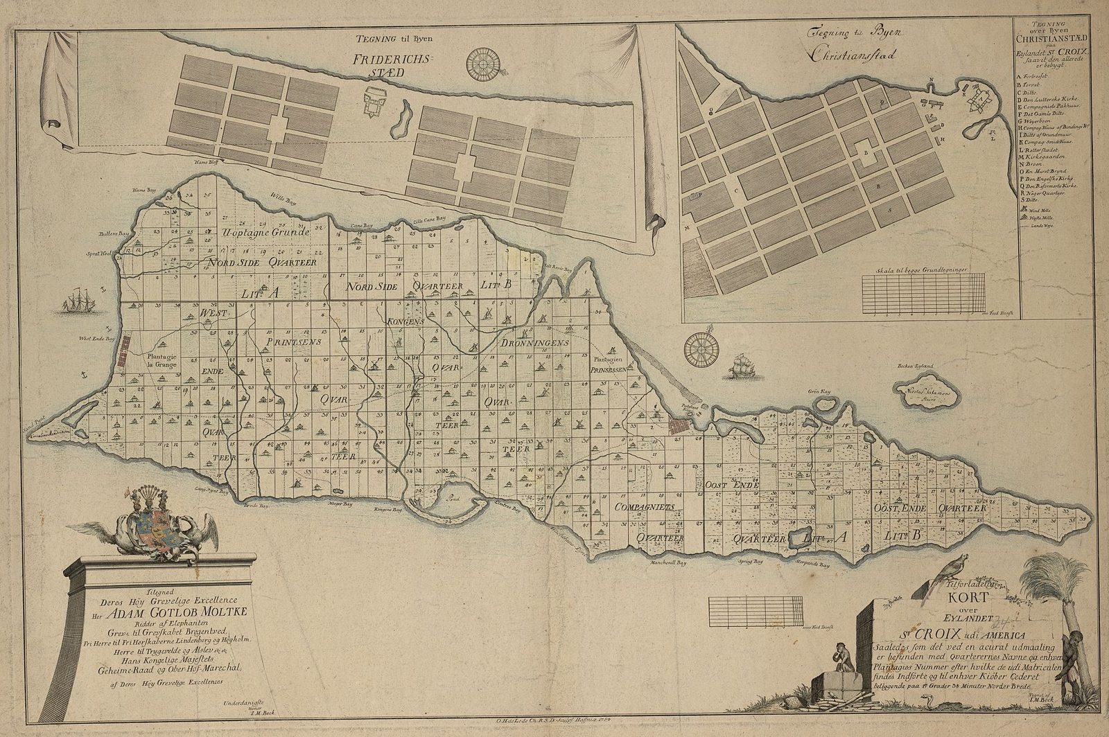
Tilforladelig Kort over Eylandet St. Croix udi America - no-nb krt 00577
Photo: Beck, I.M. (Public domain)
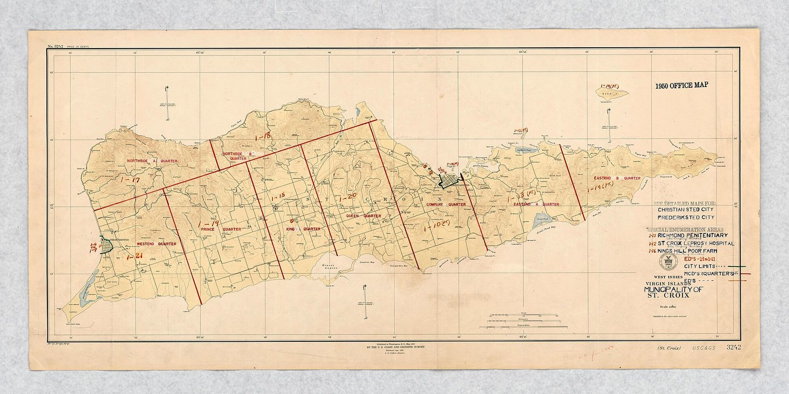
1950 Census Enumeration District Maps - Virgin Islands - St. Croix Municipality -ED-1-21 - NARA - 75639637
Photo: Unknown author Unknown author or not provided (Public domain)
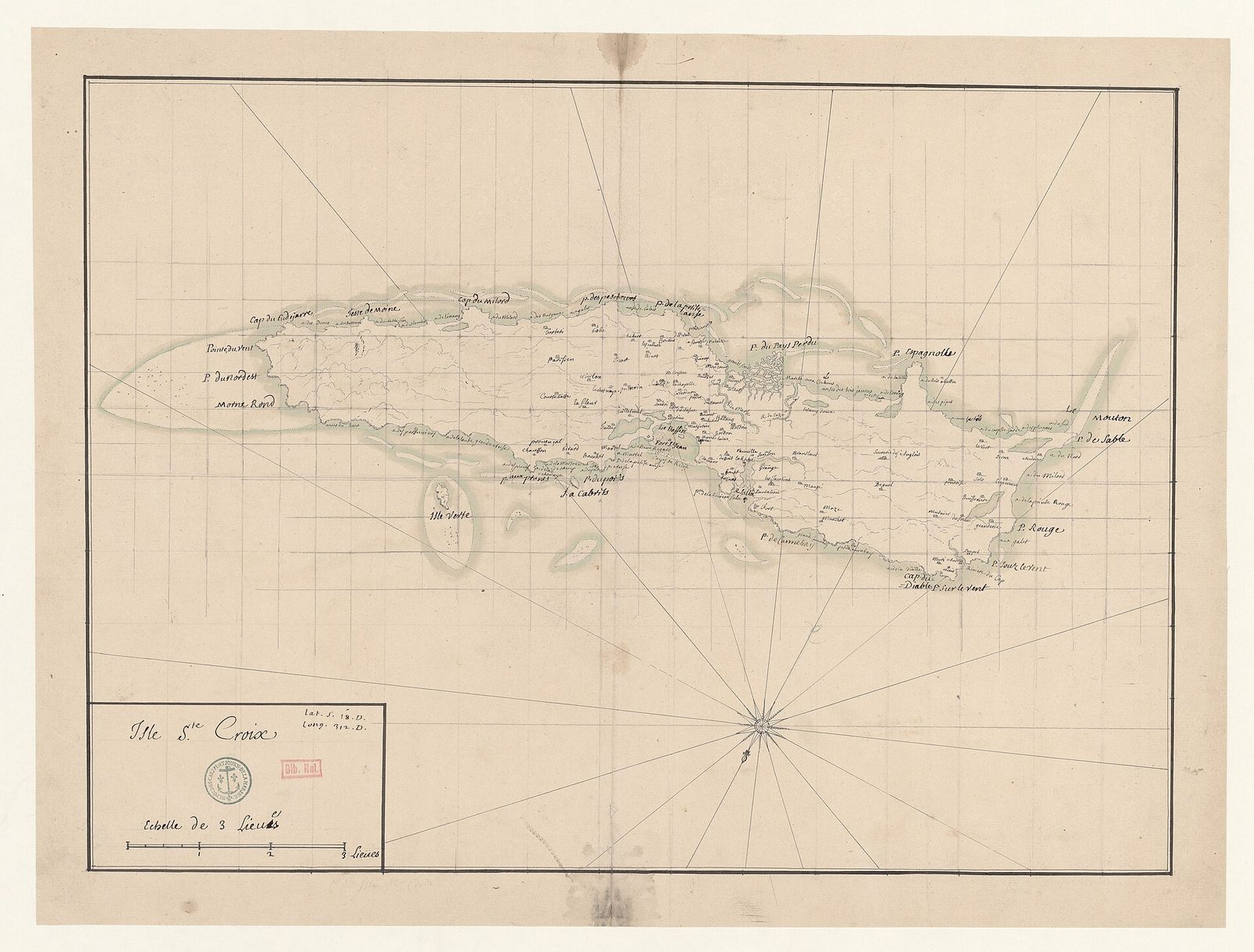
Isle Ste. Croix - btv1b53103490r
Photo: Wikimedia user Gzen92Bot (Public domain)

The English won it by sheer weight of numbers. Reinforcements came in — Caron's figures run to five or six hundred men against no more than two hundred on the other side — and the result was one-sided. In July 1645 the English expelled the French, killed the new Dutch deputy governor, a man the records name only as Denis, along with his lieutenant, and forced the last of the Dutch off the island within two months. The Dutch withdrew to St. Eustatius and St. Martin; the French fell back to Guadeloupe. St. Croix was English now, and it had been bought with the lives of two leaders and a good many men below them.

England held the island alone for five years, and they were not easy ones. The English had the land but inherited the same trouble every settler on St. Croix faced: Spain still claimed it, and Puerto Rico's garrison was still just to the west, free to sail whenever it chose. There was no quiet to enjoy, only a hard-won foothold on ground Spain had spent a century clearing of everyone else. What finally finished the English was the same pair of forces that had finished settlers before them and would nearly finish those after — a Spanish fleet, and fever.

The two blows landed close together. The Spanish expedition of April 1647 had already gutted the West End community; the sweep of July 1650 carried off the rest, and the survivors, in the language of the old accounts, were already suffering severely from an epidemic of a tropical fever. Twelve years after the Dutch first dug in, St. Croix was empty again — not by any treaty but by disease and gunfire. The scramble of the 1640s left the island exactly as it had found it: cleared, claimed on paper, and stripped once more of the people who worked it.

One thing from those years is still on the ground, barely. On the point at the west side of Salt River's mouth lie the low, grassed-over banks of an earthen fort begun in this period — thrown up by the Dutch or English, then renamed by whoever next held the point. The French, taking the island in 1650, named it Fort Salé, the name on the map today. Wikipedia calls the earthwork the only known structure to survive from the early colonial period. It is a hump in the grass above the same lagoon whose night-time glow draws kayakers now, and it is nearly all the seventeenth century left standing on St. Croix.

Salt-River-Bay-2
Salt River Bay, where the 1493 encounter took place and where the earthwork of Fort Salé is the only structure left from the early colonial century. Photo: self (Public domain)

France and the Knights of Malta

France took St. Croix in September 1650, and it took it without firing a shot. Philippe de Lonvilliers de Poincy, the governor of French St. Kitts, heard that the English had just been swept off Santa Cruz, and he moved to fill the empty island before anyone else could. He sent about 160 men across. The Spanish party still on the ground — the remnant of the July raid — pulled out rather than fight; by one account de Poincy's men talked them into sailing for San Juan. France took possession of what the records call the whole island of Sainte-Croix, its first government meant to stay since the Dutch.

De Poincy is the hinge of this chapter, and one fact about him decides what happens next: he was not only France's governor at St. Kitts, he was himself a Knight of Malta, a professed member of the old Order of St. John. He sent about 300 planters over from St. Kitts to work the new island, a real population and not a raiding party, the first meant to root itself here since 1645. The island had a French name again and a French governor — but the governor wore two hats, and within a year the second hat would decide whose flag actually flew over the ground.

In 1651 the change was made on paper, in France. The Company of the American Islands — the chartered French concern that held St. Kitts and its dependencies — sold the whole group, St. Kitts together with St. Croix, St. Barthélemy and St. Martin, to the Knights of Malta, the Catholic military order de Poincy already served. It was a real sale of real islands to a religious order, cash for territory, and it put St. Croix, improbably, under the government of the Knights Hospitaller, the same brotherhood that ruled the island of Malta in the Mediterranean. An island Columbus had named for the Holy Cross now belonged, fittingly enough, to an order of the cross.

The Order held St. Croix from 1651 to 1665, and it held the island for France — in the name of Louis XIV, whose subject de Poincy remained even as a Knight. De Poincy himself governed until his death in 1660, sending deputies to run the place and settling more planters on it. Under the Order the tobacco slowly gave way to the beginnings of sugar and the hard clearing that sugar demanded: forest came down, estates went in, and the small colony dug itself deeper into ground that had been empty a decade earlier. For fourteen years, an eight-pointed Maltese cross was the closest thing St. Croix had to a flag.

The Knights of Malta were one of the odder landlords in Caribbean history. They were not a nation but a Catholic military order — the Order of St. John, a sovereign brotherhood of warrior-monks that ruled the island of Malta in its own right and kept its own fleet and its own eight-pointed cross. That an order of Mediterranean crusaders came to own a tobacco island in the Lesser Antilles sounds invented, and it is simply what the records show happened between 1651 and 1665. They governed by deputy, over a colony most of the brothers would never see and few could have found on a chart.

It was not a calm regime. In 1657 a rebellion overthrew the Knights' government on St. Croix — the records are thin on who led it and why, but the rising was real — and de Poincy had to send a fresh governor to put it down. That governor restored order, built fortifications and a monastery, and pushed on with clearing forest for plantations. What neither the rebellion nor the Order could master was the island's quiet killer: fever, which thinned every European settlement on St. Croix in these years faster than any Spanish fleet, and which no monastery or fort could keep out of the low, wet ground around Salt River.

This is the chapter that makes the island's tally come out at seven flags rather than six. The Knights were not a country, and a strict list of sovereign states would leave them off; but they governed St. Croix outright for fourteen years, longer than the Dutch or the English ever managed, and the island counts them among its rulers. Their eight-pointed cross still turns up in local emblems because of it. The whole sequence — who came, who left, and why the Order is counted at all — is laid out in our seven flags guide, and it is worth reading beside this one.

The Order's Caribbean venture did not pay. Distant islands, high mortality and the cost of governing them drained the treasury on Malta faster than the tobacco and young sugar could refill it, and in 1665 the Knights sold St. Croix and their other American holdings to the newly formed French West India Company. The island passed from a crusading order to a trading company without ever leaving the French orbit — the flag stayed French, only the hand holding it changed — and the next forty years would carry St. Croix from a struggling colony all the way back to an empty one.

The abandoned island, 1665–1733

When the Knights of Malta sold out in 1665, St. Croix passed to the French West India Company, a crown-chartered trading concern set up that decade to run France's Caribbean. On paper it was a fresh start; in practice the company inherited the island's chronic troubles — distance, debt, disease, and a Spanish claim that had never formally been surrendered. The colony limped along, never large and never rich, a minor tobacco-and-sugar holding at the eastern edge of France's American map, worth little to Paris and defended less. It was owned, and it was worked in a small way, but it was never the island France chose to invest in.

The company did not last either. In 1674 Louis XIV dissolved the French West India Company and pulled its possessions, St. Croix among them, directly into the crown's hands. The island was now royal French territory, run as an outlier of the larger, richer French colonies to the west. But a king's ownership did not make it prosper. The population stayed thin, the estates small, the fever constant; St. Croix through the late 1600s was a place France held on a map rather than a place France actually used, and an island held that lightly is an island easily let go.

Then a European war settled its fate for two generations. The War of the Grand Alliance — the long conflict of the 1690s that set Louis XIV against most of Europe — reached the Caribbean the way those wars always did, as raids, blockades and the constant threat of invasion among the islands. For a small, poor, badly defended colony like St. Croix, hard to reinforce and easy to attack, the war was not an opportunity but a liability. France did the cold arithmetic of empire and decided the island was not worth the men and ships it would take to hold.

So in 1695 and 1696 France pulled out. Rather than defend St. Croix, the crown evacuated its colonists and shipped them west to Saint-Domingue — the booming sugar colony on the western third of Hispaniola that would one day become Haiti. The planters, the people they held enslaved, and whatever could be carried went to strengthen a colony that mattered more to Paris, and St. Croix was left behind. The fields went back to bush, the small settlements fell in, and the island emptied for the third time in two hundred years — Native, then European, now French, each departure leaving less than the one before.

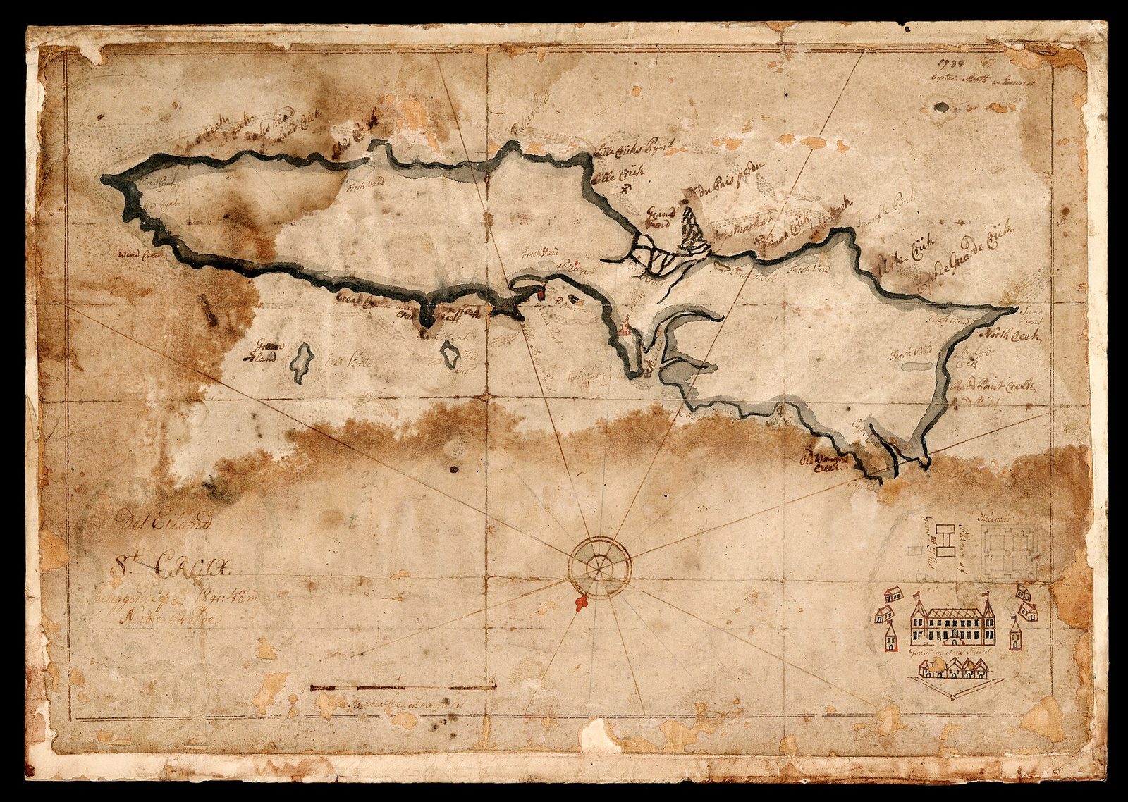
MAP OF sT. cROIX 1734
The island kept its French name, Sainte-Croix, on European maps long after France stopped living on it. Photo: NATIONALMUSEET (Public domain)

This time the emptiness held. For roughly thirty-eight years — from the evacuation of the 1690s to the sale of 1733 — St. Croix had no European government on the ground and no colony to speak of. It was not unclaimed and not entirely unused: French and English woodcutters and fishermen from neighboring islands came and went, and cattle turned feral in the abandoned fields. But there was no town, no garrisoned fort, no planter class and no administration. The most farmable island in the Virgin Islands, the flat prize everyone had fought over for sixty years, sat idle for a generation and a half.

What France kept through all of it was the title. Abandoning the ground was not the same as giving up the claim, and in the diplomatic bookkeeping of Europe St. Croix stayed French property — an empty asset on the crown's ledger, worth nothing in production but still worth something to sell. That distinction, between holding an island and merely owning it, is the whole reason the next chapter unfolds the way it does. France had walked away from the island in every practical sense, but France still held the deed, and a deed can be sold long after the house behind it has fallen in.

Which is why, when a buyer finally appeared, it was a French king who signed. By the 1720s the Danish West India and Guinea Company — running the small, steep islands of St. Thomas and St. John to the north, and short of the flat land that sugar demands — was looking hard at the empty, fertile island lying to the south. It was French-owned but French-abandoned, the best kind of thing to buy: valuable, unused, and held by an owner with no reason to keep it. The deal would be made not with settlers or a company on the island, because there were none, but with the crown of Louis XV, an ocean away.

FlagYears on St. CroixWhy it cameWhy it went
Spain1493 claim, raids to 1650Columbus's claim and Puerto Rico's flankNever settled it, and let France take it in 1650
Netherlands1638–1645Tobacco land at Salt RiverKilled off and driven out by the English
England1641–1650Tobacco planters at the west endSpanish raids of 1647 and 1650, and fever
France1650–1651 and 1665–1695To deny the island to rivals and farm itWar, mortality, and evacuation to Saint-Domingue
Knights of Malta1651–1665Bought St. Kitts and its dependencies from FranceSold out to the French West India Company
No one1695–1733France evacuated and never came backFrance sold the empty title to Denmark in 1733

So the century of scramble ended the way it began — with St. Croix empty, and a far-off European power holding a piece of paper that said the island was its own. The Kalinago were long gone, the tobacco planters were dead or departed, the Knights had sold up, and France had sailed away and left the deed in a drawer in Paris. What came next was not another scramble but a purchase. When Denmark came looking for sugar land, that drawer — not the empty island itself — is what it opened, and the king who sold St. Croix in 1733 was parting with a colony France had not lived on in nearly forty years.

Denmark buys an empty island, 1733

France had held the title to St. Croix for decades without holding the island. After the crown pulled its colonists back to Saint-Domingue in the 1690s, the land sat empty for close to forty years — farmed by no one, defended by no one, French only on paper. That is the island Denmark bought: not a going colony to take over but a blank to start from. On June 15, 1733, ratified on June 28, the Danish West India and Guinea Company bought St. Croix from France for 750,000 livres.

The buyer's full name is worth reading slowly: the Danish West India and Guinea Company. The "West India" was these islands. The "Guinea" was the stretch of West African coast where the company bought and shipped enslaved people. The name is the whole business model in five words. A firm that carried Africans across the Atlantic wanted flat ground to work them on, and in 1733 it bought some.

The company already ran two islands, St. Thomas and St. John, and both were the wrong shape for sugar. They are steep and small, ridge after ridge dropping into the sea, with little level ground to lay out cane. St. Croix was the opposite — the largest of the Virgin Islands, about twenty-two miles long, low and broad, with real soil and gentle slopes. A company that had run out of sugar land found a flat, empty island next door, and paid to have it.

How much bigger is worth a number. St. Croix covers about eighty-four square miles, the largest of the Virgin Islands by a wide margin, and its high point, Mount Eagle, reaches only about 1,165 feet — a hill, not the green wall that fills St. Thomas. Most of the island is the rolling, workable country a sugar planter wants, dry toward the eastern end and better watered toward the northwest. For a company that measured land by how much cane it could hold, that was the whole attraction.

Louis XV ratified the sale on June 28 and took his 750,000 livres, half in French coin at once and the balance over the next eighteen months. The buyer was a chartered trading company, not the Danish crown; the crown would not take the island over until 1754. But the flag it raised was Danish, and it stayed Danish for 184 years, longer than any other flag the island flew. Some accounts credit the sale to the French West India Company. It was the French crown that signed.

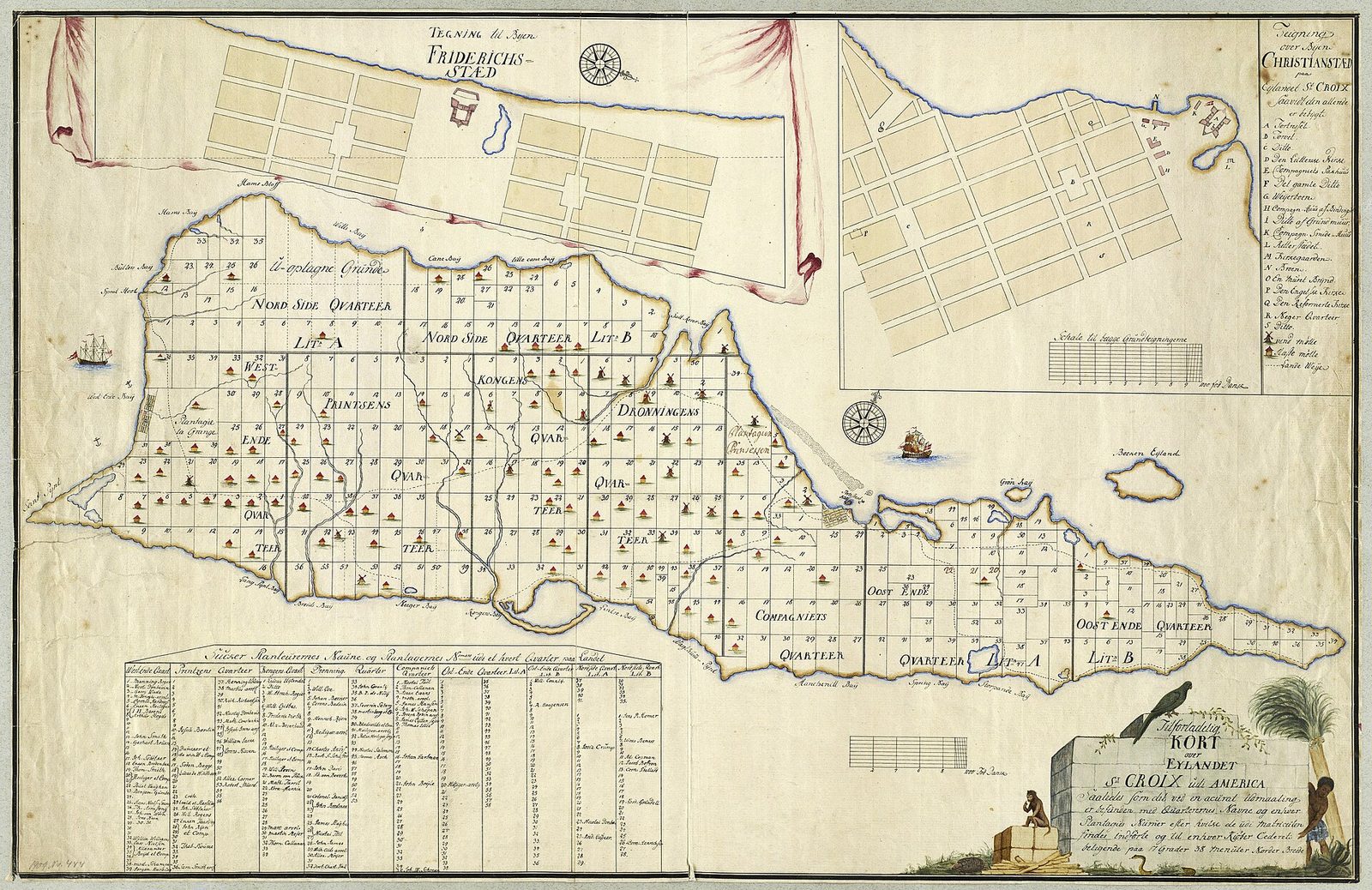
Tilforladelig kort over Eylandet St. Croix udi America
St. Croix as the Danish surveyors and European mapmakers drew it in the 1700s and 1800s, divided into nine quarters and roughly 250 numbered estates. Photo: Jens Michelsen Beck (Public domain)

The company named Frederik Moth the first Danish governor of St. Croix on November 16, 1733. His job was to turn a bought wilderness into a producing colony, and he began the way the Danes began most things here — with a plan on paper and a grid on the ground. Within a year he had chosen the site for the capital on the north-central coast, behind a reef that made a sheltered harbor, and given it the king's name. The short version of this whole chapter is in our seven-flags guide; what follows is the long one.

"Empty," the word the records use, needs an asterisk. St. Croix had been farmed, fished and fought over for well over a thousand years — by the Igneri, the Taino and the Kalinago, and then in the 1600s by Dutch, English and French planters who grew tobacco and killed one another over it. What Denmark bought was not untouched land but land that had been emptied, by Spanish raids, disease, war and evacuation. The company inherited cleared ground and other men's ruins and treated both as a fresh start.

What set the Danish venture apart was how deliberate it was. This was not a scramble of squatters but a company project, surveyed and regulated from the first season: a capital on a grid, a second town promised for the west end, a building code to come, and estates numbered into quarters across the whole island. Denmark meant to build a sugar machine, and it built one — orderly, handsome, and worked end to end by enslaved Africans who had no part in any of these decisions. That contradiction is the whole of the chapter that follows.

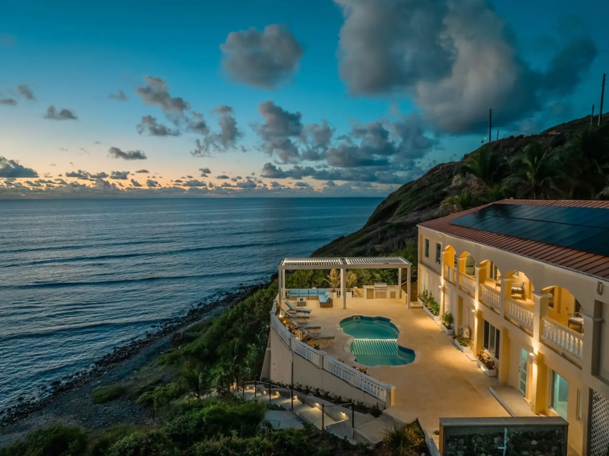
Denmark surveyed its purchase into a ledger. The island was divided into nine quarters — Company, King's, Queen's, Prince's, West End, Northside A and B, and East End A and B — and within them the records eventually counted about 250 estates, each one numbered. That grid of quarters and numbered estates still underlies the island's addresses; the East End quarter where the villa now stands was a square on that first Danish map. The plan came before the plantations, and the plantations were laid into it.

  1. 1733Denmark buys St. Croix from France for 750,000 livres
  2. 1734Christiansted is founded and named for Christian VI
  3. 1738Fort Christiansvaern is begun on the Christiansted waterfront
  4. 1747A building code fixes the town's streets, setbacks and materials
  5. 1751Frederiksted is founded at the west end
  6. 1754The bankrupt company hands the island to the Danish crown
  7. 1803The last slave auctions are held at the Company Warehouse

Christiansted and the grid, 1734

Moth founded Christiansted on September 1, 1734, and named it for the reigning Danish king, Christian VI. He set it on the north-central coast, behind a barrier reef that made a calm harbor — a place to load sugar out and unload everything a colony needed in. From May 1735 the town was surveyed into a grid: straight streets meeting at right angles, blocks of even size marching back from the water. Nothing about it was accidental.

The reef that made the harbor also helped guard it. Ships bound for Christiansted had to be brought in through a gap in the barrier reef by a pilot who knew the water, which kept out casual raiders and made the anchorage easy to defend — one more reason Moth chose the spot. The town sat at the back of a protected basin, its wharves reaching into calm water while the surf broke offshore. Frederiksted, later, would offer the opposite kind of harbor: open, deep and easy to approach.

The look of that grid was written into law in the Building Code of 1747, which set street widths, building setbacks and the materials owners could use. It is the reason the blocks still line up the way they do, and the reason the town reads as one piece rather than a jumble — masonry and brick where wood would burn, arcaded sidewalks shading the ground floors, a steady line along each street. Christiansted looks designed because it was, from the year it was drawn.

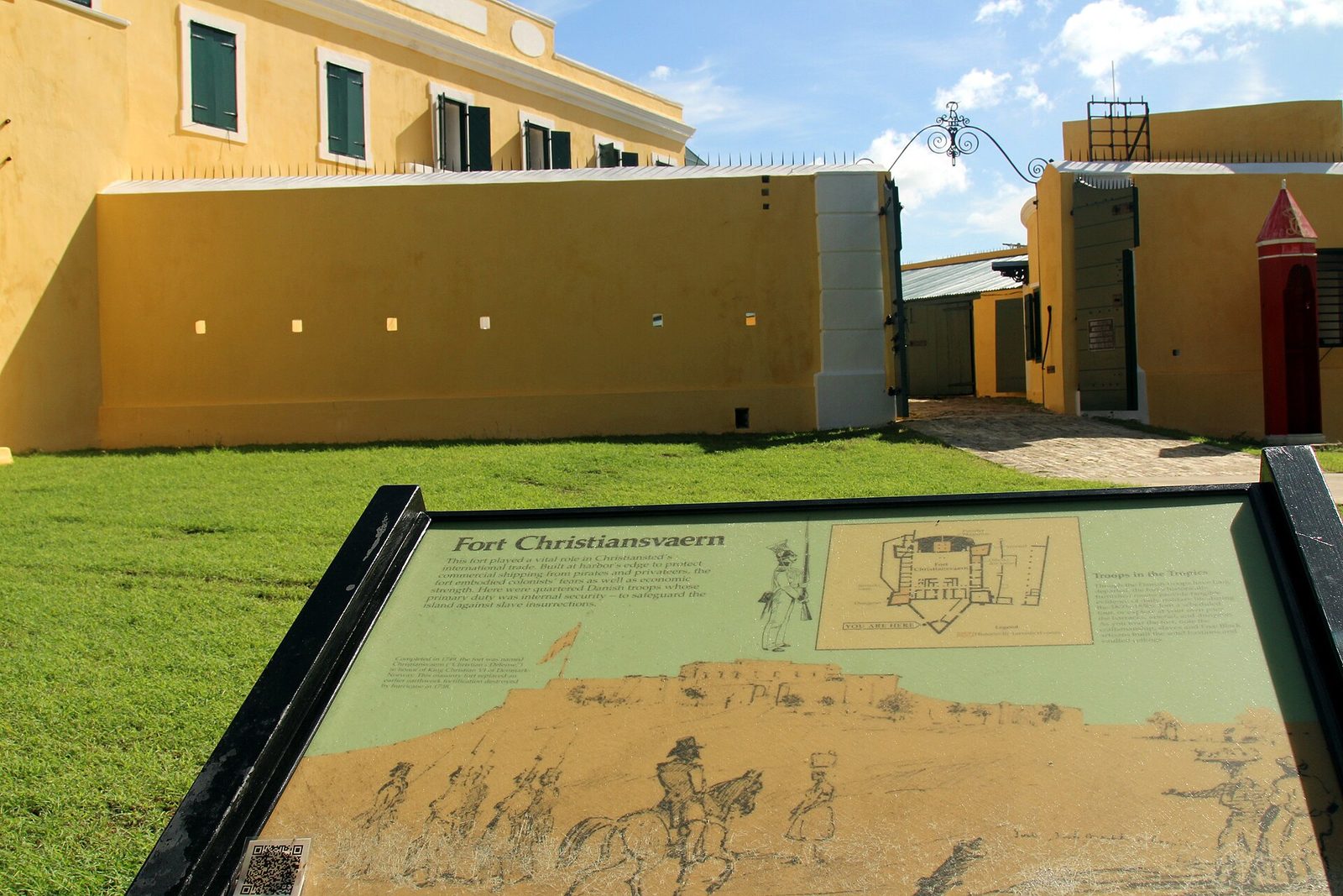
The point of the design was work. A sugar port is a machine for moving one crop out and everything else in, and Christiansted was laid out as one. On the waterfront the Danes built the pieces in sequence: Fort Christiansvaern, begun in 1738 and finished in 1749, to guard the harbor and the colony; the Danish West India and Guinea Company Warehouse of 1749, where the company's goods — and the enslaved people it shipped — were held and sold; the Custom House; the Scale House, where export sugar was weighed and taxed; and the Steeple Building of 1753, the Danish Lutheran church.

RustoptwistRuins20230925 145031
The Christiansted waterfront: the Danish capital of the West Indies, laid out on a grid from 1735 and built up as a working sugar port behind its reef. Photo: CaptJayRuffins (CC BY-SA 4.0)

Read those buildings in a line and you have the colony's whole economy at a glance — arrival, storage, worship, weighing, taxing, defense. The warehouse and the wharf took in the enslaved and the imported goods; the scale house measured the sugar leaving; the custom house taxed it; the fort protected all of it and, when needed, jailed the people who resisted. Nothing here was ornamental. Even the church had a job, and the job was to bless the arrangement.

A port town is also where people live, and Christiansted filled with them: Danish officials and soldiers, English-speaking merchants, free and enslaved workers, sailors passing through. The enslaved were not only out on the estates; they built the town, worked the wharves and warehouses, cooked and carried and traded in it. The grid the Danes drew for sugar became a small city, and by the standards of the eighteenth-century Caribbean a handsome one — which is exactly why it is easy to look at now and forget what paid for it.

The streets carry the names the Danes gave them, written in English because English is what the island came to speak: King Street and Company Street running parallel to the water; Queen Cross, King Cross, Church and Hospital Streets running down to the harbor; Strand Street along the western waterfront. "Company" is the West India and Guinea Company, the outfit that owned the island until 1754. The street plan is a map of who was in charge, and it has barely moved in three hundred years.

When the crown took the colony over in 1754, Christiansted became the capital of the entire Danish West Indies, and it held that rank until 1871, when the seat moved back to Charlotte Amalie on St. Thomas. For 117 years the orders for three islands went out from this small grid behind the reef. Most of the Danish core survives — the fort, the warehouse, the Steeple Building, the Custom House of 1844 and the Scale House of 1856 — kept as Christiansted National Historic Site since 1952. The full walking tour is in our Christiansted town guide.

Stand on the boardwalk today and the town still looks the part: yellow fort, arched walkways, straight Danish streets, and it is easy to take all of it as scenery. It was a workplace, and a hard one. The same arcades that shade a visitor sheltered the merchants who insured and sold human cargo; the same wharf that lands a ferry landed the enslaved. The architecture is real and worth seeing. What it was built for is the other half of the fact, and the two do not cancel.

Frederiksted and Fort Frederik, 1751

One town could not serve a whole island. St. Croix runs about twenty-two miles end to end, and hauling sugar the length of it to a single port was slow and costly on eighteenth-century roads. So the Danes built a second town at the west end, on the wide bay opposite Christiansted, and in 1751 — some sources say 1752 — they founded Frederiksted and named it for the new king, Frederik V.

They guarded it the way they had guarded the capital, with a fort on the water. Fort Frederik was built between 1752 and about 1760, a squat masonry work facing the roadstead where ships anchored. A west-end port needed a west-end battery — to warn off privateers, to command the anchorage, and to stand for Danish authority over the plantations spreading across that end of the island. Two towns, two forts, two harbors, one crop.

The west end had reasons to be settled hard. Rainfall on St. Croix climbs from the dry, cactus-studded East End to the wetter northwest hills — up toward fifty inches a year against twenty-five or so at the far east — and the better-watered land grew cane well. Estates crowded the center and west, and their sugar needed a nearby port. Frederiksted was the answer to a farming map as much as a defensive one, and its deep water, dropping off close to shore, made it the island's easier anchorage.

DANISH WEST INDIA & GUINEA COMPANY WAREHOUSE
Photo: JERRYE & ROY KLOTZ MD (CC BY-SA 3.0)
Governor Mansion (22753876584)
Photo: Prayitno / Thank you for (12 millions +) view from Los Angeles, USA (CC BY 2.0)
Governor Mansion (23249997232)
Photo: Prayitno / Thank you for (12 millions +) view from Los Angeles, USA (CC BY 2.0)

Frederiksted carries a nickname now — Freedom City — and it earned it after the period this section covers. It was at Fort Frederik that emancipation was proclaimed in 1848, and in the town around it that much of Frederiksted burned in the labor revolt of 1878. Those are stories for later chapters, and our emancipation guide tells the 1848 one. What matters for 1751 is quieter: within twenty years of buying the island, the Danes had finished laying out its frame — two towns, two forts, a grid apiece.

There is a visible difference between the two towns, and it is a difference of dates. Christiansted keeps its eighteenth-century Danish core largely intact. Frederiksted looks Victorian through much of its center because it was rebuilt after the 1878 fire, in the style of the 1880s rather than the 1750s. Stand in one town and then the other and you are looking at two different centuries of the same colony — the older bones the same, the skin a hundred years apart.

Fort Frederik still stands on the Frederiksted waterfront, a museum now rather than a garrison. Between it and Fort Christiansvaern you can read the whole Danish security plan in two buildings: one fort to hold each end of a long, flat, valuable island, each with its town, its wharf and its warehouses. That plan was in place by about 1760, and it fixed where people lived and worked on St. Croix for the next two centuries.

Between them, the two towns split the island's sugar between two ports. Estates in the eastern and central quarters carted their hogsheads down to Christiansted; those in the west and northwest sent theirs to Frederiksted. Each town had its custom house and its scale, its merchants and its warehouses, and each shipped the same two products — raw sugar and rum — to the same place, Copenhagen. One island, one crop, two doors to the sea.

By the time Fort Frederik was finished, the Danish frame of the island was essentially complete: a purchase in 1733, a capital in 1734, a building code in 1747, a second town in 1751, a second fort by 1760. What filled that frame — the estates, the mills, and the tens of thousands of enslaved people forced to work them — is the rest of the story.

The planters and why the island spoke English

Denmark had a problem the map could not fix: there were not enough Danes who wanted to grow cane in the Caribbean. A small northern kingdom could buy an island, survey it and fortify it, but it could not fill it with Danish planters. So the company did the practical thing and recruited whoever would come, on terms generous enough to make the trip worth it.

The pitch was cheap land and light taxes. The Danish West India and Guinea Company offered plots on easy terms and years of tax exemption to anyone who would clear ground and plant sugar, and it did not much care what flag a planter had been born under. Capital and know-how mattered; nationality did not. The result was a Danish colony run, on the ground, by foreigners.

Most of them came from the English-speaking Leeward Islands, and especially from St. Kitts, where the good land was taken and younger sons were looking for estates of their own. Dutch and French planters came too, some from families who had been on St. Croix or nearby in the 1600s. They brought their languages, their account books and the enslaved people they already owned. What they did not bring was Danish.

So the language of the cane fields became English — not the English of London but the working speech of the Leewards, used by planters and, in its own forms, by the enslaved majority, and the ancestor of the Crucian English heard on the island today. Danish stayed the language of the governor, the court and the Lutheran church. English was the language of everyone else, which on St. Croix meant almost everyone. A Danish island did its daily business in English from the start.

You can still read the mix on the road signs, because the estates kept the names their owners gave them, and the names repay a slow read. Most are English, and they carry the dry humor and plain complaint of the planters — Whim, Work and Rest, Wheel of Fortune, Hard Labour, Humbug, Jealousy, Little Profit, Barren Spot, Judith's Fancy — hope and grievance side by side.

LanguageWhere those planters came fromEstate names you still pass
EnglishThe Leeward Islands, especially St. KittsWhim, Work and Rest, Wheel of Fortune, Hard Labour, Jealousy
FrenchFrench owners and the French decades before 1733La Grange, La Vallee, La Reine, Mon Bijou
DutchA handful of Dutch planter familiesRust op Twist, Drie Kloven, Eindracht
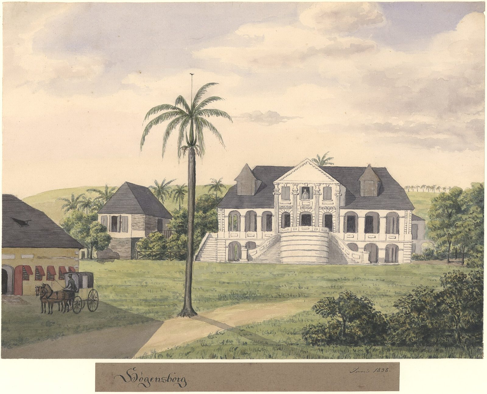
DanishThe administration and a few Danish ownersFredensborg, Hogensborg, Sorgenfri

The older layers run underneath the English. The French names lean grander, from La Grange and La Vallee to La Grande Princesse and Bonne Esperance; the Dutch handful is plainer, Rust op Twist and Drie Kloven; and a dozen or so Danish names round it out, one of them, Sorgenfri, meaning free of care. Four languages of owners, under a fifth flag — and not one of them the language of the people who worked the ground.

The recruiting worked, after a fashion — within a decade the estates were planted and producing — but the planters it drew were never many. The 1742 census counted 360 whites on the whole island against 1,906 enslaved people, and the gap only widened from there. The English, French, Dutch and Danish owners whose names sit on the road signs were a thin layer over a population that was, from very early, overwhelmingly African and enslaved. The language of the fields was English. The people in the fields were not the planters.

The company that arranged all this did not last. It had spent heavily to buy and build the island and never made the returns its directors wanted, and in 1754 the bankrupt Danish West India and Guinea Company handed all three islands to the Danish crown. King Frederik V took direct control, and Christiansted, already the capital, became a royal capital — which it stayed until 1871. The island was now Denmark's outright, run for the king.

One thing the four languages of the estate names hide is that the people who did the naming were a tiny minority. The planters — English, French, Dutch and Danish together — were never more than a couple of thousand. The people who cleared the land they named, cut the cane and boiled the sugar were tens of thousands of enslaved Africans, and they were not asked what to call anything. The signs remember the owners. The next two sections are about the owned.

The sugar machine

A St. Croix sugar estate was a factory with fields attached, and it ran on a schedule the weather set. Cane takes twelve to eighteen months to ripen, so on any large estate some fields were always growing while others were cut. Harvest — the "crop" — ran through the dry winter and spring, and while it lasted the work went on almost around the clock, because cut cane sours within a day or two and has to be crushed fast.

The first stop was the mill, and the mill is the ruin you still see on hilltop after hilltop. Most were windmills — round stone towers turning three iron-sheathed rollers that squeezed the juice out of the cane. Where the wind failed, animals walked a circle to turn the same rollers; later, in the 1800s, steam engines did it. The tower had to catch the trade wind on a rise, which is why the ruins stand where they do, on the high ground of nearly every old estate.

The juice ran from the mill to the boiling house, and this was the hardest and most dangerous work on the estate. Enslaved workers ladled it through a line of copper kettles over open fire, boiling it down and skimming it until it was concentrated enough to grain. Judging the exact moment to strike the sugar — to pull it before it burned — was a skilled job done in killing heat, day and night, through the whole crop. Burns and exhaustion were routine, and the people doing the work had no way to refuse it.

Slob (Danish West Indies)
A St. Croix sugar estate: the stone windmill tower that crushed the cane, and the factory works below it where enslaved workers boiled the juice down into sugar and rum. Photo: Unknown author Unknown author (Public domain)

What crystallized was raw brown sugar, packed into barrels called hogsheads for the voyage to Copenhagen. What drained off was molasses, and molasses was not waste. Some shipped as it was; much was fermented and distilled into rum, the island's second export and the one still made here. Cane, mill, boiling house, still: that is the whole machine, and every stage of it was worked by people who owned none of it. That rum runs to the present in our Cruzan rum guide; the distillery's own mill has stood at Estate Diamond since 1760.

From cane to rum on a Danish estate

  1. Cut the ripe cane during the dry-season crop and haul it to the mill within a day, before it sours.
  2. Crush it between the mill's three rollers — turned by wind, by animals, or later by steam — to press out the juice.
  3. Boil the juice down through a line of copper kettles in the boiling house, skimming until it grains.
  4. Strike the sugar at the right moment, cure it, and pack the raw brown crystals into hogsheads for Copenhagen.
  5. Ferment and distill the leftover molasses into rum, the island's second export.

The scale of it was enormous for so small an island. The first census, in 1742, counted 120 sugar plantations and 122 cotton plantations. Sugar won: at the peak of the plantation era, in the mid-to-late 1700s, more than 58 percent of all the land on St. Croix was under cane. The Danish records list about 250 estates, numbered into nine quarters that still organize the island's addresses. On a map, St. Croix in 1780 was very nearly wall-to-wall sugar.

Sugar had not always stood alone. That same 1742 census found almost as many cotton estates as sugar ones, worked on the drier ground where cane struggled, especially toward the East End. But sugar was where the money was, and over the century it pushed cotton to the margins. By the plantation peak more than half the island was under cane, the windmills stood on nearly every rise, and cotton had shrunk to the dry corners the sugar men did not want.

That machine left more ruins than almost anything else on the island. St. Croix holds well over a hundred sugar-mill ruins — the stone windmill towers, and the roofless walls of the boiling houses and factories below them — standing on the hills of estate after estate. One plantation is kept whole as a museum, Estate Whim near Frederiksted, its great house, windmill and factory restored; our Estate Whim guide walks through it. The last commercial cane crop on St. Croix was not cut until 1966.

None of it ran itself. The mill workers who fed cane between the rollers risked a crushed arm if they were slow; the boilers judged the sugar by eye and instinct; the distillers knew their yeast and their heat. That skill was real, and it belonged to enslaved people, who were given no credit and no pay for any of it. When a visitor admires the ingenuity of an old St. Croix works, the ingenuity on display was very often theirs.

It is worth being plain about what a sugar mill was. It was a fine piece of engineering — the tower, the rollers, the gravity-fed run from crush to kettle to still — and it was a device for turning the forced labor of enslaved people into money for men far away. Both things are true at once. The ruins are worth seeing and worth understanding, and the understanding is the harder half. Who worked them, and under what, is the next section.

The Guinea trade

The company's name told the truth about the business. It was the Danish West India and Guinea Company, and "Guinea" was the West African coast — roughly the shores around present-day Ghana and its neighbors — where the company bought and shipped human beings. The West India was the market; the Guinea was the source. St. Croix was flat land bought to be worked by people carried across the Atlantic against their will, and the company that bought the island was in the business of carrying them.

The route was the familiar triangle at its cruelest: manufactured goods from Europe to the African coast; enslaved Africans across the ocean in the packed holds of the Middle Passage; sugar and rum back to Copenhagen. On St. Croix the human cargo was landed at Christiansted and sold. The Danish West India and Guinea Company Warehouse on the waterfront — the same 1749 building that stands today — was where the slave auctions were held, and they were held there until 1803. People were unloaded, warehoused and sold on that wharf like the barrels of sugar going the other way.

The numbers climbed fast. In 1742 there were 1,906 enslaved people on St. Croix and 360 whites. By 1754 the enslaved numbered 7,566. At the peak of the plantation economy the enslaved population stood somewhere between 18,000 and 20,000, against 1,500 to 2,000 whites — roughly ten to one. By 1789, enslaved people were 88 percent of the population of the Danish West Indies. This was not a society with slaves in it. It was a slave society, built and run as one.

The ratios only sharpened. A St. Croix census in 1797 counted 25,452 enslaved people against 2,223 Europeans — better than eleven to one — plus about 1,164 free people, many of them of African descent. Free did not mean equal: free people of color lived under strict rules, shut out of many trades and rights and held apart from the ruling class, a separate caste between the enslaved majority and the white minority. The colony's whole legal order existed to hold that pyramid in place.

1,906Enslaved in 1742
7,566Enslaved by 1754
18,000–20,000Enslaved at the peak
88%Share of the population, 1789

Those totals hide a grimmer fact — how many people it took to hold them up. The work killed people faster than they bore children who survived, so the estates ran on constant imports to replace the dead. By 1778 the Danes were shipping around 3,000 Africans a year into the Danish West Indies. One St. Croix census, in 1791, counted 12,096 enslaved people, 953 free Africans, and 1,385 who had run away — more than one enslaved person in ten already gone. Over the whole span of the Danish slave trade, more than 100,000 enslaved people had been brought to the Danish West Indies by 1838.

It is easy to let the figures blur, so hold one still. The three thousand people a year the Danish ships were landing by the late 1770s were not a statistic to the people inside it — they were three thousand individuals a year, taken from families and homes on the Guinea coast, packed below deck for the Atlantic crossing, and sold on a wharf if they lived through it. The census counts that climb so steadily, from 1,906 to 7,566 to nearly 20,000, are made of that arithmetic, repeated until it built an island.

The forts you photograph were part of this. Fort Christiansvaern, begun in 1738 and finished in 1749, was built to guard the harbor from privateers and, in the plain language of the record, to protect the colonists against the people they enslaved — against slave revolts. For most of its life it was not a battery at all but the colony's jail, where the enslaved were held and punished. The most-photographed building on the St. Croix waterfront is a prison, and it was aimed inward.

The ledgers counted heads, not people. The men, women and children sold on the Christiansted wharf came from many nations of West and Central Africa, and they arrived carrying languages, skills, religions and names that the sale was meant to erase. What the Danish records keep is a number and a price. What they leave out is everyone. It is worth saying plainly, standing in the pretty town: each of those figures was a person who did not choose to be here.

Fort Christianvaern (23212111791)
Fort Christiansvaern on the Christiansted waterfront, begun in 1738 — built partly to guard a slave colony, and the town's jail for most of its life. Photo: Prayitno / Thank you for (12 millions +) view from Los Angeles, USA (CC BY 2.0)

People did not accept any of this quietly. They ran — into the rugged northwest hills, or by boat toward Puerto Rico — and they rose. The regional warning had come the same year Denmark bought St. Croix: in November 1733, enslaved Akwamu people seized St. John and held it for months before the Danes and their allies retook it. On St. Croix the reckoning would come in 1848, when the enslaved freed themselves, and again in the fire of 1878. Those are the next chapters of this history.

One date belongs here, though. The slave auctions at the Company Warehouse ended in 1803, because a Danish decree of 1792 had banned the transatlantic trade as of that year. It was the first such ban by a European state, often the one thing people know about Danish slavery. It comes with a truth attached: the ban ended the shipping, not the slavery. It freed no one. Everyone enslaved on St. Croix in 1803 stayed enslaved, and so did their children, for forty-five more years. The distance between ending the trade and ending slavery is the single most important thing to understand about the Danish flag on this island.

Alexander Hamilton's Christiansted, 1765–1772

For a few years in the 1760s and early 1770s, the merchant town Denmark had built had a teenage clerk who would become one of the most consequential people ever to pass through it. Alexander Hamilton — later the first U.S. Treasury Secretary, the man on the ten-dollar bill — spent his adolescence on St. Croix, and his time here is a clear window into the Christiansted this chapter has been describing.

He arrived in 1765, a boy of eight or ten — his birth year is given as 1755 or 1757 — brought from Nevis with his mother, Rachel, and his brother. The family was poor and, by the standards of the day, disreputable: his parents were not married, his father had left, and Rachel kept a small store in Christiansted to hold the family together. Hamilton grew up not in a great house but in the working town, among ledgers, wharves and cargo.

Then it got harder. On February 19, 1768, Rachel died of a fever, and the boy was left effectively an orphan. Whatever little the family had went to relatives. What Hamilton had instead was a head for numbers and a job, and on a sugar island the job that mattered was trade.

He clerked for the trading firm of Beekman and Cruger, at 7–8 King Street in Christiansted, a few steps from the fort and the Company Warehouse. The firm imported and sold everything a plantation colony needed and exported what it made, which means the teenage Hamilton spent his days recording exactly the traffic this chapter has described: sugar and rum going out; provisions, goods and enslaved people coming in. He was good at it. The letters and accounts he kept as a boy are careful, quick and sure of themselves.

Alexander Hamilton
Alexander Hamilton and his Christiansted: the teenage clerk of Beekman and Cruger, whose 1772 hurricane letter carried him off St. Croix for good. Photo: John Trumbull (Public domain)

A trading firm like Beekman and Cruger was the hinge of the whole economy. Planters did not sell their own sugar in Copenhagen or buy their own flour in New York; merchants did it for them, on credit, taking a cut coming and going. The firm handled bills of exchange, insured cargoes, chased slow debtors, and kept the ledgers that told a planter whether he was rich or ruined. A clerk who could keep those books straight held the town's money in his handwriting — and Hamilton could.

He was good enough that when Cruger was called away from the island, he left the whole firm in the hands of his teenage clerk. From October 1771 to March 1772, Hamilton ran the business himself — buying, selling, chasing debts, directing ships' captains — while still in his mid-teens. Read his side of it and you see the town at work: a small, sharp merchant economy where a clever clerk could hold real authority young, if he had no name, no money and only his wits.

What carried him off the island was a storm. On the night of August 31, 1772, a severe hurricane struck St. Croix, and Hamilton wrote a vivid letter describing it. A family friend thought well enough of it to have it printed, and it ran in the Royal Danish American Gazette on October 3, 1772. The writing was good enough to change his life.

“It seemed as if a total dissolution of nature was taking place.”

Alexander Hamilton, describing the hurricane of August 31, 1772, in the Royal Danish American Gazette

Local men who read it raised money to send the clever, fatherless clerk to the mainland to be educated. In the fall of 1772 Hamilton sailed for North America, to school and then to the revolution, and he never lived on St. Croix again. He left as what the town had made him: a merchant's clerk who understood trade, credit and money in his bones, which is the training the first Treasury Secretary carried out of Christiansted. His years here have their own account in our Alexander Hamilton on St. Croix guide.

That letter is also why we have an eyewitness voice from the storm at all. Most of the enslaved majority left no writing, and the official record counts sugar and heads, not feelings. A grieving, ambitious orphan clerk, writing to be read, left one vivid page, and it survives because the local paper, the Royal Danish American Gazette, printed it. That Christiansted had a newspaper to print it in is itself a measure of the town: by the 1770s this was a real commercial city, with merchants, printers and mails.

It is worth remembering what that clever clerk was counting. The cargo Beekman and Cruger handled included human beings; the wealth Hamilton learned to tally was made by enslaved people a few streets from his desk. He is a window into the merchant town, and the view through it takes in the auctions at the warehouse and the jail in the fort. The town that trained him ran on the labor of the people the next chapter is about.

Turquoise bay framed by the villa's arched veranda
The Cerulean

Plan it from the villa.

Five bedrooms, a private swimmable beach, and all of this within a day trip.

From $1,398 / night · sleeps 12 · 4.90 ★

Resistance and marronage

The merchant houses of Christiansted kept careful books, and among the entries — beside the hogsheads of sugar and the puncheons of rum — were people, listed by first name and by price. That was the ordinary paperwork of the colony Denmark had built after it bought St. Croix in 1733. For the small planter class the island was a fortune to be made; for the overwhelming majority of its people, who were enslaved and African, it was a prison. And from the first years of Danish rule, the enslaved pushed against it: by conspiracy, by open revolt, and by simply walking away.

The largest early rising was not on St. Croix but on St. John, the small mountainous island Denmark already held, and it broke out the same year Denmark bought St. Croix. Beginning about November 23, 1733, roughly 150 enslaved people, primarily Akwamu from the Gold Coast of West Africa, overran the fort and took control of most of St. John. They held the island for months. Danish forces could not retake it, and the revolt was not fully suppressed until late August 1734, when the last of the rebels were captured. Word of it reached every estate in the new colony.

St. John cut both ways: proof to the enslaved that the system could be broken, and proof to the planters that it might be. St. Croix's own resistance ran quieter and lasted longer. The center and east of the island are flat and open, easy to survey into cane and hard to hide in. The northwest is another country: steep forested ridges dropping to a rocky shore, ground too broken to plant. That corner became the refuge, and it stayed one for well over a century.

Danish records and later historians call the northwest Maroon Country, and a Danish map of 1767 labels the high ground there Maronberg — the maroons' mountain. Maroon Ridge stands above the shore near Annaly and Ham's Bluff, and the caves in the cliffs, one of them still called the Maroon Hole, served as hideouts. The documented maroon period on St. Croix runs from about 1650, before the Danes arrived, to about 1767. People who escaped the estates lived in that broken country for years, grew food and hunted, raided the plantations below for what they lacked, and joined several of the island's uprisings.

Hams-bluff-light2
The rugged northwest coast near Ham's Bluff — the "Maroon Country" of the 1767 Danish maps, where escaped people held out on the cliffs. Photo: Eoghanacht (CC0)

Marronage was more than escape; it was an alternative society at the island's edge, and the planters knew it. Maroons who had gotten away had every reason to help those still enslaved, and the northwest settlements passed information, shelter, and sometimes hands to plots on the estates below. Our guide to Ham's Bluff and Maroon Ridge walks the ground where they held out. The colony answered flight with patrols, with bounties for the return of runaways, and with punishments meant to be seen, but the ridge was never fully cleared, and the running never stopped.

One story attaches to those cliffs, and it should be told with care. By a tradition that the written records do not confirm, cornered maroons are said to have leaped from the heights rather than be taken back into slavery. It is a powerful account, and it may be true, but the documented histories of St. Croix marronage do not mention it, and we pass it along as tradition rather than fact. What the records do show is harder and, in its way, larger: flight from the estates was not rare but constant, and the colony counted it.

The census of 1791 put numbers to it. It counted 953 free Africans on St. Croix, 12,096 enslaved people, and 1,385 runaways — meaning more than one in ten of the enslaved population had escaped and had not been brought back. Some were in the northwest hills. Others left the island altogether: an estimated 300 people escaped the Danish West Indies to Puerto Rico in makeshift boats and seized vessels, steering for Spanish soil where the law was different. Running was not a private gesture of despair. It was a mass refusal, recorded in the colony's own ledgers.

About 1650–1767Maroon Country active
Maronberg, 1767Danish map label
1,385Recorded runaways, 1791
About 300Escaped to Puerto Rico

None of this was a fringe event, because the enslaved were not a fringe. By 1789 they made up about 88 percent of the population of the Danish West Indies, and by the late 1770s the Danes were shipping in roughly 3,000 Africans a year to keep the estates supplied. A society built on those proportions lived with a standing fact: most of its people wanted out. Fort Christiansvaern, begun in 1738 on the Christiansted waterfront, was raised in part to guard the colonists against exactly that. Resistance was never the exception on Danish St. Croix. It was the condition the whole island was arranged around.

The trade ends, slavery does not

Denmark liked to be first, and on one point it genuinely was. On March 16, 1792, King Christian VII signed an edict, drafted by a royal commission headed by Ernst Heinrich von Schimmelmann, banning the transatlantic slave trade to and from the Danish West Indies. It made Denmark-Norway the first European state to move against its own Atlantic slave trade, and Danish accounts have pointed to it with pride ever since. The pride needs an asterisk about the size of the edict, because of what the measure did and, more to the point, what it did not do.

It did not free a single person. It ended the importing of new captives from Africa, not the ownership of the people already held or the children they would go on to bear. And it did not even do that at once. The ban took effect only on January 1, 1803 — nearly eleven years after it was signed. The commission built the delay in on purpose, to give the planters time to adjust, and the planters used the time in exactly the way anyone might have predicted.

They stocked up. With a hard deadline coming, owners across the Danish islands imported enslaved Africans as fast as ships could carry them, buying while buying was still legal. The census figures for St. Croix show a population that had climbed steeply: by 1797 the island held 25,452 enslaved people against just 2,223 Europeans, a ratio of more than eleven to one. The slave auctions went on at the Danish West India and Guinea Company Warehouse on the Christiansted waterfront — the same building the sugar passed through — right up to 1803.

25,452Enslaved on St. Croix, 1797
2,223Europeans, 1797
24,330Enslaved on St. Croix, 1815
1803Slave-trade ban effective

The eleven-year window, in other words, did close to the opposite of what a modern reader might hope. A measure remembered as a first step toward freedom worked in practice as a last call to buy, and the number of people held in bondage on St. Croix went up, not down, in the years right after Denmark decided the trade was wrong. Good intentions in Copenhagen and a deadline a decade off added up, on the ground, to more full ships and fuller estates.

When the deadline finally arrived, the trade closed and slavery stayed. The people held on January 1, 1803 remained property, and so did their descendants. By one accounting more than 100,000 enslaved people had been carried into the Danish West Indies by 1838; the 1792 edict simply drew a line under that traffic and left the institution it had fed standing in place. On St. Croix the enslaved population barely moved for a generation: the census of 1815 still counted 24,330 enslaved people on the island.

It is worth being precise about what "first to abolish" means here, because the phrase does a great deal of quiet work. Denmark was first to abolish the trade — the shipping of human beings across the Atlantic. It was among the last of the colonial powers to abolish slavery itself, which it did not do until 1848, and did not do then by choice. The distinction is not pedantic. For a child born on a St. Croix estate in 1803, the celebrated edict meant nothing at all: it closed a door in front of her and left her exactly where she was, enslaved for life unless something else changed.

There was less to the edict than met the eye as a matter of money, too. Ending the trade took nothing from the planters they could bill the crown for; their existing human property kept its value, and an enslaved workforce that reproduced itself on the island needed no fresh purchases from the coast. Abolishing slavery outright was a different order of expense, because owners across the empire expected to be paid for the people they would lose. That argument over compensation is much of why the Danish government dragged its feet for the next half century while the estates ran on as before.

Something else was already at work, though, and it would take forty-five more years to arrive. A population that could no longer be replenished from Africa became a population born on the island — Crucian by birth, with families, estate villages, and churches of its own. The people who would march on Frederiksted in 1848 were not, for the most part, Africans newly torn from home. They were islanders, born into slavery on the ground their parents and grandparents had been forced to work, and they knew the place as well as anyone alive.

A colony in decline

The closing of the slave trade in 1803 came, roughly, at the start of a long economic slide, and the two were not unrelated: an island whose whole value was cheap forced labor had bet everything on a system the century was turning against. St. Croix in 1800 was near its peak — well over a hundred sugar estates, their windmills turning on rise after rise. Over the next fifty years the props were knocked out from under that world one by one, and the great houses that Danish account books had made rich began, slowly, to fail.

The largest blow came from a plant grown nowhere near the Caribbean. European chemists had learned to draw sugar from the beet, a crop that grew in the temperate fields of France, Germany, and Denmark itself, and beet sugar needed no ships, no colonies, and no Atlantic crossing. As European beet production rose through the early 1800s, the price of cane sugar fell, and a small island far out in the ocean was among the first producers to feel it. St. Croix's sugar had to travel farther to reach the same buyers, and it arrived worth less.

The island's own ground was tiring, too. Generations of cane on the same fields had worn the soil, and yields dropped on land that had been planted hard for a century. Hurricanes did their regular damage to mills, works, and crops. Debt spread as estates borrowed against falling returns, and ownership drifted off-island: by the census of 1815 the resident European population of St. Croix had fallen to just 180 people, set against more than 24,000 enslaved and some 2,480 free residents. Many estates were now run by managers for owners who lived in Denmark or England and saw the place only in a ledger.

Scenes in the Danish West Indies which the United States Senate decided last week to purchase LOC 4231382350
Period art from the Danish West Indies: the sugar island as painters and printmakers showed it to Copenhagen, in the decades when the plantation economy was already sliding. Photo: The Library of Congress (No restrictions)

The decline had a geography as well as a timeline. The eastern end of the island, drier and always harder to farm, gave up cane earliest; the wetter center and west held on longest. Estates were mortgaged, sold cheap, and folded into their neighbors, so that a map of many small holdings slowly became one of fewer, larger ones. One by one the windmills stopped turning, and the island is left today with well over a hundred stone mill towers standing on its hills — the skeletons of estates that gave up. What did not arrive was any alternative. St. Croix had been built to do one thing, grow and boil sugar, and when sugar stopped paying, the island had no second trade to fall back on and no wish among its owners to build one.

As the planters' world contracted, another part of the island's society grew. Alongside the enslaved and the white ruling class was a third group, the free people of color — some freed by owners, some the children of free mothers, some who had bought their own liberty. Their numbers climbed steadily, and by 1835 they made up about a quarter of the population of the Danish West Indies. They were not free in any full sense. The law hemmed them in with rules on where they could live, what work they could do, and how they could dress, and it kept them firmly below the white minority.

Still, the free population of color was where the island's future was quietly forming. They were craftsmen, market women, small traders, drivers, and clerks; they were literate more often than the law wished; and they were the people the colonial government would eventually have to reckon with as it thought about how, and how slowly, to end slavery. Their growth changed the arithmetic of the colony. An island that had once been a simple two-part machine, owners and owned, was becoming something more tangled, and harder to hold in the old shape.

Through all of it, the fundamental fact did not change: the great majority of the people on St. Croix were still enslaved, and the failing estates were still worked by force. Decline did not loosen slavery; if anything it pressed harder on the enslaved, as struggling owners cut rations and drove the cane to wring a shrinking profit from it. The windmill towers you can still count on the hills, and the plantation kept whole at Estate Whim near Frederiksted, are the ruins of that economy — a system already dying by 1840, and kept alive on the backs of people who had every reason to want it dead.

The road to July 3, 1848

By the 1830s the man at the top of the colony was Peter von Scholten, governor-general of the Danish West Indies, and he is a genuinely awkward figure to place. He was the chief official of a slave society, the enforcer in the islands of a system built on owning people, and he held that post for two decades. He was also, by the standards of the planters he governed, a reformer they distrusted, a man who used his authority to soften the edges of slavery and to widen the rights of the island's free people of color — and who would, in the end, put his own career on the line.

Under von Scholten the free people of color gained ground they had been denied for generations. Through the 1830s a series of orders extended their civil standing, easing the old restrictions and moving them, on paper, closer to legal equality with the white population. He pressed other changes the planters resented, among them schooling for the children of the enslaved. None of this made him an abolitionist in any hurry. It made him a careful administrator who could see, more clearly than the men whose fortunes depended on cane, that the arrangement he presided over could not last.

Class in a class room, Peter’s Rest Skole (9468858371)
A photograph from the late Danish West Indies. Photo: National Museum of Denmark from Denmark (No restrictions)

Pressure was building from outside as well. Freedom was not a distant idea to the enslaved of St. Croix: the British had freed the enslaved across their nearby Caribbean colonies more than a decade earlier, and in the spring of 1848 revolutionary France freed its own island colonies, word of it carrying quickly across the short stretches of water between islands. People held in bondage on a small, crowded island were not sealed off from any of this. They knew that slavery had ended within sight of home, and they had every reason to ask why it had not ended where they stood.

The wider world was in upheaval that year in a way that mattered. Eighteen forty-eight was Europe's year of revolutions, thrones shaking from Paris to Vienna, and Denmark itself was moving that spring toward its first democratic constitution. A colonial government whose home country was rewriting the rights of its own people was in a weak position to tell the people it held in the Caribbean to be patient. None of this reached the estates as a manifesto. It reached them as a mood, an unmistakable sense that old certainties were coming loose.

Copenhagen's answer, when it came, was a timetable that pleased no one on the island. In 1847 the Danish crown decreed that slavery in the West Indies would end — gradually, over twelve years. Children born after the decree were to be free from birth. Everyone else would have to wait a dozen years for full freedom, working the estates in the meantime. It was meant as a compromise between the planters, who wanted delay and compensation, and reformers who wanted a firm end date. As compromises often do, it satisfied the people arguing in Europe and ignored the people it was actually about.

Consider how the plan landed in an estate village. A mother would nurse an infant who was legally free while she, and every one of her older children, remained enslaved for another twelve years. A man of forty was told he might be free at fifty-two, if the date held — and there was no guarantee it would, because the planters were already working to stretch it. Freedom deferred twelve years is not freedom; it is a promise from the people who had broken every earlier promise. The enslaved of St. Croix weighed it as such and found it worthless.

That left von Scholten exposed. He had helped shape the 1847 decree and had seen its terms read out in the islands; he was, to the enslaved, the face of the promise to wait until 1859, and to the planters, the reformer who had already conceded too much. He spent the early months of 1848 governing a colony where neither side trusted him and the ground was visibly shifting. So the twelve-year plan bought none of the calm Copenhagen wanted. Through the first half of the year, across the western estates, people organized quietly around a simpler proposition than the one the crown had offered: not freedom in twelve years, but freedom now.

Emancipation

It came at the west end of the island, at Frederiksted, the town Crucians would afterward call Freedom City. The rising had been organized in secret, estate to estate, through the early summer, and it moved on the night the enslaved were not in the fields. Called out across the western plantations overnight, people left the estate villages in the dark and walked toward Frederiksted, joining together on the roads, so that by the morning of Monday, July 3, 1848, some 8,000 of them filled the town and pressed around Fort Frederik on the waterfront. They had one demand, and it was not a petition. It was freedom, that day.

The crowd had leaders, and the record of their names is tangled in a way worth stating plainly. The man remembered across the island as General Buddhoe appears in the Danish papers as Moses Gottlieb, and elsewhere as John Gottliff; the sources do not fully agree, and neither the spelling nor the first name is settled. What is clear is that the rising was organized and disciplined, not a spasm. Thousands of people from dozens of estates converged on one town on one morning, under a system that punished movement between plantations and any gathering at all. That takes planning, and the planning had leaders, whatever we are able to call them now.

Frederiksted Southeast, St Croix 00840, USVI - panoramio (3)
Fort Frederik on the Frederiksted waterfront, where emancipation was proclaimed on July 3, 1848. Photo: Андрей Бобровский (CC BY 3.0)

Fort Frederik was built to face the sea, not the town at its back, and its small garrison could not have held off a crowd that size. The soldiers kept the gate and sent riders east for the governor-general. What the crowd did in the hours of waiting is as important as what it demanded. It held the town without burning it. Unlike the revolt that would come thirty years later, the rising of July 1848 took Frederiksted and did not put it to the torch; the discipline of that morning is one of the few details on which every account agrees.

Peter von Scholten was in Christiansted, some seventeen miles east across the island, when the first messengers reached him. He got on the road and rode west, past estates emptying toward Frederiksted, and reached the fort in the afternoon. The choice in front of him was stark, and he had almost no time to make it: order the garrison to fire on thousands of unarmed people and touch off a war he could not win, stall and lose the town, or do the thing Copenhagen had not authorized and move the date. He moved the date.

Standing at Fort Frederik that afternoon, von Scholten proclaimed every enslaved person in the Danish West Indies free — not only the people in front of him, but the enslaved of St. Croix, St. Thomas, and St. John alike. Denmark had planned to take twelve more years. It ended instead in a single afternoon, seventeen years before the United States abolished slavery, and it ended because the people who were enslaved organized, marched, and refused to leave until they heard the words.

“All unfree in the Danish West Indies are from today emancipated.”

Governor-General Peter von Scholten, Fort Frederik, July 3, 1848

The words freed people; they did not settle anything else, and the trouble started almost at once. The proclamation carried terms — about houses and provision grounds, about labor now to be paid by agreement — that were vague where they most needed to be clear, and in the days after July 3 the unrest moved out of Frederiksted and into the countryside, where some estates were plundered and troops were sent to restore order. Emancipation was real and could not be undone. What freedom would actually mean, in wages and land and law, was a fight that had only just begun.

The leaders did not go free with everyone else. Buddhoe, whatever his true name, was taken into custody within weeks, held in the forts, and deported from the island before the year was out; the man who had called the estates out and then helped talk the countryside down was removed as the most capable organizer St. Croix had. It is the pattern the whole story keeps repeating. The people won the thing that mattered, their freedom, and the state made sure the people who had led them paid for it.

For von Scholten, too, it was the end. He had acted without Copenhagen's authority, on his own judgment, in front of a crowd, and the planters wanted a scapegoat for the fortune they had just lost. Within weeks he was recalled to Denmark, ill and under attack, and he was put on trial on the argument that in freeing the enslaved he had betrayed the colony's interests. The full account of the day, the man remembered as Buddhoe, and von Scholten's long reckoning afterward is told in our guide to July 3, 1848, at Fort Frederik. What matters here is the outcome: on that afternoon, slavery in the Danish West Indies ended for good.

Freedom on paper

The proclamation of July 3, 1848 turned the enslaved into free laborers overnight. It did not give them land, or wages they could bargain over, or the freedom to leave. Those questions were left to the colonial government, and over the winter that followed it wrote the answers into a labor law that would shape Crucian life for the next thirty years. The Labor Act of 1849 is the reason this history does not end in 1848 with freedom won. Freedom was won. What the freed then got to do with it was written down, by the same class of men who had owned them, in terms designed to keep the cane cut.

The law bound rural workers to the estates by annual contract. A laborer signed on to one plantation for a year and could not simply move to another that offered better; wages were fixed, not negotiated, set at a low rate the worker had no power to raise. The contract counted a house and a provision plot as part of the pay, which tied the laborer's roof to the estate as tightly as the work did. In form it was employment. In practice it reattached the freed people to the ground they had just been freed from, and to the owners they had just been freed from serving.

Oscar E. Henry Customs House
Photo: Mrgiarc (CC BY-SA 3.0)
Fort Frederik 2012 Wade
Photo: This image or media was taken or created by Matt H. Wade . To see his entire portfolio, click here . @ thatmattwade T… (CC BY-SA 3.0)
Frederiksted Southeast, St Croix 00840, USVI - panoramio (2)
Photo: Андрей Бобровский (CC BY 3.0)

Two rules gave the system its particular grip. The first was on movement: leaving the island required a passport, and the passport carried a fee, so that a laborer who wanted to try his luck elsewhere in the Caribbean had to pay for the privilege of going, if he was allowed to go at all. The second was Contract Day. A worker could change estates only once a year, on the first of October, and only then. For 364 days the arrangement was fixed; on the 365th, and no other, a laborer could choose a different master for the year to come.

Set beside actual freedom, the difference is easy to name. A free worker sells his labor to whoever will pay most, quits when he likes, and goes where he pleases. A laborer under the 1849 act did none of these. He worked for a wage he could not raise, on a contract he could not leave except on one appointed day, on an island he could not depart without paying to. The chains were gone, and the law had put paperwork in their place, but the paperwork ran in the same direction: it kept the workers on the estates and the estates supplied with workers.

What the freed people wanted, more than anything, was land of their own — a few acres to farm independently, outside any estate's gate. Almost none could get it. The land of St. Croix was already surveyed, owned, and held, divided among the plantations and the crown, and there was little a laborer on a fixed wage could buy even if an owner had been willing to sell, which mostly they were not. Without land, the freed had little choice but the estate, and the estate, through the labor law, set the only terms on offer. Freedom without land, on an island owned end to end, was freedom with nowhere to stand.

The cruelest word in the whole arrangement was "temporary." The labor regulations were presented as a bridge, a short-term measure to carry the plantations through the awkward first years after emancipation while something more lasting was worked out. Something more lasting never came. The rules meant to hold for a few seasons ran for three full decades, unchanged in their essentials, so that a person freed as a young adult in 1848 could reach middle age in 1878 having never once been free to name a wage, leave an estate at will, or quit the island without a government stamp.

That is the fuse. The Labor Act did not merely disappoint the freed people of St. Croix; it held them, year after year, in a condition close enough to the old one to be felt as a broken promise, and it built the resentment slowly and thoroughly across an entire generation. It also handed that resentment a date. Because the one day a laborer's fortunes could change was the first of October, that day carried every year's worth of hope and grievance. Thirty years after emancipation, on Contract Day, the grievance came due.

The Fireburn and the Queens

It came due on October 1, 1878, thirty years after emancipation, on the one day the labor contracts turned over. Frederiksted filled with workers who had come to town for Contract Day, and the year's demands — for better wages, for an end to the conditions the 1849 law had fixed on them — were refused once again. By evening the refusal had become a revolt. Over the following days the laborers of St. Croix burned much of the west of the island: an estimated fifty plantations and over half of Frederiksted itself, and, by one widely cited figure, some 879 acres in all.

The revolt is remembered by the name the island gave it, the Fireburn, and by its leaders, four women remembered as the Queens. Mary Thomas, Queen Mary, in her forties and the mother of three, is the one whose name carried furthest. Beside her stood Axeline Salomon, known as Agnes; Mathilda McBean; and Susanna Abramsen, called Bottom Belly, whose part in the rising was documented by the historian Wayne James more than a century later, in 2004. That the leaders of a labor revolt this large were laboring women is not a footnote to the story. It is the center of it.

The Fireburn- St. Croix Labour Revolt, 1878 (28436989024)
An engraving of the 1878 Fireburn, the St. Croix labor revolt that burned much of Frederiksted. Photo: Archives New Zealand from New Zealand (CC BY-SA 2.0)

The cost in lives is real but not fixed, and honesty requires the range rather than a false precision. Accounts differ: roughly 60 to 100 laborers were killed, most of them shot as soldiers put the rising down, against a handful of deaths on the other side. Twelve men were condemned to death for their part in it, and here too the sources disagree — some say they were hanged, others that they were shot. Dozens more were convicted and imprisoned. However the figures are counted, the state answered the fire with a great deal of blood.

It is worth marking what kind of revolt this was. The people who rose in 1878 were not enslaved; they were free, and had been for thirty years. The Fireburn was a strike that became an uprising — a demand for decent wages and the right to move freely that turned to fire when it was refused, which is about the plainest possible verdict on what emancipation had and had not delivered. Freedom that left people bound to the same estates at wages they could not raise was freedom the freed proved willing to burn the west end of the island to be rid of.

The Queens were taken, tried, and imprisoned, and their punishment carried them a long way from home. Mary Thomas, Agnes Salomon, and Mathilda McBean were shipped across the Atlantic to the women's prison at Christianshavn, in Copenhagen, where they were held from 1882 to 1887. Then they were returned to St. Croix to serve out the rest of their sentences in Christiansted. Denmark punished the women who led the revolt by carrying them to the heart of the empire and back — a journey no free person of their class would otherwise have made, taken as prisoners of the country that had held their island in bondage.

The Fireburn did what the fire was meant to do. The labor system that had bound the freed to the estates since 1849 was loosened in the years after 1878, its worst rules given up at last, because the revolt had made the old arrangement impossible to simply continue. And the town tells the story in its own architecture: Frederiksted burned so thoroughly in 1878 that much of what stands there now was built afterward, in the Victorian style of the rebuilding, which is why Freedom City looks a generation younger than the older Danish core of Christiansted. Our Frederiksted guide reads the town street by street.

Oct 1, 1878Fireburn began
About 50Plantations burned
Over halfFrederiksted destroyed
1882–1887Queens jailed in Copenhagen

The memory outlasted the punishment. Queen Mary became a folk song still sung in the Virgin Islands, a melody that keeps her name in the mouths of people born a century after the fire. And in March 2018 she returned to Copenhagen in a form Denmark could not carry off to prison: "I Am Queen Mary," a statue more than twenty feet tall, raised outside the old Danish West India Warehouse by the artists Jeannette Ehlers and La Vaughn Belle. Mary Thomas sits on a throne with a torch in one hand and a cane bill — the knife for cutting sugarcane — in the other. It was Denmark's first public monument to a Black woman.

The statue was built as a reckoning. Its plinth was raised from a ton and a half of coral stone brought from St. Croix, so that a piece of the island stands under her in the Danish capital, and the figure joins the woman who led the 1878 revolt to the country that shipped her fellow Queens across the ocean and back. As of the latest reporting the sculpture has had a hard history of its own — the original was badly damaged in a storm in December 2020, and the artists have worked toward a permanent cast — but the point of it holds whatever becomes of the first version. The Queens are not a story St. Croix has agreed to forget, and Denmark is no longer allowed to either.

Britain's two occupations

Step back from the Fireburn and look at the island whole. By the last quarter of the 1800s St. Croix was a freed society and a failing one. Slavery was thirty years gone, the labor laws that had replaced it had just been burned off the west end, and the sugar that had paid for everything was worth a little less every year. The story left to tell is how Denmark, tired of a colony that lost money, finally sold the island out from under the people who lived on it.

Before that, though, two flags need accounting for, because they fall at the top of this same long slide. Crucians tell their history as the seven flags: Spain, the Netherlands, England, France, the Knights of Malta, Denmark and the United States, and our guide to that chronology walks each one in turn. Britain is not on the list, though the British flag flew over St. Croix for about nine years across two separate occupations.

It is left off the count for a plain reason. Both times, Britain took the Danish islands and then handed them back. It occupied; it never owned. That makes it a footnote rather than an eighth flag, and it is the footnote we owe before the ending.

The first occupation came in March 1801. Denmark-Norway had joined a group of northern European states that Britain read as a threat to its command of the sea, and a British fleet arrived in the Danish West Indies to take the harbors out of the equation. There was no fight for the islands. Denmark-Norway accepted the terms, and St. Thomas, St. John and St. Croix changed hands, in the standard phrase, without a shot being fired.

The occupation was short. When the wider quarrel cooled in the spring of 1802, Britain returned the three islands to Denmark, and the Danish flag went back up about where it had come down a year before. It had settled nothing on the island itself.

The second occupation lasted longer and cut deeper into the century. By 1807 Denmark had been pushed onto Napoleon's side of the war, and Britain moved again on the Danish colonies to deny France any use of them. A British force took St. Thomas on December 22, 1807, and St. Croix three days later, on December 25 — a Christmas surrender, and again without real resistance.

This time the British stayed. The occupation ran on through the rest of the Napoleonic wars, until 1815, when the peace that finally settled Europe returned the Danish West Indies to Denmark for good. Eight years is long enough to raise a child. It was long enough to leave a mark on St. Croix, if it was going to leave one, and it did not.

Neither occupation changed the things that made the island what it was. The plantations kept running, worked by the same enslaved people under the same overseers, for the same absent profits. The language stayed English, as it had been since Denmark recruited its first planters out of the English-speaking Leeward Islands. For a planter class already more English than Danish, a spell under the British Crown was less a rupture than a change of the flag on the fort.

Les Antilles - btv1b59708433 (33 of 54)
A period map of the Danish West Indies, surveyed into quarters and estates during the Danish colonial era. Photo: Wikimedia user Gzen92Bot (Public domain)

Nothing British survives on the ground to mark the two occupations. There is no British fort on St. Croix, no British street name, no plaque a visitor can go and find. Fort Christiansvaern flew the Union Jack for a while and fired at no one over it. The estates kept their English, French, Dutch and Danish names, and not one of them is British by way of the occupation.

If you wanted to stand in the British chapter of St. Croix's history the way you can stand in the Danish one, there would be no spot to stand in, and that absence is exactly why the island keeps the number at seven. The occupations matter for their timing more than their traces. They fall right after Denmark's 1792 trade decree took effect in 1803, when the sugar economy was near its peak and about to turn against itself. Within fifty years of the British handover of 1815, Denmark would be looking for someone to take the islands off its hands.

The long Danish afternoon

Return now to the main thread, at emancipation. Freeing the enslaved in 1848 did not save the sugar island; in some ways it sealed the island's decline. The estates had been built on labor that cost only its keep, and once that labor had to be paid at all, however little under the 1849 rules, the arithmetic that had once made St. Croix rich stopped adding up.

The freed people wanted land of their own and could seldom get any. The planters wanted their old profits and could not have them back. What followed was not a collapse so much as a long, slow settling, an afternoon that ran out the rest of the Danish century.

The forces working against the island were the ones the earlier chapters named, and they did not let up after 1848. European beet sugar, grown in the fields of France, Germany and Denmark itself, kept pushing the price of cane sugar down, and cane that had to cross an ocean to market felt the drop first. The island's soil was tired from a century and more of the same crop on the same ground, and storms took their regular turns at the mills and the works.

Debt spread with the falling returns. Estates were mortgaged and folded into their neighbors, and a growing share of them belonged to people who lived in Europe and knew St. Croix only as a line in a ledger. The island was being run, more and more, by managers for owners who never saw it.

The clearest sign of how Denmark now saw the colony came in 1871. Christiansted had been the capital of the Danish West Indies since 1755, the seat of the governor-general and the center of the whole three-island colony for well over a century. In 1871 the capital was moved back across the water to Charlotte Amalie, on St. Thomas, where it had sat in the earliest Danish days.

St. Thomas had the deep harbor and the shipping trade; St. Croix had the played-out cane fields. With one administrative order, Christiansted stopped being the first town of the colony and became the second town of the second island. For a town that had run the whole colony since 1755, it was a quiet demotion, and the island felt it as one.

Høgensborg, Plantation, St. Croix, Danish West Indies
Ruined stone windmill towers stand on hills across St. Croix, the remains of the sugar estates that failed through the 1800s. Photo: Drawing: Frederik von Scholten (1784 – 1854) Photo: M/S Museet for Søfart - Maritime Museum of Denmark (Public domain)

The move made a cold kind of sense. St. Thomas, mountainous and poor for farming, had reinvented itself as a free port and a coaling station, a place ships stopped rather than a place that grew anything, and its harbor stayed busy while St. Croix's fields emptied. Denmark followed the traffic to the harbor. For St. Croix the demotion meant that the governor-general, the main offices and the government's attention all went across to St. Thomas.

The 1878 Fireburn, already told, fell seven years after the capital left, and it reads in part as the fury of a place that had been used up and set to one side. In the decades that followed, people left of their own accord as well. With the estates failing and little other paying work, Crucians emigrated in real numbers, to other islands, to the canal works and plantations of Central America, and later to the United States. The island that the sugar machine had once packed with forced laborers grew quieter, poorer and emptier.

By the last decades of the 1800s Denmark had more or less stopped pretending the colony paid its way. Governing three small islands on the far side of the Atlantic cost money that the sugar no longer returned, and in Copenhagen the Danish West Indies came to be discussed the way an owner discusses a property that runs at a loss. A colony that its own government has decided is a burden is a colony that government will sell, if it can find a buyer at a price it can defend to its voters.

As it happened, a buyer had been circling for a generation. The United States had wanted the harbors of the Danish West Indies since the 1860s, and had already made one failed run at buying them before the Fireburn was even lit. Between Denmark's growing wish to be rid of the islands and America's on-again, off-again appetite for them, the sale of St. Croix was never a sudden event of 1917. It was the end of a negotiation that had opened half a century earlier, and failed twice before it finally took.

  1. 1848Emancipation is proclaimed at Fort Frederik on July 3
  2. 1871The colonial capital moves from Christiansted back to Charlotte Amalie on St. Thomas
  3. 1878The Fireburn burns much of Frederiksted and about fifty estates
  4. 1902A treaty to sell all three islands to the United States fails in the Danish parliament
  5. 1916Denmark and the United States sign the sale treaty, and Danish voters approve it in December
  6. 1917Transfer Day, March 31, when the Danish flag comes down for the last time

Three tries to sell

The United States had wanted the Danish West Indies since before the guns of the Civil War were cold. What Washington wanted was not the sugar or the land but the harbors, deep and defensible anchorages in the eastern Caribbean, St. Thomas above all, at a moment when the U.S. Navy was thinking hard about coaling stations and about keeping the European powers out of the American hemisphere.

Denmark, for its part, had a colony it was beginning to find expensive and a standing willingness to talk about a price. The two wants met three times over fifty years, and the first two meetings came to nothing. One side always seemed to want the deal a little more than the other, and for half a century the timing never quite lined up.

The first attempt was made in 1867. A treaty signed on October 24 of that year would have sold the United States two of the three islands, St. Thomas and St. John, the ones with the harbor, and not St. Croix, for $7.5 million in gold. The Danish side was willing. Then the deal died in Washington.

The U.S. Senate, in no mood after the Civil War to spend gold on Caribbean islands, simply never ratified the treaty, and it lapsed. Denmark had agreed to sell and discovered it had no buyer after all, a reversal it would remember the next time an American offer arrived.

The second attempt reversed the roles. By 1902 the United States, fresh from the war with Spain and newly interested in Caribbean bases, was ready to try again, and a treaty signed on January 24, 1902, would have sold all three islands, St. Croix now included among them, for $5 million. This time the American side was willing. The treaty failed on the Danish side instead, dying in the Danish parliament. Denmark had, for the moment, decided that it would not sell its islands to the Americans.

Two women in front of a house at St. Croix (9468858855)
A photograph from the last decades of the Danish West Indies. Photo: National Museum of Denmark from Denmark (No restrictions)

What finally moved the deal was a war that neither government wanted to lose control of. By 1916 the First World War was two years old. German submarines were sinking ships across the Atlantic, the United States had opened the Panama Canal and now had a waterway it badly needed to protect, and Washington had one specific fear.

If Germany overran Denmark in Europe, it might inherit Denmark's Caribbean colony and turn those same fine harbors into a submarine base astride the approaches to the canal. Better, the reasoning went, to buy the islands outright than to risk waking one morning with the German navy anchored in them. The strategic case that had simmered for fifty years now demanded an answer.

TreatyPriceIslandsOutcome
1867$7.5 millionSt. Thomas and St. JohnU.S. Senate never ratified
1902$5 millionAll threeFailed in the Danish parliament
1916$25 millionAll threeSigned and ratified — Transfer Day 1917

So the third treaty was signed under pressure and at a much steeper price. On August 4, 1916, in New York, U.S. Secretary of State Robert Lansing and the Danish minister Constantin Brun signed the Treaty of the Danish West Indies: $25 million in gold for all three islands, five times what the same three had been offered for just fourteen years earlier. The U.S. Senate gave its approval on September 7, 1916, the reluctance of 1867 long gone now that a European war had turned the harbors into a matter of national security.

Denmark, which had let the 1902 sale die in its parliament, this time put the question to its own people. In a national referendum on December 14, 1916, Danish voters approved the sale, with 64.2 percent in favor, a clear majority but not an overwhelming one, for parting with a colony Denmark had held since 1733. The parliament ratified the treaty on December 22, President Woodrow Wilson signed for the United States on January 16, 1917, and the two governments exchanged ratifications on January 17.

It is worth noticing whose voices were in the room and whose were not. Two governments haggled; a U.S. Senate, a Danish parliament and the Danish electorate all had their say. The people who actually lived on St. Croix, St. Thomas and St. John, by now overwhelmingly the Black descendants of the men and women Denmark had shipped in to cut its cane, were not asked whether they wished to be sold from one European crown to a mainland republic. They would learn the terms of their own transfer, the price included, as something decided for them.

Transfer Day, March 31, 1917

Transfer Day was a Saturday, March 31, 1917. At four o'clock that afternoon, on St. Thomas and St. Croix at the very same hour, the Danish flag came down and the American flag went up, and a colony Denmark had held since 1733 became a possession of the United States.

There was no ceremony on St. John, which had no garrison left to hand over. The two flag-lowerings that carried the weight of the day happened on St. Croix, one in each of its towns, both timed to the same stroke of four as the larger ceremony across the water in Charlotte Amalie.

In Christiansted the handover took place at the wharf below Fort Christiansvaern, the yellow Danish fort that had guarded the harbor and served as the colony's jail for the better part of two centuries. A detachment of Danish gendarmes under Captain F. N. C. Fuglede lined up facing a detachment of U.S. Marines under First Lieutenant Edward A. Willing. Between the two lines of soldiers stood the officials of a government about to end.

Our Christiansted town guide walks the waterfront where this played out. On Transfer Day that quiet stretch of harbor front was the stage for the most consequential hour in the island's modern history. The fort still looks down on the same wharf, and the ground has not moved; only the flag on the pole above it has.

The Government Secretary, Will Jacobsen, read out the Royal Act by which the King of Denmark gave up the islands, the formal words in which the governor ad interim "delivers at this moment these islands to the representatives of the United States of America." Then the order was given, and the Dannebrog, the red-and-white Danish flag, came down its pole while the band played the Danish royal anthem.

The Marines and the gendarmes exchanged places. The Stars and Stripes rose in the Dannebrog's place, and the band struck up "Hail Columbia." The whole exchange, the work of centuries and of fifty years of treaties, took only a few minutes to carry out. It was a small ceremony for so large a change, a matter of soldiers, a band and two flags trading places at four o'clock.

Frederiksted, the island's west-end town, held its own ceremony at the same hour, with the American cruiser USS Olympia lying offshore, the same ship that had led Dewey's squadron at Manila Bay two decades before, sent now to witness a quieter conquest done by contract. Fort Frederik, where von Scholten had proclaimed emancipation in 1848, watched the Danish flag lowered a second time that afternoon. Our Frederiksted guide covers the fort and the town that Crucians still call Freedom City.

Andreas Riis Carstensen - Parti fra Hams Bluff på St. Croix
A period image of the Danish West Indies from the years around the 1917 sale to the United States. Photo: Andreas Riis Carstensen (Public domain)

The money changed hands that same day in Washington, and not in the form the treaty's language might suggest. The price was $25 million "in gold," but no gold was moved anywhere. Secretary Lansing handed the Danish minister a Treasury warrant, a paper instrument, for the full amount. The Treasury Secretary, William McAdoo, explained the choice about as plainly as a treasury secretary can: the actual gold coin, he said, would weigh nearly forty-eight tons.

Twenty-five million 1917 dollars comes to something on the order of $740 million in today's money. It bought three islands, three harbors and the people who lived on them, counted in the deal much the way the harbors were. It was a real estate transaction, in the end, with a population written into the price the way acreage or wharf frontage would be.

You will sometimes see the date given as April 1, 1917, and a few reference works still print it that way. The ceremonies, the reading of the Royal Act, the two flags, the warrant in Washington and the public holiday the Virgin Islands keep to this day are all March 31. Where the sources disagree by a day, the island's own memory and its calendar settle the matter: Transfer Day is the thirty-first of March, and it has been a territorial holiday for more than a hundred years.

What the day did not include was any moment in which the people of the islands were asked. The population standing at the wharves on March 31 was overwhelmingly Black, the descendants of the Africans Denmark had brought across the ocean to cut its cane, and they had been transferred from one flag to another without a vote that counted. They did not become citizens of the country that had just bought them. They became its wards, held under a status no one in Washington had yet defined. The band played "Hail Columbia," and the harbor changed owners over the heads of the people who lived beside it.

The United States had bought the islands as a piece of naval strategy, and for the first fourteen years it governed them as one. From 1917 the Virgin Islands of the United States, the territory's new official name, were administered by the U.S. Navy, with naval officers serving as governors.

A temporary Organic Act, passed by Congress on March 3, 1917, four weeks before the transfer itself, set up a stopgap government and carried the old Danish colonial law forward until something permanent could be written. The something permanent was a long time coming. In the meantime the man who sat in Government House wore a naval uniform and answered to the Navy Department.

$25 millionU.S. price, 1917
64.2% in favorDanish referendum, 1916
~48 tonsWeight of the gold
1927Citizenship granted

The people of the islands were not made citizens of the United States when the flag changed. This is the fact that sits at the center of the early American decades, and it is easy to slide past because it sounds like a technicality. It was nothing of the kind.

Danish subjects had become, overnight, something the law did not clearly name: nationals of the United States who were not citizens of it, living under a Navy that answered to Washington and not to them. They could not vote for the government that ruled them. They had traded one colonial status for another, and the new one, for a full decade, did not even carry a name that came with rights attached.

Citizenship came on February 25, 1927, ten years after the purchase, when Congress finally granted U.S. citizenship to most Virgin Islanders and the territory settled into its place as an unincorporated territory of the United States. A decade is a long time to hold a whole population in an undefined status, and the length of that gap tells you plainly how low the islands sat on Washington's list of concerns.

They had been bought to keep a harbor out of German hands in a war that ended in 1918. Once that danger had passed, the people who had come with the harbor were, for a good while, largely forgotten. The purchase had been an act of wartime nerves, and once the nerves settled the buyer lost much of its interest in what it had bought.

Other pieces of Danish life took even longer to change over. The islands went on using the Danish West Indian daler, the old colonial currency, for years after they became American soil; the U.S. dollar did not replace it as legal money until 1934, seventeen years after the transfer. For a Crucian going to market in the 1920s, the flag on the fort was American but the coins in the hand were still Danish, a small daily reminder that the change of sovereignty had been arranged at the top and was reaching ordinary life slowly, and late.

Naval government was, by its nature, government by appointment and by order rather than by ballot. The governors were officers rotated in from elsewhere, accountable to the Navy Department and not to the governed, and the priorities of the service were the priorities of an institution that had wanted the harbors, not of a people who needed schools, work and a voice.

The islands stayed poor straight through the 1920s. The sugar economy that had already failed under Denmark did not revive under the American Navy, and no new economy was built to take its place. The change of flag, in its first decade, had brought St. Croix a new name and not a great deal else.

By the end of the 1920s the arrangement had few defenders left. Running a settled civilian population through a military department looked more and more like a mismatch, and pressure built in Washington to move the islands to civilian control. That move would come in 1931, when administration passed from the Navy to the Department of the Interior. But 1931 brought something else to the islands as well, something that would put their poverty onto the front pages of the mainland press: the Great Depression had arrived, and it fell on St. Croix with particular weight.

The poorhouse of the Caribbean

The Depression that began in 1929 was hard everywhere, and hardest of all on places that had only one thing to sell. St. Croix, by 1930, barely had even that. The sugar economy was a shadow of its 1800s self, there were few industries to lay workers off because there had been few industries to begin with, and an island that imported much of what it ate had no cushion at all when money stopped moving through it.

Poverty on St. Croix was not new, and nobody who lived there needed a mainland economist to describe it. The Depression simply deepened that poverty, and made it visible to a mainland that had spent thirteen years not looking. What changed in the 1930s was not the hardship so much as the audience, as hard times at home finally turned Washington's eyes south.

In late March 1931, President Herbert Hoover sailed through on a Caribbean tour and stopped in the Virgin Islands, the first sitting American president ever to set foot in the territory. It might have been a moment for a word of reassurance to new citizens. Instead it produced one of the bluntest things any president has ever said about a piece of the country he governed.

Hoover did not like what the United States had bought in 1917, and he did not keep the opinion to himself. About a week after the visit, in a written statement dated April 6, 1931, he set down a verdict that Virgin Islanders have never forgotten and were never meant to enjoy.

The United States, Hoover wrote, had made a poor bargain in 1917. He put a dollar figure on it and a population underneath the figure, and the phrase that stuck was the one that turned the islands, for a generation of mainlanders, into a shorthand for American neglect. It is worth reading in his own words rather than in paraphrase, because paraphrase softens it, and the whole point of the sentence is that it was not offered softly.

“we paid $25,000,000 for them, we acquired in effect a poorhouse, comprising 90% of the population”

President Herbert Hoover, statement of April 6, 1931

He went further in the same statement. It was, he said, "viewed from every point except remote naval contingencies," unfortunate that the United States had ever acquired the islands at all. He did allow that, having taken on the people, the country now owed them something in return: the United States, he wrote, must "do our best to assist the inhabitants."

But the word that ran in the mainland papers was poorhouse. A president had described the residents of an American territory, citizens for just four years by then, as a liability the nation regretted having bought. It remains one of the most quoted sentences in Virgin Islands history, and one of the least flattering to the country that produced it.

Two points of accuracy are worth holding onto, because the quotation gets garbled in the retelling. Hoover said this after the visit, not before it: an earlier White House statement of March 14, 1931, issued ahead of the trip, contains none of this language. And "poorhouse" was his own deliberate word, not a reporter's invention. A poorhouse, in the language of that time, was the public almshouse where a town warehoused its destitute.

He was not describing the island's beaches or the character of its people. He was describing, coldly, what he believed the United States had gotten for its $25 million: a population it would now have to support. It was an accountant's verdict, delivered about human beings, and it landed on the islands as exactly that.

That same year, the government the islands actually lived under finally changed. By executive order in 1931, Hoover transferred the administration of the Virgin Islands from the Department of the Navy to the Department of the Interior, ending fourteen years of naval rule, and the naval station on St. Thomas was decommissioned. It was a genuine improvement in principle, since civilians would now govern civilians, but a change of department put no food on any table. The island a president had just called a poorhouse needed money and work, not a new letterhead. What it got, over the next few years, was the New Deal.

The New Deal and the Virgin Islands Company

When help finally came, it came in the shape of the decade's signature idea: a federal corporation set up to repair an economy the market had walked away from. The Virgin Islands Company, which Virgin Islanders and the records alike call VICO, was established in 1934 with an opening $1 million from the Public Works Administration.

It was chartered under Franklin Roosevelt to rehabilitate the islands' sugar and rum industries and, in the words of the charter, to promote the general welfare. It was a New Deal instrument pointed at the exact problem Hoover had named three years before: an island economy flat on its back, and a population Washington had admitted it had a duty to assist.

VICO's most lasting idea was to put land into Crucian hands. Alongside working the cane and distilling the rum, the company ran a homesteading program, selling farmland to Virgin Islanders on twenty-year, low-interest mortgages, a deliberate reversal of the whole Danish arrangement, under which the freed people of 1848 had been kept off the very land they worked.

For the first time an official body was trying to make small independent farmers out of the descendants of the enslaved, on the same ground their grandparents had been forced to cut cane on for someone else's profit. It was, in a sense, the promise of 1848 offered at last, by a different government and some eighty-odd years late.

At its height the company worked 2,200 acres of sugar cane and made 93,000 gallons of pure cane-juice rum a year, and it branched out besides into poultry, dairy, tractor rental and rock-crushing, a whole small state-run economy running on one island. It was never a money-maker, and it was never meant to be one. It was meant to keep St. Croix working and fed while the old sugar order finished dying and while somebody figured out what might replace it.

The Virgin Islands Company ran in this form from 1934 until it was wound up in 1965, three decades of federal effort spent holding a single island's economy together by hand. For a whole generation of Crucians it was employer, landlord, banker and distiller at once, the nearest thing the island had to an economy of its own.

Cultivating sugar cane on the Virgin Islands Company land, vicinity of Bethlehem, St. Croix LCCN2017878942
A 1941 Farm Security Administration photograph of sugar-cane work on St. Croix, from the Library of Congress. Photo: Jack Delano (Public domain)

We know what that St. Croix looked like because the same federal government that ran the company also photographed the island. In December 1941 the Farm Security Administration sent the photographer Jack Delano down to document the Virgin Islands, and he made roughly sixty prints of St. Croix: cane cutters in the fields, street scenes in Christiansted and Frederiksted, farmers and fishermen at their work, and a series in the village of La Vallée, one of the estate settlements the freed people had built.

Those photographs are held today in the Library of Congress, filed in the same great Farm Security Administration collection that recorded Depression America from the Dust Bowl to the Deep South. St. Croix is in that national record, cane knife in hand. Delano's Virgin Islands work set the island into the country's picture of itself at the very moment it needed the country most.

The Virgin Islands, sugar cane country1a33998v
Photo: Jack Delano (Public domain)
Cultivating sugar cane on the Virgin Islands Company land1a33976v
Photo: Jack Delano (Public domain)
Sugar farms along the northern coast 1a33943v
Photo: Jack Delano (Public domain)

The economy that VICO tried so hard to save did not, in the end, survive, and the moment it ended can be named to the year. The Bethlehem central factory, the island's main sugar mill, ground St. Croix's last commercial sugar-cane crop in 1966. With that one harvest the island's sugar era closed, an industry that had begun when Denmark bought the island in 1733 and had defined the place for well over two centuries, gone in a single unremarkable season.

The factory was later dismantled and sold off, though its tall smokestack still stands as a landmark near the center of the island. The stack is the last full-height piece of the sugar machine left standing, long cold and gone quiet above the cane land it once served. The plantation kept whole at Estate Whim is where you can now walk through what those years actually were.

By the time that last crop was cut in 1966, St. Croix was already turning into a different island. The federal effort had bought the island time, and into that time came the things that would make the modern economy: an alumina plant and then an oil refinery rising on the south shore, resorts opening on old sugar and cattle estates, and a slow, hard-won push by Virgin Islanders for the right to elect their own government.

The poorhouse Hoover had scorned was about to become something else again, poorer in some ways and richer in others, and finally, after two centuries of other people's plans for it, beginning to make a few of its own. The sugar era had lasted about 230 years. The modern island starts here.

Self-government, step by step

Start with the government, because that is where the island began, at last, to make a few of its own decisions. The people of St. Croix had been made U.S. citizens in 1927, ten years after the flag changed, but citizenship on its own gave them no say in who governed them. A Navy officer, and then an official from the Interior Department, still ran the place from far away. The story of the twentieth century, alongside the story of what the island grew and refined and sold, is the slow return of the vote.

The first real step was the Organic Act of the Virgin Islands, signed on June 22, 1936. It replaced the stopgap law of 1917 and gave the territory its first full organic charter, with a locally elected legislature in place of the Danish colonial councils that had lingered under the Navy. It was a beginning rather than an arrival. Washington still held the levers that mattered, and the man in Government House was still chosen in Washington, not on the island.

It was an awkward arrangement to defend. An island that the United States had spent decades treating as a burden it half regretted buying was being governed from an office more than a thousand miles away, by people who would never have to live under the rules they wrote. Every widening of the franchise over the next forty years was, underneath, an argument against that distance, a push to move the decisions closer to the people they actually landed on.
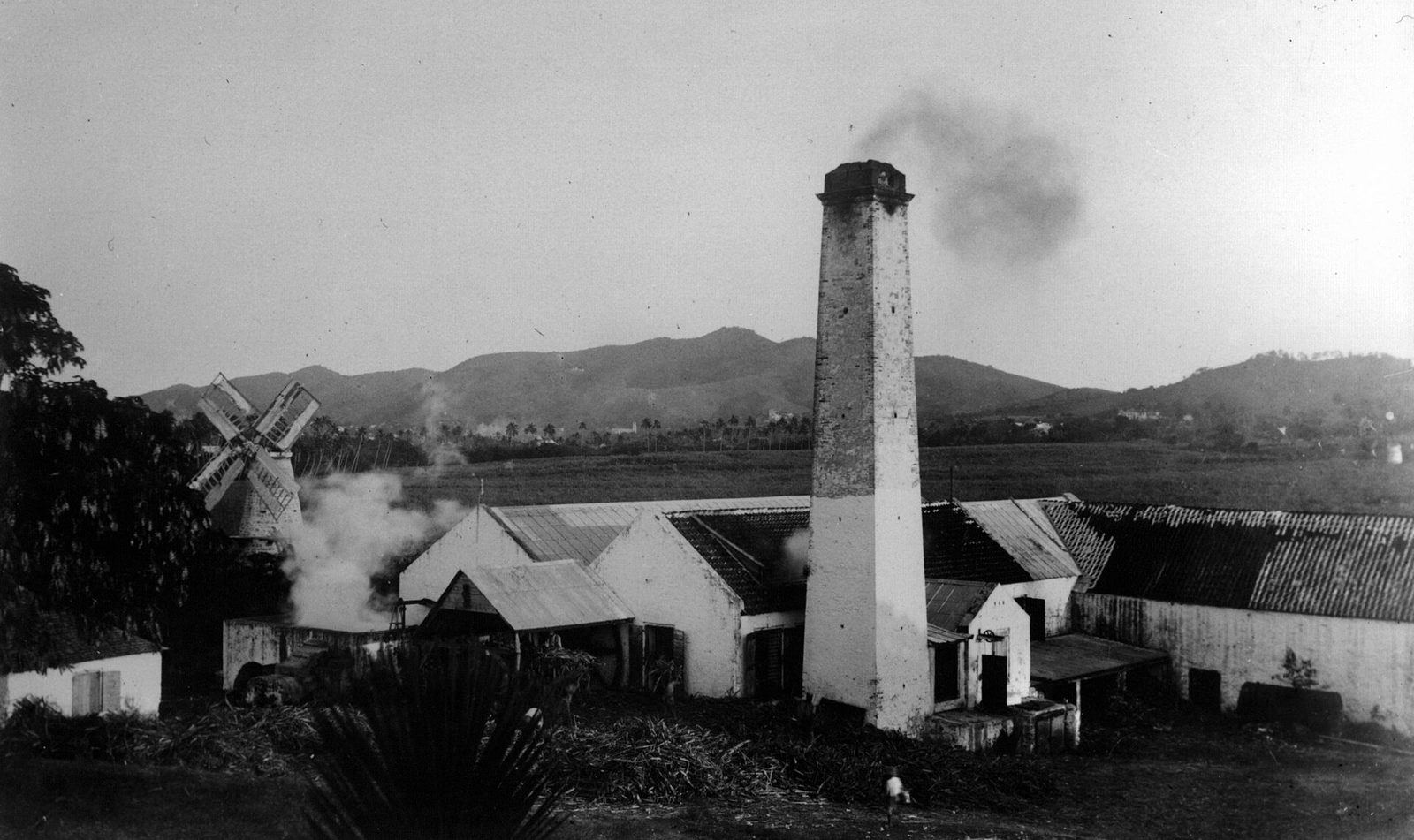
St Croix, US Virgin Islands (ASTER)
St. Croix from above — at about 84 square miles, it is the largest of the U.S. Virgin Islands. Photo: NASA/METI/AIST/Japan Space Systems, and U.S./Japan ASTER Science Team (Public domain)

The next milestone rebuilt the government itself. The Revised Organic Act of 1954 gave the territory the three-branch shape it still keeps: an executive under the governor, a single elected legislature, and a federal district court. More than seventy years later that 1954 act is still the territory's basic law. It is, in every practical sense, the Virgin Islands constitution, even though it is a federal statute passed by a Congress the islands cannot vote for.

The vote for governor came later still. The Elective Governor Act of 1968 gave Virgin Islanders the right to choose their own governor for the first time, rather than receive one appointed by the president. The first election under the new law was held in 1970, and it produced a figure the territory has measured its politics against ever since.

Melvin H. Evans had been appointed governor in 1969, the last man to hold the office by appointment. He then ran for it in his own right and won. On January 4, 1971, Evans was sworn in by Justice Thurgood Marshall as the first popularly elected governor of the Virgin Islands, and the first elected Black governor anywhere in the United States. For an island whose people had been handed among seven flags without once being asked, a Virgin Islander taking that oath from Marshall was its own kind of answer.
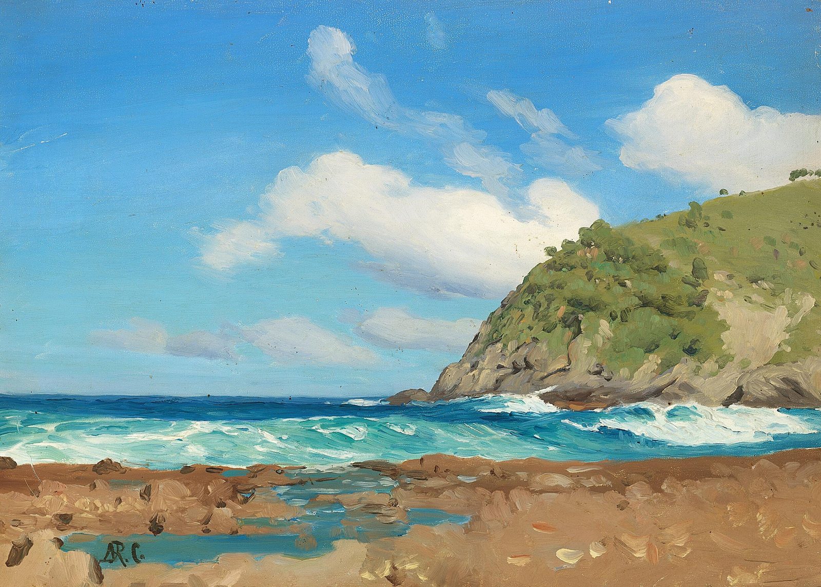
  1. 1936The first Organic Act
  2. 1954The Revised Organic Act sets the present three-branch government
  3. 1966The last sugar crop is ground and the Hess refinery opens
  4. 1971Melvin Evans is sworn in as the first elected governor
  5. 1989Hurricane Hugo
  6. 2017Hurricane Maria and the Transfer centennial

Representation in Washington followed, after a fashion. From 1972 the territory has elected a single non-voting Delegate to the U.S. House of Representatives, a seat that can speak and work in committee but cannot cast a deciding vote on the floor. In 1976 President Ford signed a law authorizing the territory to draft a constitution of its own. That authority still exists; so does the 1954 Revised Organic Act, which remains the framework the government actually runs on.
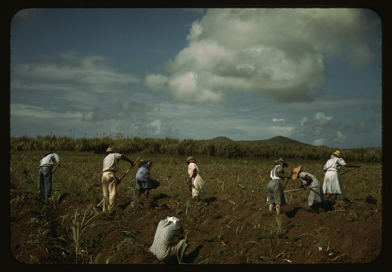
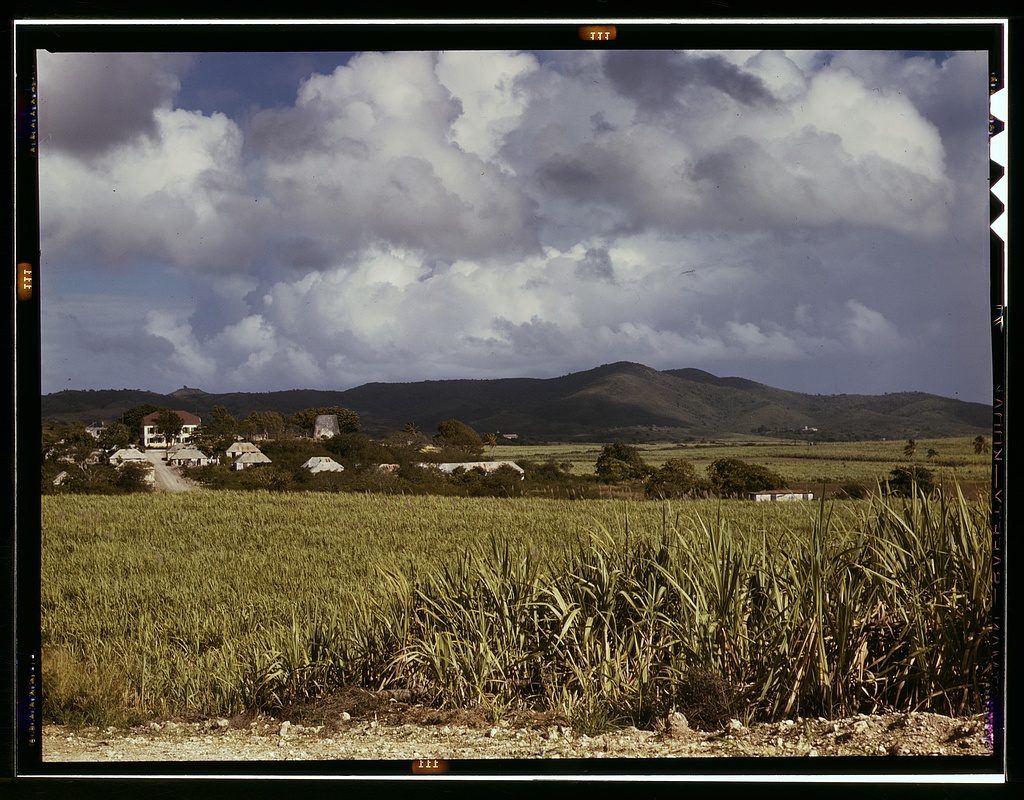
Self-rule also meant building institutions the island had never had before. In 1962 the territory founded its own College of the Virgin Islands, with a St. Croix campus alongside the one on St. Thomas; in 1986 it became the University of the Virgin Islands, one of the country's historically Black universities, and its St. Croix campus now carries the name of Albert A. Sheen. An island that had spent most of its recorded history as someone else's sugar colony, its majority brought here precisely to be worked and not taught, now grants its own degrees on the same ground the cane once grew. The distance from being sold in 1917 to conferring its own diplomas by the 1960s is small in years and enormous in every other way.

All of which leaves St. Croix in a particular constitutional place, easy to state and strange to sit inside. It is part of an unincorporated, organized U.S. territory. Its people are U.S. citizens who carry U.S. passports, serve in the U.S. armed forces, and elect their own governor, legislature, and delegate. But they cannot vote for the president who is their head of state, and the delegate they send to Congress cannot help decide the laws that bind them. It is self-government, real but bounded, and it is the modern shape of a very old question about who gets to decide.

Oil, alumina and the industrial gamble

The year 1966 is the hinge of the island's modern economy. That was the year the Bethlehem factory ground St. Croix's last commercial sugar crop, closing out more than two centuries of cane. It was also the year Hess started up an oil refinery on the south shore. The island did not simply drift from one economy to the next. It placed a deliberate bet, trading the cane fields that had defined it for heavy industry it hoped would pay better and last longer.

Bethlehem Middle Works Historic District 18
The ruins of the Bethlehem sugar works, where St. Croix's last commercial cane crop was ground in 1966. Photo: W. Chapman (Public domain)

Oil was not the first industrial gamble. From 1962 Harvey Aluminum had been building an alumina plant on the same south-shore flats, refining imported bauxite into alumina and blasting a channel through the coast to make a deep-water port it called Port St. Croix. The plant changed hands over the years, Martin Marietta running it from 1972 to 1984, before Alcoa closed it for good in 2000. For a while, though, it made the south shore look like the island's industrial future.

The refinery was the far bigger bet. Hess began construction in January 1966 and had the plant running by that October. Within a decade it had grown into one of the largest refineries on earth: by 1974 its capacity reached 650,000 barrels a day. For a generation it was the island's economic center of gravity, the biggest private employer and the biggest taxpayer, the reason a St. Croix paycheck could stand up next to a mainland one.

1966Refinery opened
650,000 bbl/dayPeak capacity, 1974
2012Refinery closed
~5 months2021 restart lasted

In 1998 the operation became HOVENSA, a joint venture between Hess and PDVSA, the state oil company of Venezuela. Through the 2000s it still ran on a huge scale, around 500,000 barrels a day as late as 2010. Then the economics turned against it. The owners concluded the refinery was losing more money than it was worth, and in January 2012 they closed it.

The blow to St. Croix is hard to overstate. Estimates of the jobs lost run from roughly 1,200 to 2,000, an enormous number on an island this small, and the vanished payroll and tax revenue rippled through every corner of the local economy. The site kept working as a storage terminal for a few more years, but the refining itself, the thing that had anchored the island's wages for forty-six years, was finished.

When it went, it took far more than the paychecks. The refinery had underwritten a whole way of life on the island's south and west sides, and its closing rippled into public budgets and small businesses at the very moment thousands of households lost their income. The island had bet a generation on a single industry, and in 2012 the bet came due all at once.

Bethlehem Middle Works Historic District 09
Photo: W. Chapman (Public domain)
Bethlehem Middle Works Historic District 16
Photo: W. Chapman (Public domain)
Bethlehem Middle Works Historic District 01
Photo: W. Chapman (Public domain)

The plant did not stay quiet for long. In late 2015 a venture called Limetree Bay bought the refinery out of bankruptcy, and in early 2021, after nearly a decade offline, it restarted part of the operation under a federal permit, aiming for around 200,000 barrels a day. For a few months it looked as if the refinery, and the paychecks, might come back. The restart lasted about five months.

It ended badly. Twice in 2021, in February and again in May, the plant showered the neighborhoods below it, Clifton Hill and Enfield Green, with a mist of oil that coated homes and fouled the cisterns families drink from. On May 14, 2021, the EPA ordered the refinery to stop, using an emergency Clean Air Act power it had reached for only three times before in the agency's history. By that September the company was back in bankruptcy and had cut about 271 more jobs, shutting the plant down indefinitely.

Through all of it, the neighborhoods closest to the plant, Clifton Hill and Enfield Green among them, lived with the refinery's flares, noise, and air for half a century, and it was those same neighborhoods the oil rained on in 2021. Whatever the refinery gave the island in wages, its nearest neighbors paid part of the price in their health and their drinking water. That is part of the ledger too, and it is easy to leave off.

Since 2022 the refinery has belonged to Port Hamilton Refining and Transportation, which says it intends to start it up again. As of 2026 it is not operating, and any restart is unscheduled, held up by cleanup work and environmental compliance and doubted, publicly, by some of the same federal agencies that would have to approve it. Sixty years after the island traded cane for oil, the south shore is quiet again.

The one old industry that outlived the cane turned out to be neither oil nor alumina, but rum. Cruzan still distills near Frederiksted, on a site that has made rum since the plantation days. The story of the refinery is really the story of the whole modern island: a long, unfinished search for something, after sugar, that will pay the bills and stay.

The tourism turn

If sugar was the island's first economy and heavy industry its second gamble, tourism was the third, and, in the end, the one that stuck. It arrived quietly, on a smaller scale than the cruise crush that would come to define St. Thomas, and it grew, fittingly, out of the same estates the cane had built. The great houses and mill towers that had run on forced labor became, a couple of centuries later, the scenery people paid to come and see.

The clearest starting point is The Buccaneer, on the hills just east of Christiansted. The Armstrong family had held the land as a cattle estate since 1922; in 1947 they opened an eleven-room inn on it. That inn grew into a resort the same family still runs four generations later, and it bills itself as the longest-running family-owned resort in the Caribbean. Its grounds gather the whole island's history onto one property: a French great house from 1653, raised in the years the Knights of Malta held the island, a Danish-era sugar mill, and a twentieth-century hotel, all on the same hillside above the sea.

The bigger money came with Laurance Rockefeller, whose Rockresorts brought a particular kind of low-key luxury to the Caribbean. On St. Croix the name to know is Carambola, on the northwest coast, and it is worth keeping two dates straight. The Robert Trent Jones Sr. golf course there opened in 1966. The Carambola beach resort itself came twenty years later, in 1986, a separate project on the same stretch of shore. As of 2026 the resort was changing hands once more and slated for redevelopment.

Cruise ships called at the other end of the island, at the deep-water pier off Frederiksted, the west-end town that had been rebuilt in Victorian style after the Fireburn of 1878. On the days a ship is in, Frederiksted's quiet waterfront fills with visitors for a few hours and then empties again; on the days it is not, the town is as sleepy as any on the island. That rhythm still shapes a St. Croix trip.

Tourism became the island's fourth economy, after the subsistence of the first Crucians, after sugar, and after industry, and it has always worn differently here than on the sister islands. St. Thomas built a cruise-and-duty-free machine around a single busy harbor. St. Croix, larger and far more spread out, never did. Its visitors scatter across estates and reefs and two small towns, and the island stays lower-key for it, closer to the way much of the Caribbean looked a few decades ago.

What St. Croix sells, more than sand, is its own past. The restored plantation at Estate Whim, the seven-acre Danish waterfront of the Christiansted National Historic Site, the fort at Frederiksted where emancipation was proclaimed in 1848, the reefs, the rum: the island's whole draw is bound up in the history this guide has been telling. That is unusual for a Caribbean destination, and it cuts both ways. It makes St. Croix a rewarding place for a traveler who wants more than a beach chair, and it means the island is, in a real and literal sense, still living off the estates the cane built.

The pivot was never clean or total. For decades tourism and the refinery ran side by side, the plant paying the big industrial wages while the resorts and guesthouses filled in around it. When the refinery closed in 2012, visitors were suddenly carrying far more of the island's economy than before. That made St. Croix's welcome warmer and its footing more exposed at the same time. An island that lives on people choosing to come is an island that feels every hurricane season, every downturn, and every headline about the Caribbean, whether the news is about St. Croix or not.

Fountain Valley, 1972

On September 6, 1972, the island's young tourism economy suffered a wound it would carry for a generation. That morning, gunmen attacked the golf course at Fountain Valley, in the Rockefeller-developed area on the northwest side of the island. Eight people were killed and eight more were wounded, a mix of visiting tourists and St. Croix residents who worked there. Seven of the eight who died were white.

The dead were Richard and Ruth Griffin, Charles and Joan Meisinger, Nicholas Baele, Alliston Lowrey, John Gulliver, and Patricia Tarbert. Some were on vacation; some worked at the course. Naming them matters, because in the retelling they are too often flattened into a number and a date and the effect the killings had on the visitor trade.

The attack landed in the middle of a decade of fast and uneven change. The refinery was climbing toward its 1974 peak, resorts were rising along the northwest coast, and land values were rising with them, while many Crucians watched the new money arrive largely in the hands of people who had only just gotten there. None of that excuses what happened at Fountain Valley. But a history that records only the crime, and not the pressures around it, would not be an honest one.

Five Virgin Islanders were arrested and charged. Known afterward as the Fountain Valley Five, Ishmael LaBeet, Beaumont Gereau, Meral Smith, Warren Ballentine, and Raphael Joseph, they were convicted, and each was sentenced to eight consecutive life terms; a federal appeals court affirmed the convictions in 1974. The case was bitterly contested, tangled from the start in the racial and economic tensions of an island where most of the land and most of the resort money belonged to outsiders and most of the labor did not.

The effect on St. Croix was immediate and lasting. The killings made national news across the United States, attaching a single terrible day to the island's name at the very moment it was trying to sell itself as a place to unwind. Bookings collapsed. Hotels emptied. The resorts that had risen in the boom years suddenly had rooms they could not fill, and the island's tourism recovered only decades later, long after the men were convicted, long after the golf course changed hands, long after most mainlanders had forgotten why the numbers ever fell.

The case did not close cleanly. The appeals ran into 1974, the convictions were affirmed, and the episode became one of the most argued-over in the territory's modern history, its questions about the trial and about the island's tensions never fully put to rest. Even now it surfaces in conversations about land, justice, and who the island's economy was ever built for.

It is a hard thing to hold in a history that is also, in part, an invitation to visit, and it should be hard. Eight people died. An island that had staked its future on being a welcoming place learned how quickly, and how unfairly, one morning can come to stand for a whole community in the eyes of strangers. The episode is not on the brochures, and it is not the first thing most Crucians would raise with a guest. But any honest account of the modern island has to include the day its welcome and its grievances collided, and eight people did not go home.

The great storms

St. Croix sits in the hurricane belt, and its modern history is marked by storms much the way its older history is marked by flags. Two hurricanes in particular split living memory into a before and an after: Hugo in 1989 and Maria in 2017. How the season actually works, when it runs, what the real odds are, how the island prepares, is its own subject, and our guide to the hurricane-season truth covers it plainly. What follows here is the history.

Hurricane Hugo hit St. Croix on the night of September 17 into September 18, 1989, as a Category 4. It was a direct, full-strength strike, and the damage was catastrophic: roofs torn off, the power grid down, communications cut, a large share of the island's buildings damaged or destroyed. For an island of its size it was about as complete a physical blow as the century delivered anywhere.

What happened next belongs in the honest record. In the days after the storm, with the island cut off and effectively unpoliced, widespread looting broke out, and some of the looters were police officers and National Guard members who were supposed to be keeping order. The federal government charged fifteen people, among them a Frederiksted police commander. On September 21, 1989, President George H. W. Bush sent in about 1,100 Army troops, most of them military police, along with 170 FBI agents and federal marshals, to restore order on American soil.

FEMA - DR4340 364 - Debris Remains in Roadways in St. Croix
Storm recovery on St. Croix — the island has rebuilt after Hurricane Hugo in 1989 and Hurricane Maria in 2017. Photo: Jocelyn Augustino (Public domain)

The island rebuilt, as it always has, over years rather than months. Hugo became the storm every older Crucian measures the others against, the one that redrew the skyline and reset the clock. For nearly thirty years it held that place by itself. Then came the fall of 2017.

That September the Virgin Islands were hit twice inside two weeks. First came Hurricane Irma, a Category 5, on September 6, 2017. Irma tore through the northern islands, devastating St. Thomas and St. John, and largely spared St. Croix, which for a moment left the big island the least-damaged place in the territory. The reprieve did not last.

Two weeks later it was St. Croix's turn. Hurricane Maria, another Category 5, passed just south of the island in the early hours of September 20, 2017. St. Croix caught the western eyewall: sustained winds around 100 miles an hour, gusts measured as high as 137, the power grid gone again, most mobile service down. Maria had made its first landfall two days earlier on Dominica, the first Category 5 on record to strike that country, before it swept up toward the Virgin Islands and Puerto Rico. Two of the strongest storms on record had struck the same small territory within a single fortnight.

Sept 1989, Cat 4Hurricane Hugo
~1,100Troops sent, 1989
Sept 2017, Cat 5Hurricane Maria
137 mphMaria gusts measured

Recovery from 2017 ran for years, and it shaped much of what a visitor sees on the island now: newer roofs, hardened power lines, a generator behind every serious business, and a population well practiced at getting ready and getting through. Federal aid and insurance money rebuilt roofs, schools, and the grid over the seasons that followed, though the work stretched on for years and in places is not finished yet. It is not a reason to stay away, since the season is predictable and most of the year is calm, but it is part of the truth of the place. The island has been knocked flat and has rebuilt itself more than once. It expects, matter-of-factly, to do so again.

A living culture

Run back through this whole history and one thread never breaks: the Africans brought here in bondage, and their descendants after them, made and kept a culture of their own through every flag that flew. On St. Croix today that inheritance is not shut in a museum case. It is the island's music, its masquerade, and its festival, the living end of a story that began in the slave ships and never stopped.

The island's traditional dance music is quelbe, also called scratch-band or fungi music. It grew out of the sounds enslaved and freed people made on the estates, and its lyrics long carried the island's news, its humor, and its complaints, sung out where they could not safely be spoken. In 2004 the territorial Legislature made quelbe the official music of the U.S. Virgin Islands, with a signing ceremony at Government House in Christiansted. You are most likely to hear it live during the Christmas festival, and our guide to mocko jumbies and quelbe goes deeper on both.

The most striking survival is the moko jumbie, the stilt dancer. The tradition came across the Atlantic from West and Central Africa with enslaved people, and even the name carries the crossing: Moko, a healer or a god in Central Africa, joined to jumbie, the Caribbean Creole word for a spirit. Dancers rise ten to twenty feet in the air on painted stilts. In the old belief a figure that tall could see trouble coming from far off and keep evil away; today the moko jumbie leads the parades and stops a crowd cold. Walking, and then dancing, on stilts that tall takes years to learn, and on St. Croix the skill passes from older dancers down to children, so the tradition renews itself with every festival rather than fading into a photograph.

4th Annual Caribbean Heritage Festival
A Caribbean stilt dancer — the moko jumbie tradition, carried across the Atlantic from West and Central Africa. Photo: jalexartis Photography (CC BY 2.0)

All of it comes together in the Crucian Christmas Festival, the island's biggest public celebration, which officially began in 1952. Unlike the pre-Lent carnivals of much of the Caribbean, St. Croix's runs across the Christmas season, starting just after Christmas Day and building through the new year toward Three Kings Day on January 6, the old Feast of the Epiphany. It brings food booths, music, and a festival village to the island for weeks. Our full guide to the Crucian Christmas festival lays out the schedule.

The heart of the festival is in the streets. Before dawn on the big days comes J'ouvert, the old daybreak opening, with music moving through the dark. Then come the parades, the adults' and the children's held on separate days, troupes in costume filing along behind quelbe bands and moko jumbies while the crowds line the route. It is loud, it is proud, and it belongs to the island in a way no resort ever will.

There is a deep reversal in all of this, and it is worth saying out loud. The music, the masquerade, and the midwinter festival began as the culture of people the law counted as property, made in the few hours that were ever their own. Today that same culture is the official culture of the territory, protected by statute, taught to children, and put at the front of every parade. What the plantation worked to stamp out, the island now leads with, and it does so on purpose.

This is where the African thread that runs through four centuries surfaces in plain daylight. The flags all claimed the island; not one of them made this. The music, the stilt dancers, and the festival came from the people the flags tried to own, and they have outlasted every one of those flags in turn. Since 1952 the festival has closed out the island's year, from the day after Christmas to the sixth of January.

A people made of many

Ask who Crucians are, and the honest answer starts with the enslaved. The population of St. Croix today is descended, overwhelmingly, from the Africans who were brought here in chains to cut cane. That is the foundation of the place. Everything else about the island's people is a layer added on top of it over four centuries, and the island absorbed each layer without ever losing that base.

On top of it sit the others. The European planter and merchant families, Danish and English and Dutch and French and more, who ran the colony and left their surnames and their estate names behind. A large and old Puerto Rican community, close enough and long enough established to carry its own name here, Puerto-Crucian. Middle Eastern and other merchant families who built the shops of the two towns. And down-islanders from the smaller eastern-Caribbean islands, who came for work across the generations and stayed.

Bulows Minde Estate House, Bulows Minde, Bulows Minde, St. Croix, VI HABS VI,1-COMP,3- (sheet 1 of 2)
A St. Croix sugar estate — the plantation names given in the Danish era still mark the island's roads today. Photo: Wikimedia user Fæ (Public domain)

The Puerto Rican thread deserves its own line. St. Croix lies just a short hop from Puerto Rico, close enough that people, work, food, and music have moved back and forth for generations. The result is a settled Puerto-Crucian community that is less an immigrant story than a permanent part of who the island is, present in its surnames, its Spanish, its cooking, and its feast days. It is one reason the island feels, in places, as much a piece of the Spanish Caribbean as of the old Danish one.

The other great current came from down-island. Over the years, and especially during the boom years of the refinery and the building that came with it, workers arrived from the smaller islands of the eastern Caribbean. Some came for a season and left; many stayed, married in, and became Crucian in a generation. The island's labor history has always been, at bottom, a migration history: first forced, then free, but always people arriving to work someone else's ground. Over the generations the lines between all these groups blurred through marriage and shared streets, so that "Crucian" now names not one origin but the particular mix the island made of them.

You can read the whole layered story off the road signs. St. Croix's estates still carry the names the planters gave them, in four European languages, and driving the island is like reading a census of everyone who passed through. The English names are the bluntest, Work and Rest, Wheel of Fortune, Hard Labour, Jealousy, Humbug, Barren Spot, Whim. The French left La Grange, La Vallée, La Reine, La Grande Princesse. The Dutch left a handful like Rust op Twist, and the Danish, Fredensborg and Hogensborg and Sorgenfri.

The names are European, but the labor those names describe was not, and the people who did that labor left no estate signs of their own. What they left instead is the island's population, which is the more lasting record by far. The same census shows up on the table: Crucian cooking layers African, European, and Caribbean hands, kallaloo simmered over fungi, salt fish, pates, sorrel at Christmas, maubi to drink, and our Crucian food guide follows that thread through the kitchen.

That is the real answer to who owns St. Croix. Seven flags claimed it; a dozen peoples settled it; and out of all of them the island made one population that calls itself Crucian and belongs to no one else. The estate names still say, in four languages, who arrived. The people are what stayed.

The reckoning

On March 31, 2017, St. Croix marked one hundred years under the American flag. A century earlier, to the day, the Danish flag had come down over Fort Christiansvaern and the Stars and Stripes had gone up in Christiansted. The centennial was observed there with a parade and, fittingly, a naturalization ceremony, a new group of Americans sworn in on the anniversary of the day the whole island had been handed from one nation to another without being asked. The symmetry was pointed: the island took on new citizens by their own choice, on the exact date it had once been made American with no choice at all.

Denmark came back for the occasion. The Danish prime minister of the day, Lars Løkke Rasmussen, spoke at the Christiansted program. He did not apologize, not for slavery, not for the colony, not for the sale. What he offered instead was a scholarship program for Virgin Islander students and warmer words about the relationship between the two places. For many Crucians, the absence of an apology was the loudest thing said all day.

The conversation Rasmussen left unfinished is still going on. The question of what Denmark owes the descendants of the people it enslaved on St. Croix, an apology, reparations, some real accounting beyond a scholarship, remains open between the territory and the old mother country. It is part of a wider reckoning underway across the Caribbean over the debts of the slavery era. It is not a settled matter, and this history is not going to pretend that it is.

One answer came not from a government but from two artists. In 2018, on the same March 31 anniversary, a monument was unveiled in Copenhagen: "I Am Queen Mary," by Jeannette Ehlers of Denmark and La Vaughn Belle of the Virgin Islands. It was the first public statue of a Black woman ever raised in Denmark. It stands beside the old Danish West Indian warehouse on the Copenhagen waterfront, the building where goods from the plantations once landed.

The woman in the statue is Mary Thomas, remembered as Queen Mary, one of the leaders of the 1878 Fireburn, the labor revolt that burned much of Frederiksted and dozens of estates thirty years after emancipation. A Crucian who helped set the colony's estates alight now sits in bronze in the colony's old European capital, looking out over the same water that once carried the island's sugar to Denmark. It is as sharp a piece of historical reckoning as the island has, and Denmark itself helped build it. You can follow the Fireburn's own story through our Frederiksted town guide.

Stand back from the whole four centuries and the shape of it comes clear. Seven flags flew over this island, Spain, the Netherlands, England, France, the Knights of Malta, Denmark, and the United States, and two British occupations the count leaves out. Every one of them came to own the place. Every one of them left. What did not leave is the island itself: the name that changed language but never changed meaning, Santa Cruz to Sainte-Croix to Sankt Croix to Saint Croix, the two Danish towns, the forts, the estate names still bolted to the road signs, and, above all, the people.

That is the thing to carry out of this history and into the rest of the island. Crucians are descended from the people every flag tried to own, and they outlasted all of them. Their history is not shut inside a book. It is standing in the forts and the sugar ruins, playing in the Christmas festival, spelled out in four languages on the road signs, and waiting on the reef and in the two towns for anyone who wants to go and see it.

The Cerulean's pool at sunset above the sea
The Cerulean

Twelve of you, one private beach.

The Cerulean sleeps twelve on St. Croix's quiet East End — check your dates.

From $1,398 / night · sleeps 12 · 4.90 ★

Seeing it today: Christiansted National Historic Site

Denmark is the flag you can still walk through, and Christiansted is where you do it. The National Park Service keeps five buildings on a seven-acre stretch of waterfront and dates them plainly: Fort Christiansvaern, begun in 1738 and finished in 1749; the Danish West India and Guinea Company Warehouse of 1749; the Steeple Building of 1753, built as the Danish Lutheran church; the Custom House of 1844; and the Scale House of 1856. Read them as one machine — fort, warehouse, wharf, customs house, scale house and church — built to move sugar and rum out and enslaved people and goods in. The site was made a national historic site in 1952, on the initiative of local citizens, which is why it stands at all.

The fort is the one building you can walk top to bottom: ramparts, cannon, courtyard and cells. It was the colony's jail for most of its life, which is the unromantic reason it survived, and it is where the Danish flag came down at four o'clock on March 31, 1917. As of 2026 it is open daily, roughly 8:30 to 4:30, with an adult ticket around ten dollars that is good for three days — but hours and fees change, so check the NPS page before you cross the island. Then walk the grid outside the gate. King Street and Company Street run parallel to the water; Queen Cross, King Cross, Church and Hospital Streets run down to the harbor; the names are Danish, written in English, because English is what the island spoke.

Governor Mansion (23329970591)
The yellow walls of Fort Christiansvaern and the Danish waterfront buildings at Christiansted National Historic Site, the core of what survives from the Danish period. Photo: Prayitno / Thank you for (12 millions +) view from Los Angeles, USA (CC BY 2.0)

Two corners are worth finding. At King and King's Cross Streets, a teenage Alexander Hamilton clerked for the trading firm of Beekman and Cruger, ran it for five months in 1771 and 1772, and wrote the hurricane letter that carried him off the island for good; the whole thread is in the Hamilton guide. And on the wharf facing the fort you are standing where the Danish gendarmes lined up opposite the U.S. Marines on Transfer Day. Give the site two hours, add Government House and Apothecary Hall on King Street, and you have the everyday Denmark of the seventeen and eighteen hundreds in one morning. The full walk, with hours and lunch, is in the Christiansted town guide.

Seeing it today: Frederiksted, Whim and the estate ruins

Frederiksted, the west-end town Crucians call Freedom City, holds its history in one building. Fort Frederik, on the waterfront, was built in the 1750s and named for Frederik V, and it is where Governor-General Peter von Scholten proclaimed emancipation on July 3, 1848, after some eight thousand people surrounded the town. It held its own Transfer Day ceremony in 1917 and is a museum today; confirm the current hours before you go. The town around it is Victorian rather than Danish-old because much of it burned in the Fireburn of 1878 and was rebuilt after — a fact you can read straight off the architecture once you know it. The Frederiksted guide and the emancipation guide take up both stories.

To see what the forts were guarding, drive the middle of the island. Estate Whim, on Centerline Road near Frederiksted, is the St. Croix Landmarks Society's twelve-acre plantation museum — a restored great house, a windmill and the factory works, with the "My Granny House" exhibit — and it keeps the sugar economy whole in a way no ruin can. Go there before the forts if you can; it explains everything else. Then read the hills. The island holds well over a hundred sugar-mill ruins, stone windmill towers standing on rise after rise, and the last commercial cane crop was cut only in 1966, at Bethlehem. The mills, the estate names and the windmills are in the Estate Whim guide.

Frederiksted Southeast, St Croix 00840, USVI - panoramio (4)
Photo: Андрей Бобровский (CC BY 3.0)
Frederiksted, St Croix 00840, USVI - panoramio (2)
Photo: Андрей Бобровский (CC BY 3.0)
Frederiksted, St Croix 00840, USVI - panoramio (3)
Photo: Андрей Бобровский (CC BY 3.0)

The subtlest survival is the one you drive past without noticing, and Whim is one of them: the estate names on the road signs. The Danish land records list roughly two hundred and fifty estates in nine quarters, in English, French, Dutch and Danish, and those names still label the island's map and its addresses today. As the earlier chapter on who the Crucians are lays out, they turn a drive across St. Croix into a ledger of everyone who once owned it — which is worth remembering as you pass them on the way to and from Frederiksted.

Seeing it today: Salt River, the north shore and the far east

The island's oldest history is on the north shore, at Salt River. This is where the Igneri and then the Taíno lived, where the only ceremonial ball court in the U.S. Virgin Islands was built and dug up in 1923, where the Kalinago met Columbus's longboat in 1493, and where the low earthwork of Fort Salé is the only structure to survive from the early colonial century. It is all inside Salt River Bay National Historical Park and Ecological Preserve, established in 1992 and co-managed by the Park Service and the territory. Come for the layers of history; stay for the glowing bio-luminescent lagoon behind the bay, which has its own guide. The 1493 story in full is in the Columbus guide.

Salt river
Salt River Bay on the north shore — the site of the island's oldest known settlement, the 1493 encounter, and the only Native ceremonial ball court found in the U.S. Virgin Islands. Photo: Kborer (Public domain)

From the oldest history to the newest geography: drive to Point Udall, the easternmost point in the United States, where a millennium monument marks the spot the country's first sunrise touches. The East End's dry, cactus-studded hills are a different island from the wet rainforest at the west end, and the contrast is a five-mile drive. The Point Udall guide has the details, and the wildlife guide covers what lives out here, from the endangered St. Croix ground lizard to the leatherback turtles that nest at Sandy Point in the west.

A history of St. Croix you can drive in a day

The whole story fits into one long day on an island you can drive end to end in under an hour. Start early, before the heat, and go in chronological order — it makes the drive itself feel like the timeline it is.

The history of St. Croix, in one day

  1. Begin at Salt River on the north shore for the first thousand years and the year 1493 — the beach at Columbus's landing and the earthwork of Fort Salé, open sunrise to sunset, free.
  2. Drive into Christiansted and give the National Historic Site two hours: the fort at opening, the Company Warehouse, the Steeple Building, the Scale House and the grid of Danish streets.
  3. Find Hamilton's corner at King and King's Cross, then Government House and Apothecary Hall, and have lunch on the boardwalk.
  4. Take Centerline Road west and read the estate signs as you go — English, French, Danish and Dutch names on a single road.
  5. Stop at Estate Whim for the sugar economy told whole, then finish at Fort Frederik in Frederiksted, where freedom was proclaimed in 1848.
  6. Drive back east — about forty-five minutes from Frederiksted to the East End — and let the day settle over dinner.

Do it on a wet morning if you can. A cloudy day on the East End is the natural time for forts and museums, and the loop is the best rainy-day plan on the island. The cultural and historic directory lists the sites with current hours and links, and if the dates land right, March 31 (Transfer Day) and July 3 (Emancipation Day) are the two days the island talks to itself about all of this.

Doing it from The Cerulean

The history starts at the villa's gate. The Cerulean sits on the quiet East End, in the quarter the Danish tax rolls called East End Lit. B — the ledger of Teague Bay, Grapetree Bay, Cotton Valley, Solitude and Jack's and Isaac's Bay — so the first Danish fact of any day here is the address, and the road signs on the way to town are the estate list read aloud. Christiansted is about fifteen to twenty minutes west; Salt River about half an hour; Frederiksted and Whim about forty-five to fifty minutes across the island. The full loop above is one long day, or two easy half-days with the beach in between.

The arched veranda at The Cerulean on the East End. Christiansted's Danish waterfront is about fifteen to twenty minutes' drive west, and the estate names on the way are Danish-era.
The arched veranda at The Cerulean on the East End. Christiansted's Danish waterfront is about fifteen to twenty minutes' drive west, and the estate names on the way are Danish-era. Photo: The Cerulean

The two-day version is the good one. Day one: sunrise on the pool deck, then Christiansted before the heat — the fort at opening, the grid, Government House, Apothecary Hall, lunch on the boardwalk — and back to the East End for the afternoon in the water. Day two: Salt River in the morning, then Centerline Road, Whim and Fort Frederik, and home before dark. The villa's concierge can line up a Park Service-area guide for Christiansted or a driver for the cross-island day, and can find out whether anything is scheduled for Transfer Day or Emancipation Day if your dates fall near either.

There is a version of St. Croix that is only a beach, and the East End does that better than almost anywhere. But the island rewards the guest who reads it. The Kalinago at Salt River, the enslaved who built the towns and freed themselves, the Crucians who kept the estate names and made English out of a Danish colony — that through-line is still here, on the road signs and in the two towns. That is what you are looking at from the veranda: not a postcard, but the oldest continuously inhabited story under the U.S. flag, held by the island that outlasted everyone who ever tried to own it.

Questions people ask

How far back does the history of St. Croix go?

People were living on St. Croix well over a thousand years before Columbus. Igneri (Saladoid) pottery dates from roughly the first century CE to about 700; the Taino followed to around 1400 and built the ceremonial ball court at Salt River, the only one known in the U.S. Virgin Islands; and the Kalinago took the north-shore village around 1425. It was a Kalinago canoe that met Columbus's longboat in 1493.

How did St. Croix get its name?

Columbus named the island Santa Cruz, meaning Holy Cross, on November 14, 1493. The French, who took the island in 1650, made it Sainte-Croix; the Danes, who bought it in 1733, wrote it Sankt Croix; and the Americans, who bought it in 1917, settled on Saint Croix. The people are called Crucians, from the Spanish form, pronounced KROO-shun.

What are the seven flags of St. Croix?

Spain (Columbus's 1493 claim), the Netherlands and England (rival tobacco settlements of the 1630s and 1640s), France (from 1650), the Knights of Malta (1651 to 1665, holding the island for France), Denmark (1733 to 1917) and the United States (since 1917). Britain also occupied the Danish islands twice, in 1801-02 and 1807-15, but is usually left off because it handed them back.

When did Denmark rule St. Croix?

Denmark ruled St. Croix from 1733 to 1917 — 184 years, the island's longest era under any flag. The Danish West India and Guinea Company bought the island from France for 750,000 livres in 1733, founded Christiansted in 1734 and Frederiksted in 1751, and built a sugar economy worked by enslaved Africans. The Danish crown took the island over from the bankrupt company in 1754.

When did slavery end on St. Croix?

On July 3, 1848, when about 8,000 enslaved people marched on Frederiksted and Governor-General Peter von Scholten proclaimed emancipation at Fort Frederik. Denmark had planned a gradual 12-year emancipation; the rising forced immediate freedom. The leader is remembered as General Buddhoe (recorded as Moses Gottlieb). July 3 is still marked as Emancipation Day.

What was the Fireburn?

The Fireburn was a labor revolt that began on October 1, 1878, when freed workers — tied to the estates by a harsh contract-labor law — rose up and burned most of Frederiksted and around fifty plantations. It was led by four women remembered as the Queens, chief among them Mary Thomas, Queen Mary. A statue of her, I Am Queen Mary, was unveiled in Copenhagen in 2018.

When and why did the United States buy the Virgin Islands?

The United States bought St. Croix, St. Thomas and St. John from Denmark for $25 million in gold under a treaty signed August 4, 1916. With the First World War on and German submarines at sea, Washington feared Germany could seize the islands' harbors through Denmark. The formal handover, Transfer Day, took place on March 31, 1917.

When did Virgin Islanders become U.S. citizens?

Not until February 25, 1927, a decade after the transfer. The islands were run by the U.S. Navy from 1917 to 1931, then by the Interior Department. Civil government came with the Organic Act of 1936 and the Revised Organic Act of 1954, and the first popularly elected governor, Melvin H. Evans, took office in 1971.

Where can I see St. Croix's history today?

Christiansted National Historic Site keeps the Danish core — Fort Christiansvaern, the Company Warehouse, the Steeple Building, the Custom House and the Scale House. Fort Frederik in Frederiksted is where emancipation was proclaimed. Estate Whim preserves a whole sugar plantation, Salt River Bay holds the oldest history and the 1493 encounter, and the estate names on the road signs are Danish-era.

Is St. Croix part of the United States?

Yes. St. Croix is part of the U.S. Virgin Islands, an unincorporated territory of the United States since 1917. People born there are U.S. citizens, the currency is the U.S. dollar, and U.S. citizens need no passport to visit. Virgin Islanders elect their own governor and a non-voting delegate to Congress but cannot vote in presidential elections.

Sources

Facts in this guide were checked against these primary sources in 2026. Hours, prices and schedules change — confirm before you go.

  1. Wikipedia — Saint Croix
  2. Wikipedia — History of the United States Virgin Islands
  3. Wikipedia — Danish West Indies
  4. NPS — Salt River Bay: the People (Gudmund Hatt, the ball court)
  5. National Museum of Denmark — Salt River Bay (ball court, artifacts, chronology)
  6. Wikipedia — Salt River Bay National Historical Park and Ecological Preserve
  7. Wikipedia — Buck Island Reef National Monument
  8. NPS — Christiansted National Historic Site, history & culture
  9. Wikipedia — Fort Christiansværn
  10. Wikipedia — Fort Frederik
  11. Founders Online — Hamilton to the Royal Danish American Gazette, 1772
  12. NPS — Alexander Hamilton's First Career (7–8 King Street)
  13. Wikipedia — Peter von Scholten
  14. Wikipedia — John Gottlieb (General Buddhoe)
  15. GoToStCroix — Maroon Sanctuary (Maroon Ridge, the 1791 census)
  16. Wikipedia — 1878 St. Croix labor riot (the Fireburn)
  17. nordics.info — The meaning of the 1878 Fireburn
  18. Wikipedia — I Am Queen Mary (statue)
  19. Rigsarkivet (Danish National Archives) — Estate Names on St. Croix
  20. St. Croix Landmarks Society — Transfer Day, March 31, 1917
  21. Wikipedia — Treaty of the Danish West Indies (1916–17)
  22. TIME — 'The Presidency: Poorhouse' (Hoover, April 6, 1931)
  23. Wikipedia — Virgin Islands Company
  24. Living New Deal — Virgin Islands Company (1934–1965)
  25. Library of Congress — Jack Delano's 1941 FSA photographs of St. Croix
  26. Wikipedia — HOVENSA (the St. Croix refinery)
  27. Wikipedia — Fountain Valley massacre (1972)
  28. Wikipedia — Melvin H. Evans (first elected governor)
  29. Wikipedia — University of the Virgin Islands
  30. Wikipedia — Hurricane Hugo (1989)
  31. NHC — Tropical Cyclone Report: Hurricane Maria (2017)
  32. St. John Source — Quelbe named the official music of the USVI (2004)
  33. Wikipedia — Moko jumbie
  34. St. Croix Source — Transfer Day 1917 and the 2017 centennial
Keep reading

Related guides.

The Cerulean villa at dawn above the sea
The Cerulean

Read it here. Live it from the villa.

Five bedrooms, a private beach, and all of this within a day trip.

From $1,398 / night · sleeps 12 · 4.90 ★