


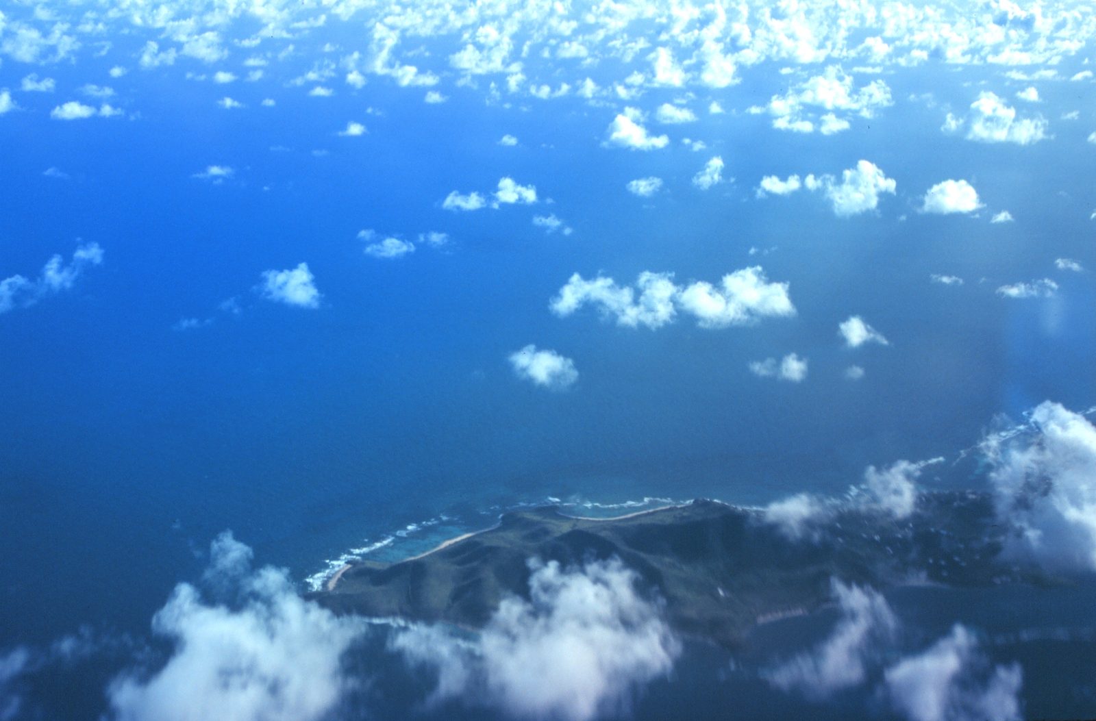
Top Hikes on St. Croix, USVI
St. Croix offers several hiking trails that vary in difficulty and terrain. These trails provide access to coastal views, historical sites, and protected natural areas. What the island's hikes have in common is that they're mostly undeveloped — few are signposted the way a mainland state park would be, and that's part of the appeal. Come prepared, respect the boundaries, and you'll have most of them nearly to yourself.
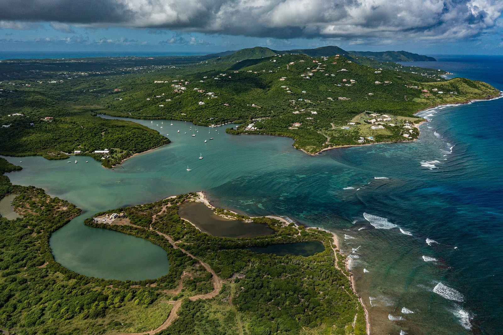
Salt River Bay National Historical Park Trail
The Salt River Bay Trail is a 1.8-mile loop with moderate difficulty. It passes through coastal woodlands and mangroves, with access to the estuary shoreline. Points of interest include a Taino petroglyph site and the ruins of a sugar mill. Trail markers are present but can be weathered. The trail is mostly flat, though humidity can increase exertion. Rest areas are limited. This trail is managed by the National Park Service.
This is the hike to do if you want history with your walk. Salt River is where a European landing party first came ashore on what is now United States territory, in 1493, and the bay was a center of Taíno and later Carib life long before that. The estuary you're walking is the island's most important nursery for reef fish and one of the last healthy mangrove systems on St. Croix. Start at the visitor contact station off Route 82, and give yourself time to read the interpretive signs — the story here is bigger than the distance suggests.
Centerline Trail
The Centerline Trail follows an old military access road through the central hills of St. Croix. It spans approximately 8 miles from Christiansted to Frederiksted, though most hikers use short segments. The trail passes through dry forest with occasional signage. Elevation changes are gradual. Sections near the East End are less maintained. GPS navigation is recommended.
Nobody walks the whole eight miles unless they're training for something. The way locals use the Centerline is in pieces — an hour out and back through the dry interior forest, watching for the island's roaming donkeys, deer, and the mongoose that scatter ahead of you. It's the most reliably shaded walking on the island, which makes it a decent midday option when the coast is too exposed. Download an offline map before you go; the signage can't be trusted.
Mount Pellier Trail
This 1.9-mile one-way trail climbs over 1,000 feet in elevation, making it the most strenuous hike on the island. The trailhead is located in the southwest interior. It is poorly marked in places, with rocky and uneven footing. Cell service is unreliable. Hikers should carry a physical map or GPS device. The summit offers 360-degree views of St. Croix and surrounding waters. There are no facilities along this route.
This is the island's one genuinely demanding hike, and the payoff is the best land view on St. Croix — a full 360 from the high western interior, water on every side. Treat it seriously: real shoes, more water than you think you need, an early start to beat the heat, and a companion, because you will not have a phone signal and you will not see many other people. If you want the summit without the route-finding stress, a local guide is money well spent.
Sandy Point National Wildlife Refuge
Sandy Point allows limited foot access along the beachfront dunes during turtle nesting season (April–August). The area is closed to the public at other times to protect leatherback sea turtles. When open, visitors may walk along marked paths. No inland trails exist.
Sandy Point isn't a hike so much as a walk on the most protected beach in the territory — and the reason for the access limits is one of the great wildlife stories in the Caribbean. This is a globally significant nesting beach for leatherback turtles, the largest turtles on earth, and researchers have monitored the nests here for decades. When the refuge is open — generally weekend mornings outside the closed season — a walk along the wide sand is worth the trip on its own.
Annaly Bay Tide Pools
This informal route leads to a rocky coastline known for tide pools and ocean views. The path is unmarked and requires careful footing over loose stone and vegetation. No official signage or maintenance exists. It is best accessed in dry conditions. This area is on private land; hikers should respect boundaries and not trespass.
The Annaly Bay tide pools are the island's classic adventure hike — a rugged scramble down to a series of natural pools in the rocks where the waves break just beyond. It's genuinely beautiful and genuinely rough underfoot; the trail is steep, unmarked, and crosses private land, and the pools themselves are dangerous when the north swell is up. Go in dry, calm conditions, wear proper shoes, and turn around if the ocean looks angry. Many people do it as part of a guided group, which solves the access and route-finding at once. (For a smaller, quieter version of the same idea, Monk's Bath on the northwest coast is its lesser-known cousin.)
Why hike St. Croix at all
With water this good, it's a fair question why you'd spend a morning walking instead of snorkeling. The answer is that the trails show you a St. Croix the beaches never will. From the ridges you see the whole shape of the island — the reef line, the two coasts, the green interior — laid out at once. The interior forest is cooler, quieter, and older-feeling than the shore, full of birdsong and the ruins of a vanished sugar world. And the coastal hikes lead to the places you literally cannot reach any other way: the empty preserve beaches at Jack and Isaac Bay, the tide pools at Annaly, the tip of the country at Point Udall. A week here that's all beach is a lovely week, but a morning or two on foot is what turns a nice trip into really knowing the island. Just do it early, do it prepared, and be back at the pool before the day gets hot.
What you'll walk through
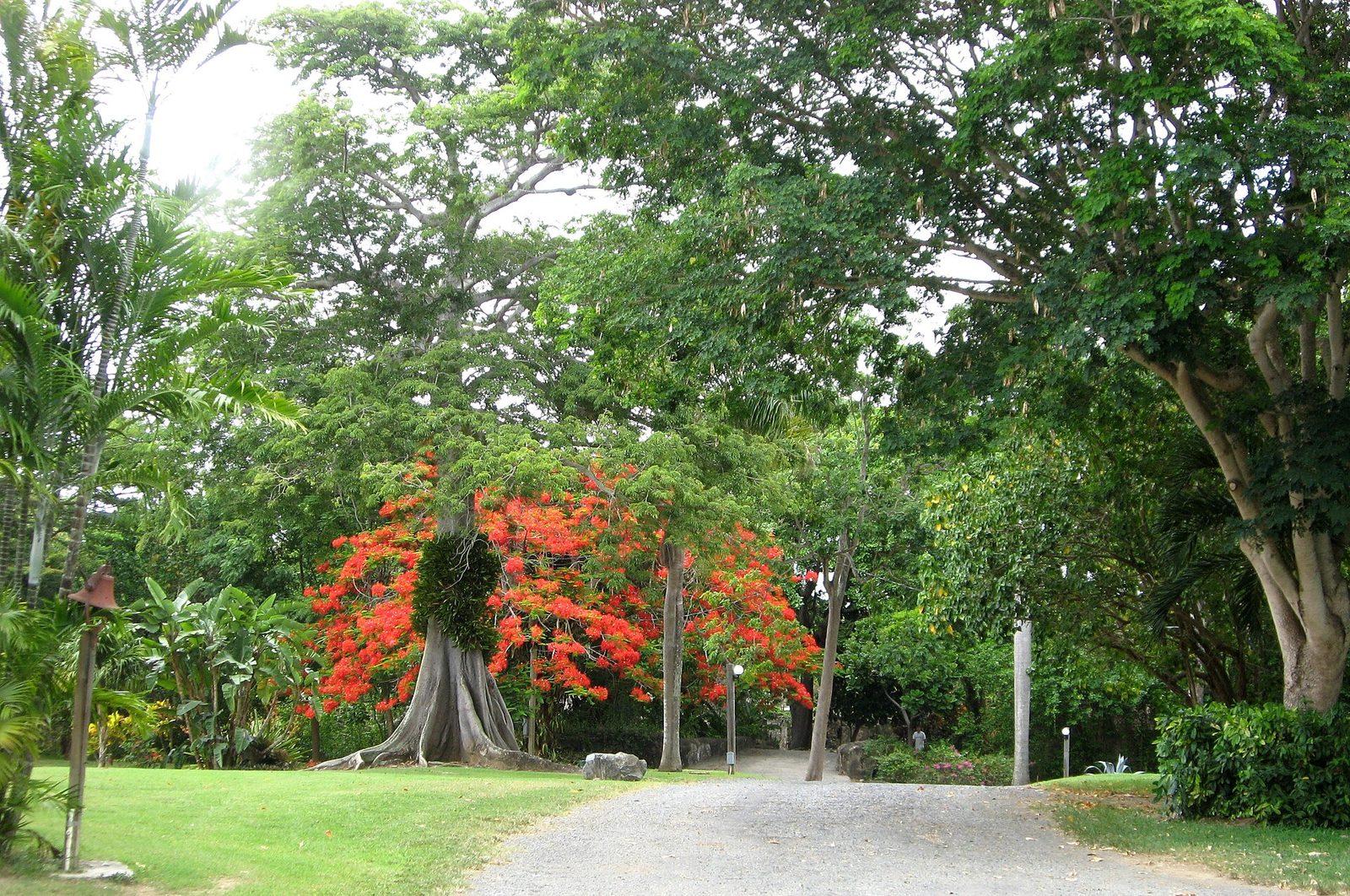
St. Croix packs a surprising range of landscapes into a small island, and the hikes are the best way to feel it. The wetter western third rises into genuine rainforest — mahogany, kapok, and turpentine trees, tree ferns, and a green canopy that feels a world away from the beaches. The central and eastern parts are subtropical dry forest: lower and more open, with acacia, century plants that send up tall flower stalks, and stretches of golden grass in the dry season. Along the coast you get sea-grape thickets, mangroves in the sheltered bays, and salt ponds that draw wading birds.
Underfoot the terrain shifts constantly, too — from soft forest duff in the interior, to loose volcanic scree on the climbs, to sharp coral-limestone along the coast — which is why closed shoes with real grip matter more here than the modest distances suggest.
The wildlife is part of the fun. You'll almost certainly meet the island's free-roaming animals — donkeys and horses descended from the plantation era, white-tailed deer introduced long ago, and mongoose darting across the trail (brought in during the sugar days to control rats, with predictably mixed results). Birders do well here: pearly-eyed thrashers, bananaquits, green-throated caribs and Antillean crested hummingbirds, herons and egrets in the wetlands, and frigatebirds and pelicans along the coast. None of it is dangerous — St. Croix has no venomous snakes — but the sun and the heat are, so plan around them.
Guided or on your own?
Two of these hikes — Salt River and the Centerline segments — are comfortable to do on your own with an offline map. Two others — Mount Pellier and the Annaly Bay tide pools — are the kind where a local guide genuinely changes the trip, because the trailheads are unmarked, the routes cross private land, and the footing is unforgiving. Local eco-tour outfitters run regular trips to both, and they handle the access permissions, the pace, and the "is the ocean safe today" judgment call that's hard to make if you don't know the coast. If you only hire a guide once on St. Croix, spend it on Annaly Bay.
Easier walks, if you'd rather stroll
Not every day has to be a scramble. For a gentle history walk, the streets of Christiansted are flat, shaded by arcaded sidewalks, and dense with 18th-century Danish architecture — an hour's wander takes in the fort, the wharf, and the old warehouses. The St. George Village Botanical Garden, on the site of a former sugar estate, has easy paths through gardens and plantation ruins. And the Frederiksted waterfront makes for a level, breezy sunset stroll past the fort and the pier. These are the outings for a recovery day, or for anyone in the group who'd rather not climb.
Hiking Considerations
- Trail markings vary—some routes are poorly maintained or overgrown
- Many trails pass through protected areas or private property; confirm access before hiking
- No potable water is available on trails
- Weather can change quickly; afternoon showers are common
- Some trailheads have minimal parking and no facilities
The East End trails, on your doorstep
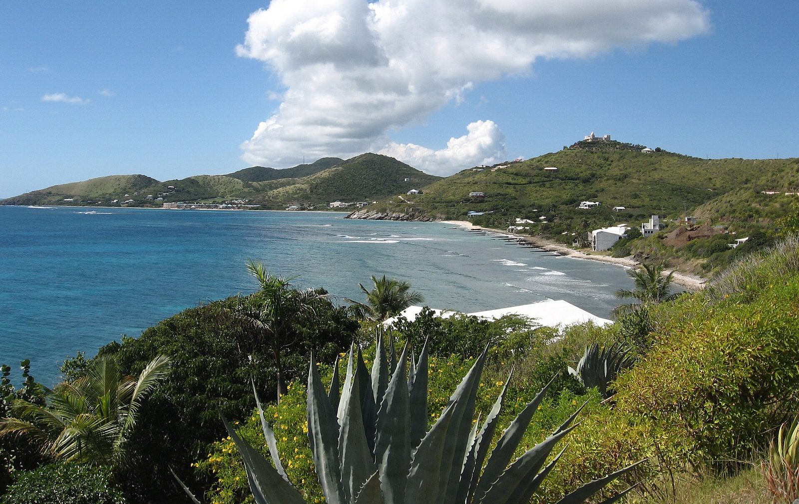
If you're basing yourself on the East End, the island's easternmost walks are right there. From near Point Udall — the easternmost point in the United States, marked by a sundial-like Millennium Monument — a trail drops over a dry headland to the twin beaches of Jack and Isaac Bay, protected inside a 300-acre preserve that The Nature Conservancy has looked after since the 1990s. There's no road in, which is exactly why the sand stays empty and the water stays clear; it's a nesting ground for sea turtles, so tread lightly. The walk is short but fully exposed, so it's a morning hike, done before the heat — and then you're a few minutes from the pool. For guests at the villa, it's the most rewarding hour of walking on the island, and you barely have to drive to reach it.
The heat is the real hazard
It's worth saying clearly: on St. Croix, the sun and heat injure far more hikers than the terrain does. The island sits deep in the tropics, the trade-wind breeze that cools the coast disappears the moment you step inland, and the exposed trails offer little shade. Heat exhaustion sneaks up on visitors who'd hike the same distance easily back home. The defenses are simple and non-negotiable: start at first light, turn around by mid-morning on exposed routes, drink more water than you think you need (and carry more than that), wear a hat and light long sleeves, and rest in shade before you feel you need to. If anyone in the group feels dizzy, headachy, or stops sweating, that's the signal to stop, cool down, and rehydrate immediately.
Respecting the land
A lot of St. Croix's best walking crosses either protected preserves or private property, and the access is a privilege rather than a right. Stay on the established paths, pack out everything you bring in, don't disturb the ruins or take "souvenirs" from historic sites, and give any marked turtle nests a wide berth. Where a trail crosses private land — Annaly Bay is the notable one — go with a guide or with clear local permission rather than assuming. The reason these places stay beautiful and open is that visitors before you treated them well; leave them the same way.
What to bring
The island's heat and sun do more people in than the terrain does. For any of these hikes, carry more water than feels necessary, real closed shoes (not flip-flops), a hat, and reef-safe sunscreen. Add an offline map or GPS, a small first-aid kit, and a fully charged phone even where there's no signal. Start early — by mid-morning the exposed trails are hot — and tell someone at the villa where you're headed and when you expect to be back.
History underfoot
Part of what makes hiking on St. Croix different from hiking almost anywhere in the mainland U.S. is that you're rarely walking through untouched wilderness — you're walking through a landscape people have worked for centuries. The Centerline Trail follows the line of an old Danish road. The interior hills are dotted with the ruins of more than a hundred sugar estates: round stone windmill towers, the arched openings of boiling houses, great-house foundations slowly returning to bush. Salt River layers Taíno petroglyphs and a 1493 European landing over its mangroves. Even Monk's Bath and the Annaly quarries are industrial relics of the sugar age. When you hike here, the ruins in the undergrowth aren't a detour from the scenery; they're the story of how the island came to look the way it does, and reading a little about the sugar-and-slavery era before you set out makes every stone wall in the forest mean something.
Trail difficulty at a glance
- Easy: the Christiansted historic streets, the Botanical Garden paths, the Frederiksted waterfront — flat, short, and shaded enough for anyone.
- Moderate: the Salt River loop (1.8 miles, flat but humid) and short out-and-back segments of the Centerline through the interior forest.
- Moderate with hazards: the walk in to Jack and Isaac Bay — not long, but fully exposed to the sun.
- Strenuous / for the prepared: Mount Pellier's climb of over 1,000 feet, and the steep, unmarked scramble to the Annaly Bay tide pools across private land. Both are best done early, with plenty of water, and ideally with a guide.
Frequently Asked Questions
Are there guided hiking tours on St. Croix?
Yes, limited guided options are available through local eco-tour operators, particularly for Salt River Bay and the East End trails. For Annaly Bay and Mount Pellier especially, a guide takes the guesswork out of access and route-finding.
Is a permit required to hike?
No general hiking permit is required, but access to protected areas like Sandy Point is time-restricted.
Can I camp on hiking trails?
Camping is not permitted on any hiking trails or in national parks.
Are trails open year-round?
Most trails are accessible year-round, though conditions may be affected by weather or conservation activities.
Which hike is best for a first-timer?
The Salt River loop. It's flat, it's short, it's managed by the Park Service, and the history makes it interesting even if you're not a serious hiker. Save Mount Pellier and Annaly Bay for when you know how the island's heat and terrain feel.
Conclusion
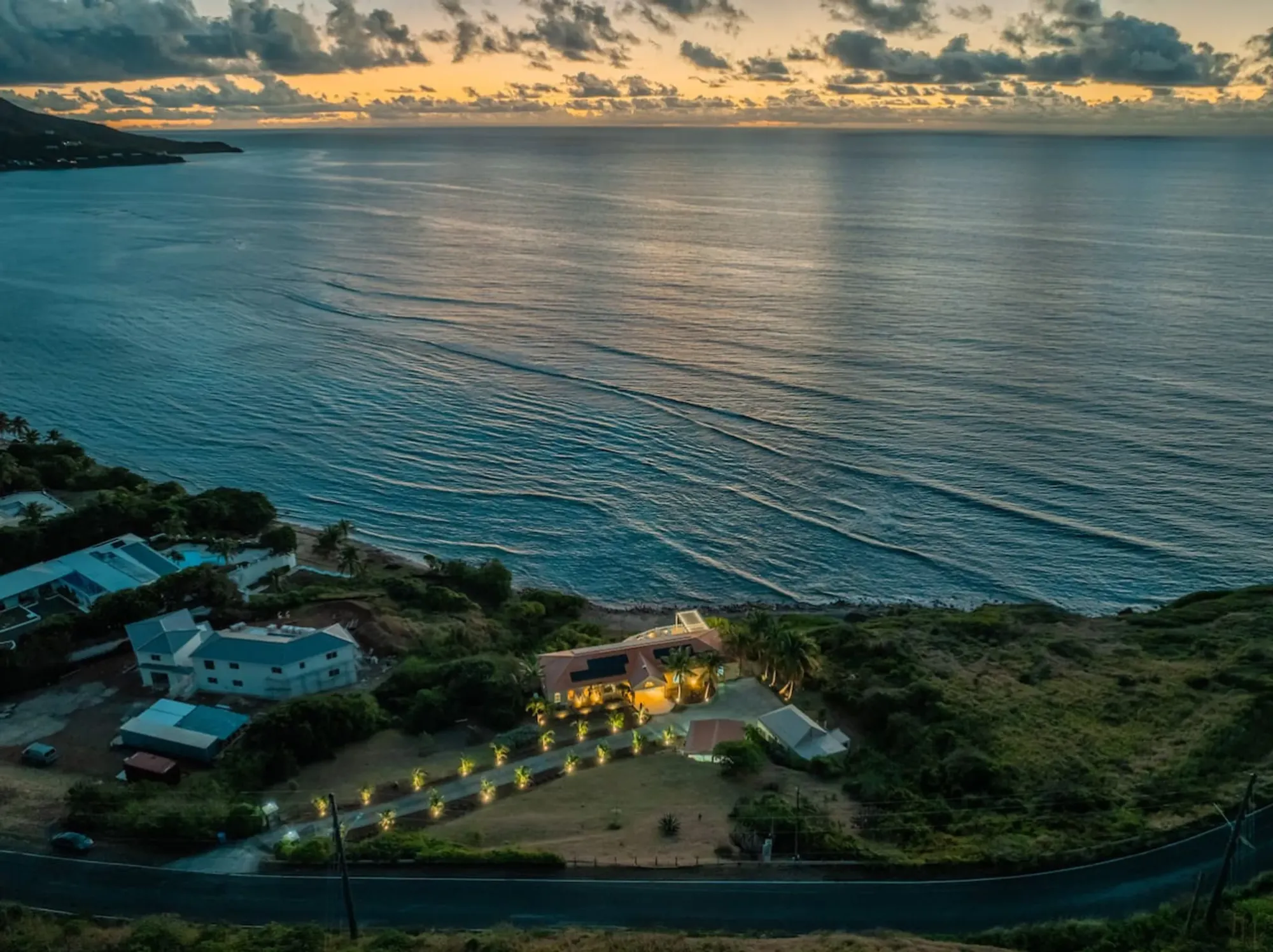
St. Croix's trails offer access to the island's diverse terrain and coastal ecosystems. Most trails are minimally developed, requiring self-sufficiency and preparation. Hikers should verify current conditions and access rights before setting out. Do that, and you'll find an island that rewards the effort — empty coastlines, real history underfoot, and views you earn. And from The Cerulean on the East End, the easternmost trails at Point Udall and Jack and Isaac Bay are only minutes away, an easy morning before the heat sets in.
Plan your own week.
Check the villa's calendar and hold your dates.